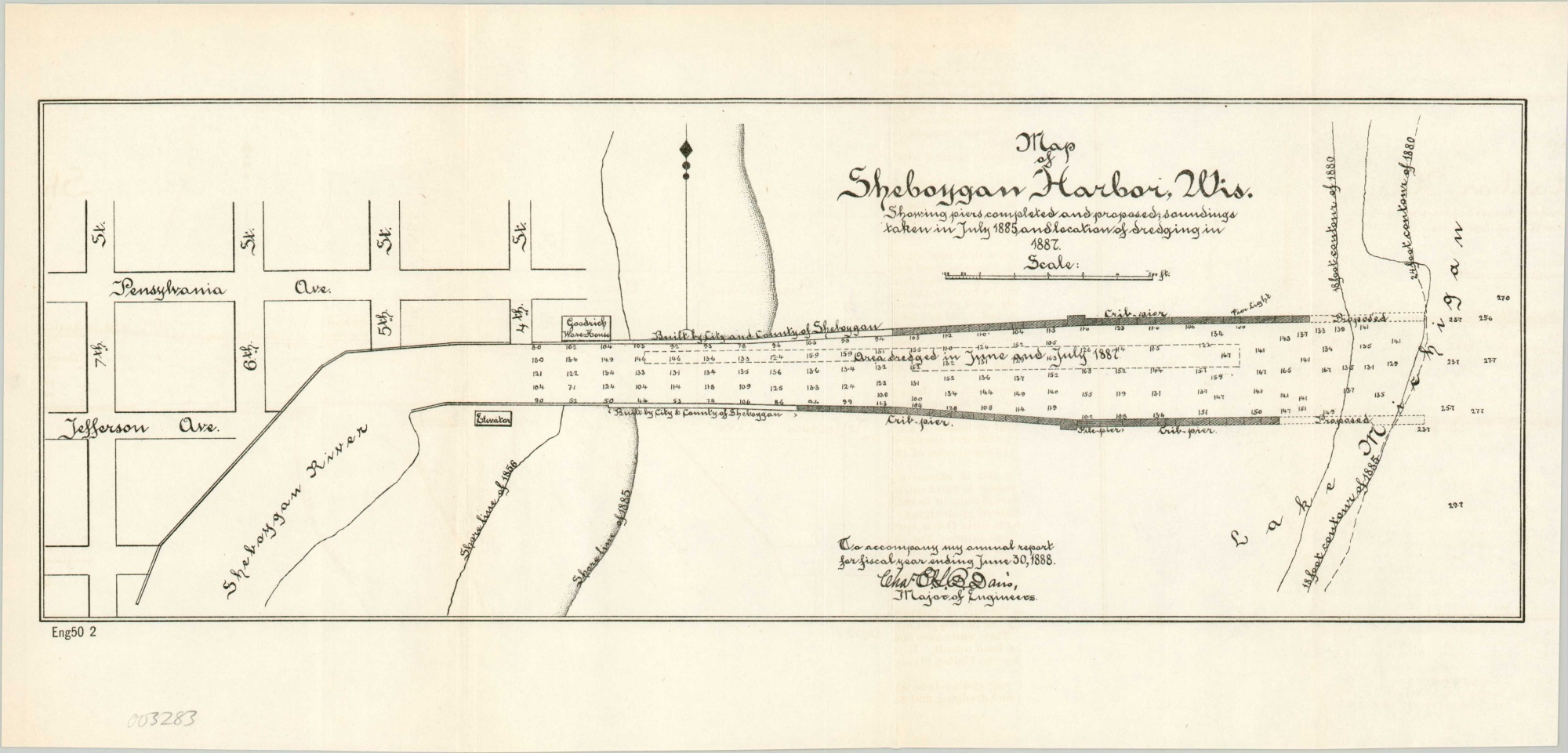
Map of Sheboygan Harbor, Wis.
$50.00
Army Corps of Engineers survey of Sheboygan Harbor.
1 in stock
Description
This interesting survey of the mouth of Sheboygan River and the nearby town of the same name was issued by the United States Government Printing Office as part of an Army Engineering report in 1887. Street names, a warehouse, and grain elevator are the only terrestrial details apart from an evolving depiction of the Lake Michigan shoreline starting in 1856.
Pier and breakwater construction is also shown, along with depth soundings and an area along the harbor that was dredged the year prior to publication. Proposed extensions are noted, hoping to further minimize the impact of shoreline erosion in silting up the mouth of the river.
Map Details
Publication Date: 1887
Author: Government Printing Office
Sheet Width (in): 16.75
Sheet Height (in): 8
Condition: A
Condition Description: Light creasing and faint wear along former fold lines, otherwise in fine shape.
$50.00
1 in stock