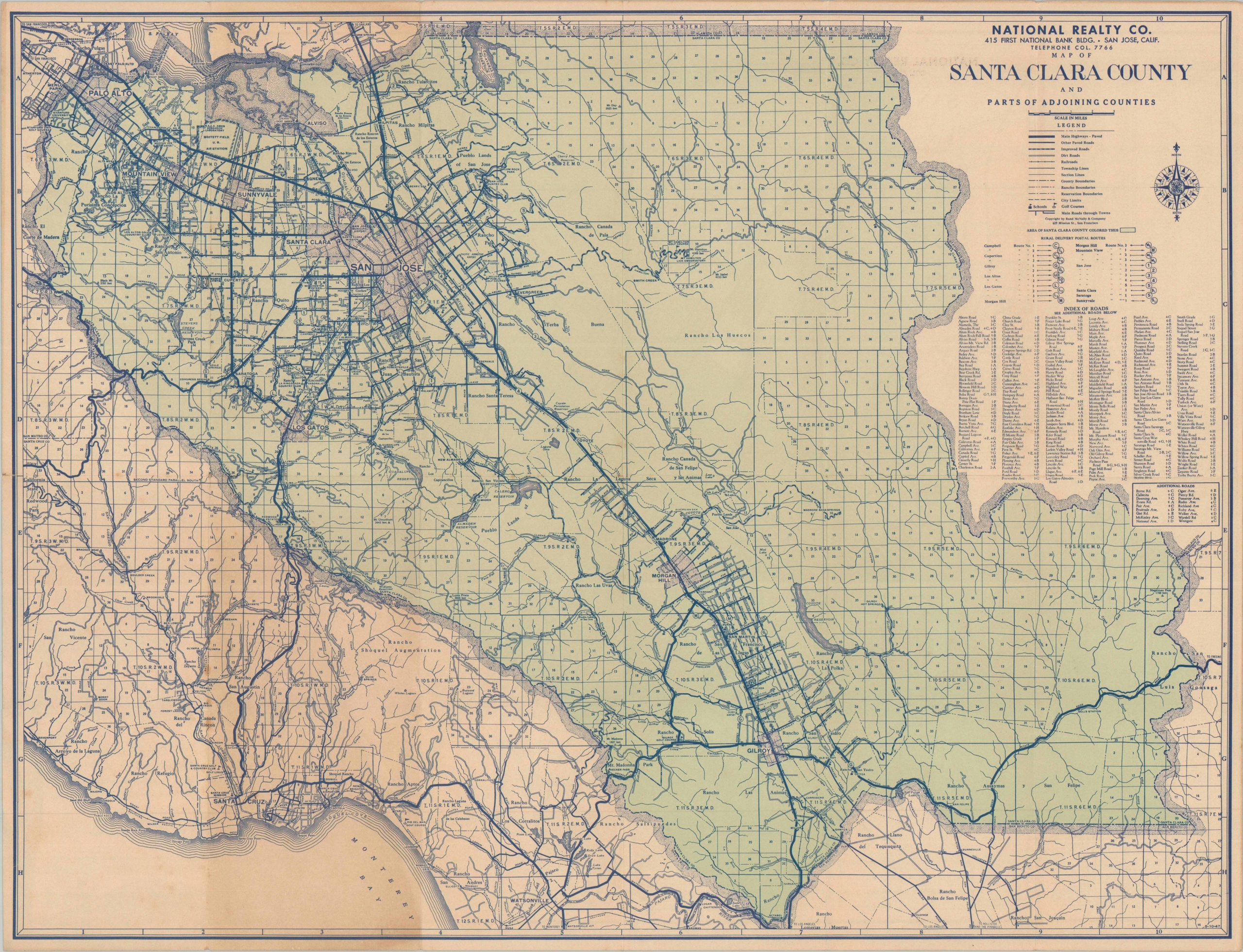
Map of Santa Clara County and Parts of Adjoining Counties
$75.00
Mapping the gradual transition from a valley of orchards to one of silicon.
1 in stock
Description
This detailed map of Santa Clara County, California, was created by Rand McNally of Chicago in 1947 and distributed courtesy of the National Realty Co. The postwar years saw a surge in settlement across San Francisco’s southern suburbs, though the region has yet to attain the urban character by which it is best known today.
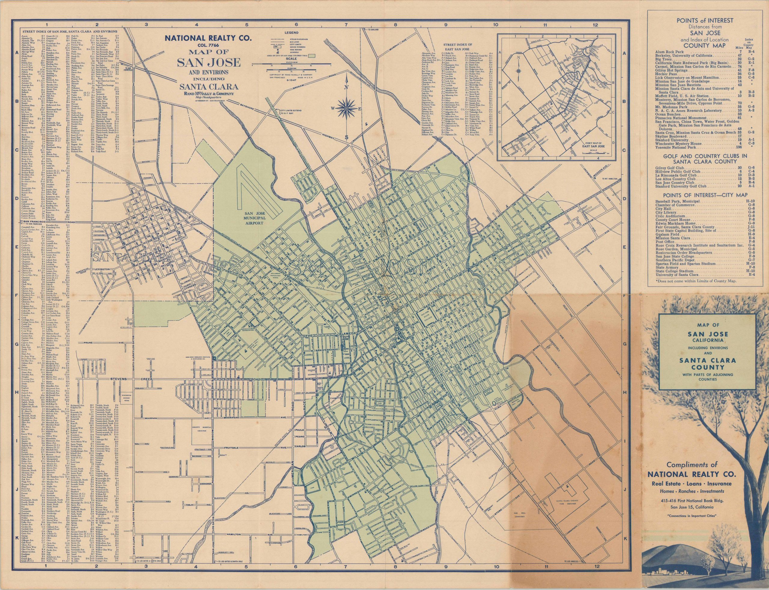
Cities like San Jose, Santa Clara, and Palo Alto contrast sharply with the massive ranchos and mostly unpopulated landscapes on either side of Highway 101. Types of roads, rural postal routes, legal boundaries, schools, and golf courses are noted according to the legend in the upper right. The verso presents a street map of San Jose and its environs, along with a street index and a list of points of interest across Santa Clara County.
Map Details
Publication Date: 1947
Author: Rand McNally
Sheet Width (in): 23.25
Sheet Height (in): 18
Condition: B+
Condition Description: Double-sided folding brochure with heavy toning on the front covers that does not substantially affect the image. Small edge tears and faint discoloration along the outer edges of the sheet, consistent with age and use. Good condition overall.
$75.00
1 in stock