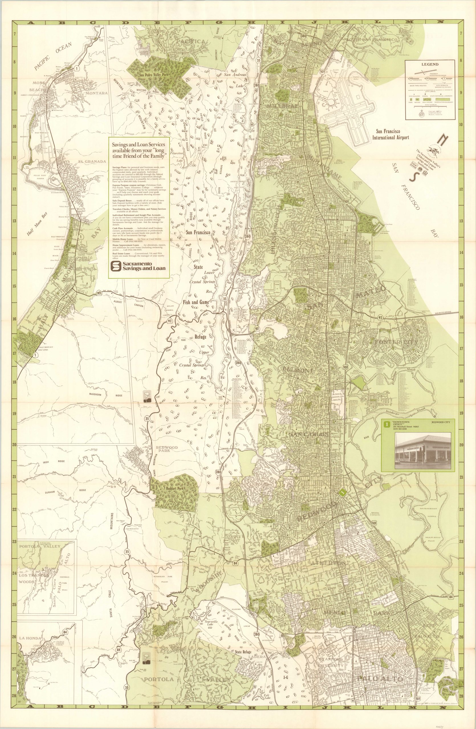
Map of San Mateo County
Northern Silicon Valley in the late 1970s.
Out of stock
Description
This detailed overview of San Mateo County California was published in Modesto in 1977 by Compass Maps. It was distributed by the Sacramento Savings and Loan Corporation – “The Sacramento Valley’s Oldest and Largest Savings and Loan Institution” – according to text in the compass rose (upper right).
The image shows a large area from the San Francisco International Airport in the north to Palo Alto and Portola Valley in the south. Large swathes of land are shown as various protected reserves, a status that fortunately remains largely in place today. Various locations of interest are labeled, such as campus buildings of Stanford University, other schools, country clubs, public buildings, and historic landmarks. The downtown office of the Sacramento Savings & Loan is prominently noted and two insets in the lower left show the communities of Los Trancos Woods and La Honda.
At the time of publication, the area was a hotbed for technological innovation – particularly in the development of the personal computer. The Homebrew Computer Club began meeting in Menlo Park in 1975. Members included Steve Wozniak and Steve Jobs (Co-Founders of Apple), Ted Nelson (founder of Project Xanadu), and Jerry Lawson (father of the video game cartridge).
Sources: Homebrew Computer Club History; Silicon Valley Stories
Map Details
Publication Date: 1977
Author: Compass Maps
Sheet Width (in): 22.5
Sheet Height (in):
Condition: B+
Condition Description: Moderate wear, light discoloration, and creasing along originally issued fold lines. Several fold intersections have small spots of separation along the seam. Good to very good overall.
Out of stock

