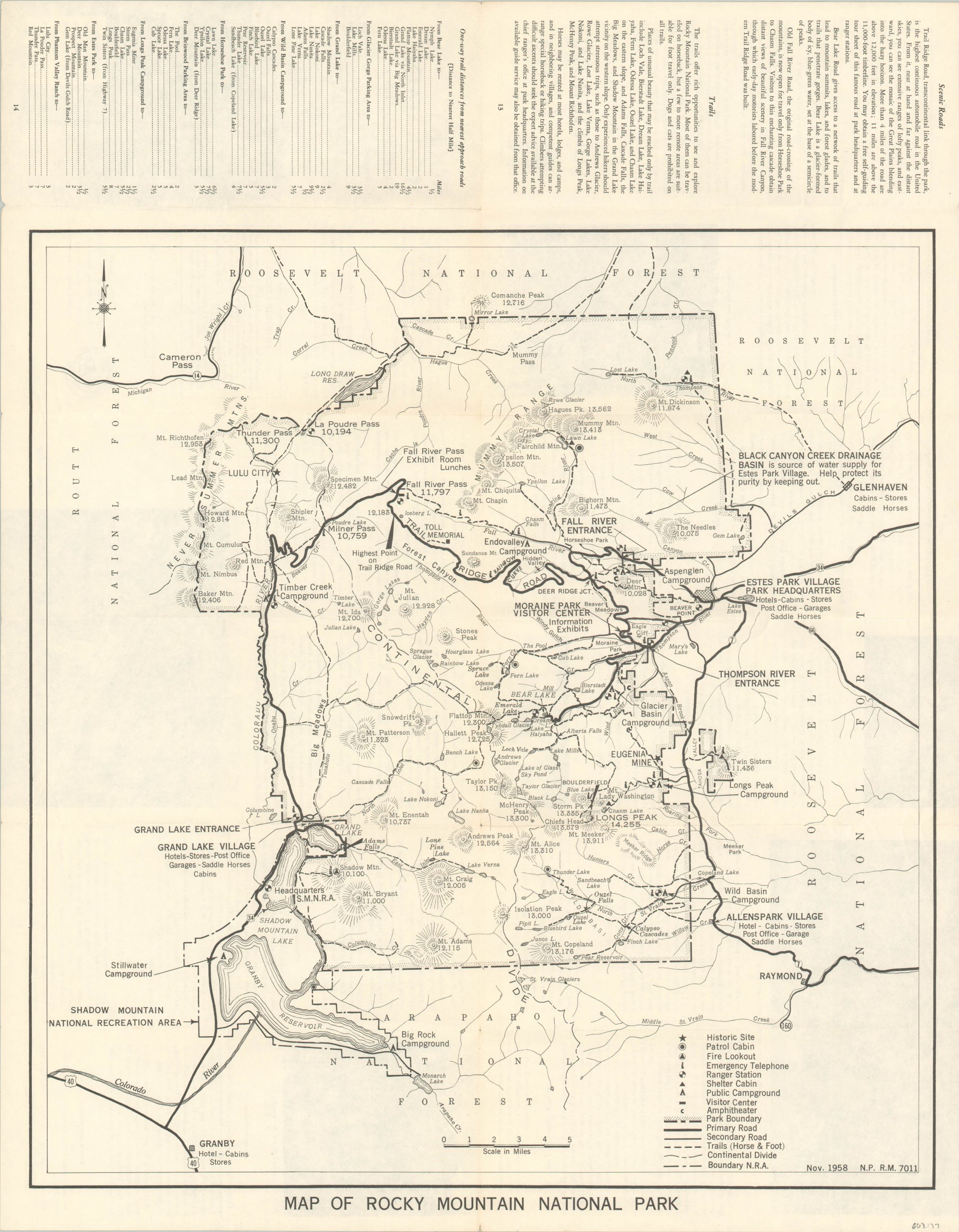
Map of Rocky Mountain National Park
Detailed map of Rocky Mountain National Park from the late 1950’s.
Out of stock
Description
Established by President Woodrow Wilson in 1915, today Rocky Mountain National Park is one of the most popular tourist destinations in the United States. This map, created by the National Park Service and issued by the Government Printing Office in 1959, shows the park boundaries adjacent to Route, Roosevelt, and Arapaho National Forests.
Historic sites, patrol cabins, fire lookout, ranger stations, and other important sites are noted according to the legend in the lower right, along with the primary transportation routes throughout the park. Rules and regulations, photographs, and additional information available on the verso.
Map Details
Publication Date: 1959
Author: Government Printing Office
Sheet Width (in): 18.40
Sheet Height (in): 23.40
Condition: A-
Condition Description: Originally issued folded into 12 panels, with light wear and creasing along fold lines. Several small tears along the bottom edge, but in very good condition overall.
Out of stock

