
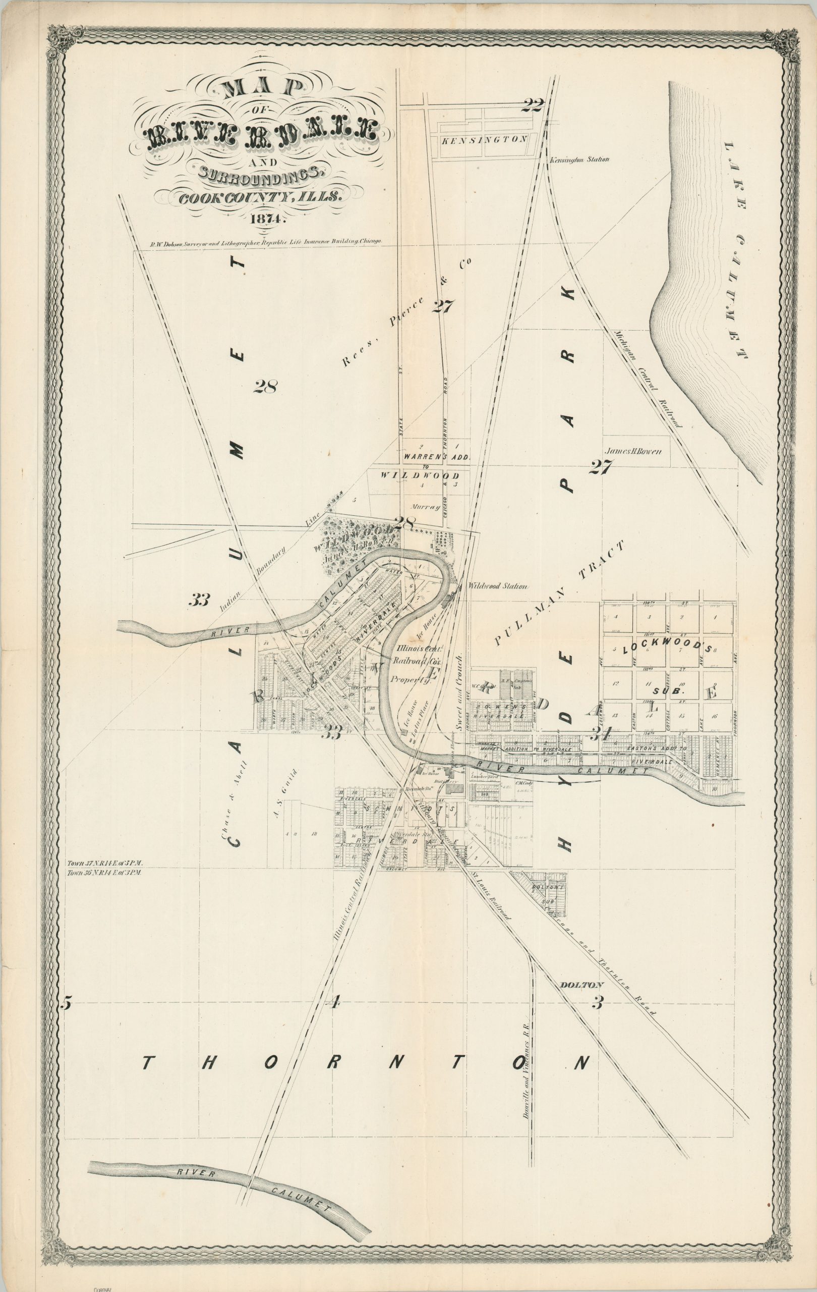
Map of Riverdale and Surroundings, Cook County Ills.
$800.00
An early promotional map of Chicago’s far South Side.
1 in stock
Description
This fascinating 1874 map of Riverdale, Chicago’s far southern neighborhood, captures a transitional moment in the region’s development, just as it was evolving from a quiet commuter village into an industrial hub. Designed and published by R.W. Dobson from his office in the Republic Life Insurance Building, the map was issued only a year after the local post office was established. At the time, Chicago’s elite were beginning to take a keen interest in the little settlement nestled along the scenic bend of the Little Calumet River.
Foremost among these regional boosters was Colonel James H. Bowen, often called the “Father of South Chicago.” Having lost his home in the Great Chicago Fire of 1871, Bowen constructed a grand country estate, “Wildwood,” on the river’s edge. His beautifully manicured parcel, along with several other tracts bearing his name, are clearly delineated on the map just south of the Wildwood Station on the Illinois Central Railroad.
The Illinois Central itself is shown as a dominant local force, alongside significant landholdings belonging to the Pullman Company – acquired just years before George Pullman would build his famous model industrial town a mere three miles to the north. Dobson’s map also meticulously documents the area’s burgeoning commercial infrastructure, identifying a sprawling distillery, a lumber yard, and the massive riverfront ice houses that supplied the Chicago market.
Map Details
Publication Date: 1874
Author: R.W. Dobson
Sheet Width (in): 30.5
Sheet Height (in): 30.50
Condition: A-
Condition Description: Single-sided sheet with soft creasing and faint discoloration along old folds. Light marginal wear, including a small tear (lower left) and faint discoloration (upper left). Good to very good condition overall.
$800.00
1 in stock