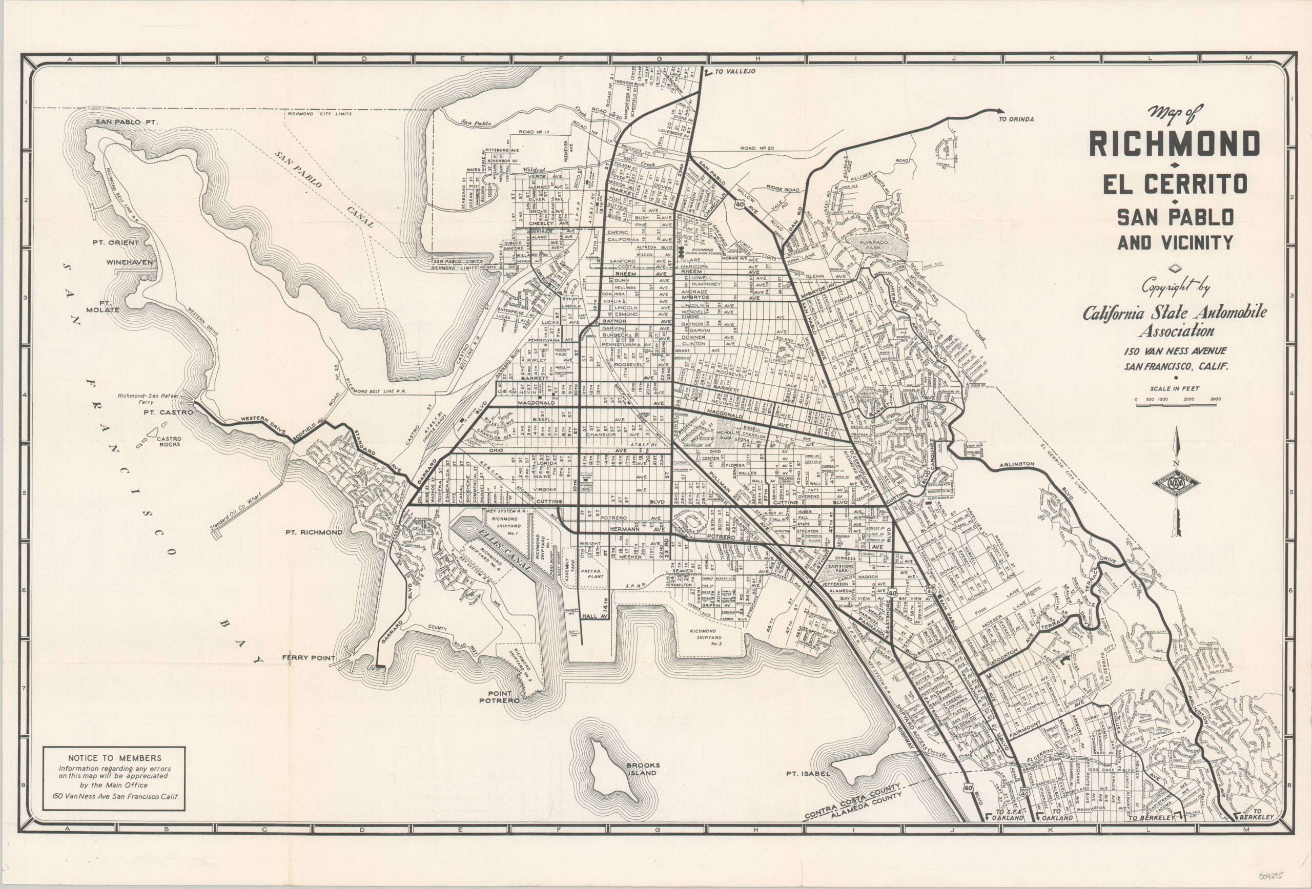
Map of Richmond – El Cerrito – San Pablo and Vicinity
$119.00
Mid-century road map of Richmond, California and the surrounding area.
1 in stock
Description
This easy-to-read street plan covers a large area in San Francisco’s East Bay region that includes the cities of El Cerrito, Richmond, and San Pablo. U.S. Highways, State Highways, and other primary thoroughfares are shown with bold lines. Railroads and city limits are also noted. Locations of interest are labeled throughout the image and include parks, schools, shipyards (a major local industry), and train stations.
The verso provides a comprehensive street index for the three cities depicted on the map. Published in San Francisco around 1955 by the California State Automobile Association.
Map Details
Publication Date: c. 1955
Author: California State Automobile Association
Sheet Width (in): 21.75
Sheet Height (in): 14.5
Condition: A-
Condition Description: Faint wear and light creasing along originally issued fold lines. Scattered soiling visible in the lower left margin. Very good overall.
$119.00
1 in stock

