Map of Reservoirs, Feeders, and Sources of Water Supply for the Middle Division of the Erie Canal
Detailed survey of the hydrological infrastructure along the Erie Canal in New York.
Out of stock
Description
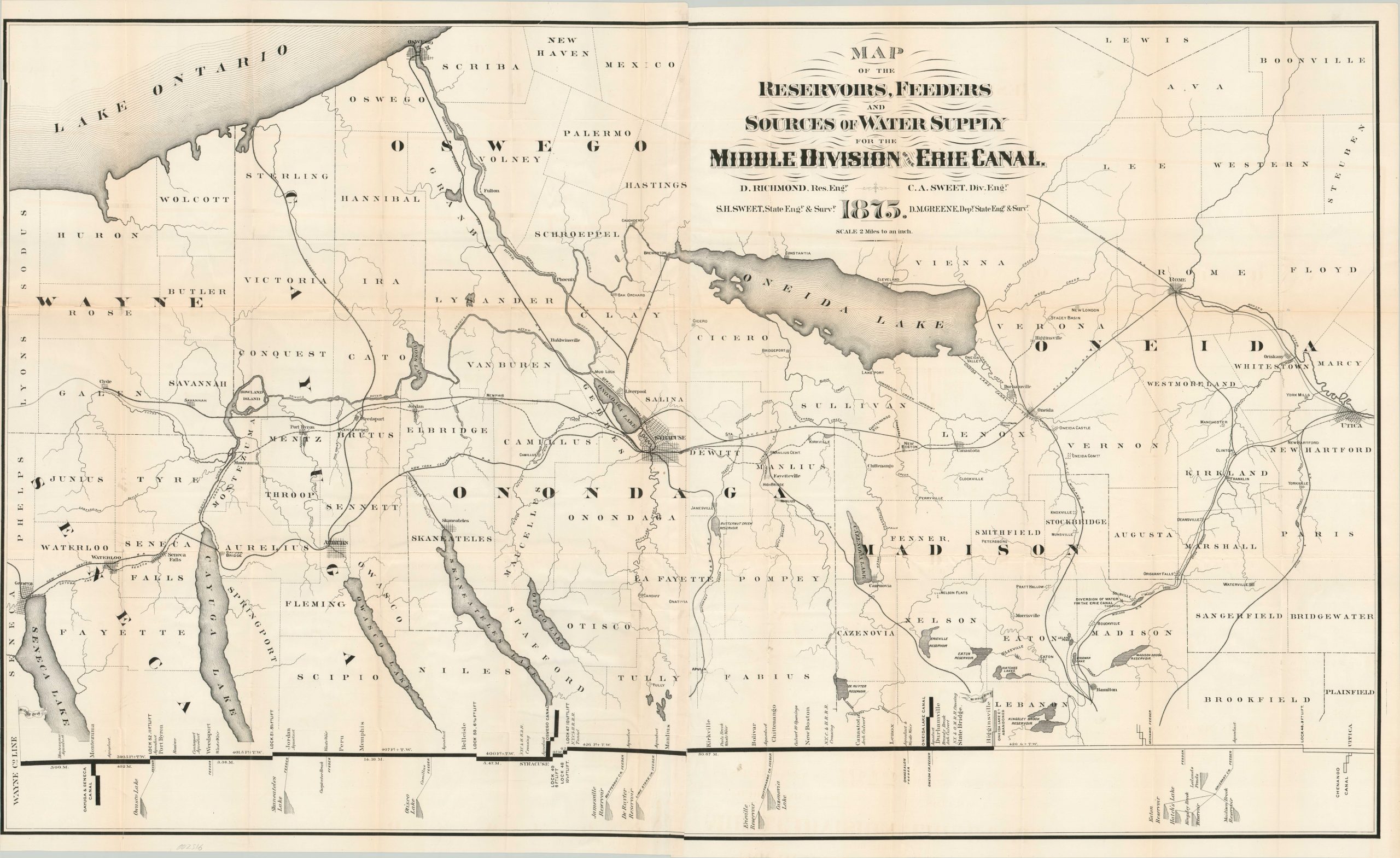
An important part of keeping a canal functional is ensuring that there is constantly enough water to provide adequate depth for safe passage and operation of the locks. Traffic along the Erie Canal was among the highest in volume on the globe after its completion in 1825, and constant efforts were required to ensure smooth transit.
This map, showing the middle portion of Erie Canal between Utica and Seneca Lake, reflects the myriad of feeder lakes, reservoirs, and rivers that kept the system afloat. Railroads, towns, and counties are also depicted and labeled. A profile at the bottom shows the locks and adjoining canal systems, with a more diagrammatic representation of the various water sources along the route. T
he map was originally designed in 1875 by New York State engineers D. Richmond and C.A. Sweet.
Map Details
Publication Date: 1875
Author: D. Richmond & C.A. Sweet
Sheet Width (in): 47.60
Sheet Height (in):
Condition: B+
Condition Description: Creasing and moderate wear along former fold lines, including small separations at the fold intersections. The sheet has a narrow left edge and a few edge tears, one of which (at the top) extends into the border and has been repaired on the verso.
Out of stock