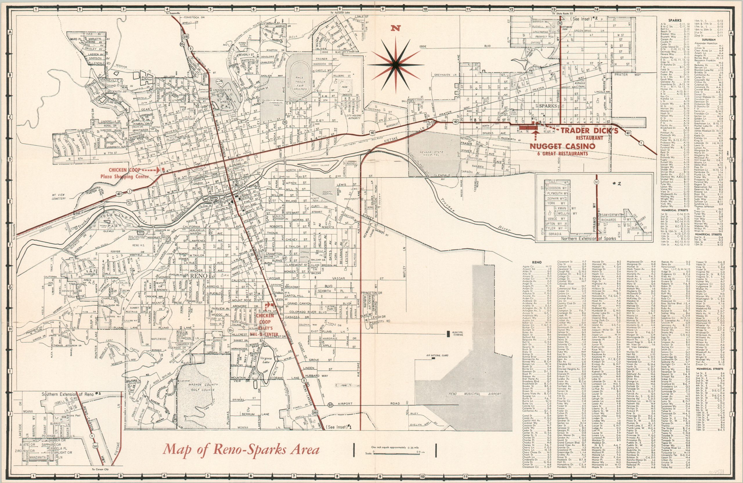
Map of Reno-Sparks Area
$45.00
Street plan of the Reno-Sparks area from the early 1960s.
1 in stock
Description
Come on down to the Nugget Casino with this simple promotional map of the Sparks-Reno area. There’s ‘Free Parking for over 1,000 cars, a children’s theater, and multiple restaurants, according to text and photographs on the verso. The image identifies the location of the casino and Trader Dick’s restaurant (opened 1958) in the upper right, as well as two Chicken Coops – possibly local restaurants? A street index, lower right, is divided by town and suburbs and organized alphanumerically.
Issued by the Nugget Casino around 1960, based on the presence of Trader Dick’s and the absence of Bertha the Elephant, a major attraction introduced in 1962.
Map Details
Publication Date: c. 1960
Author: Sparks' Nugget Casino
Sheet Width (in): 18.25
Sheet Height (in): 11.75
Condition: A
Condition Description: Creased along originally issued fold lines. Near fine overall.
$45.00
1 in stock

