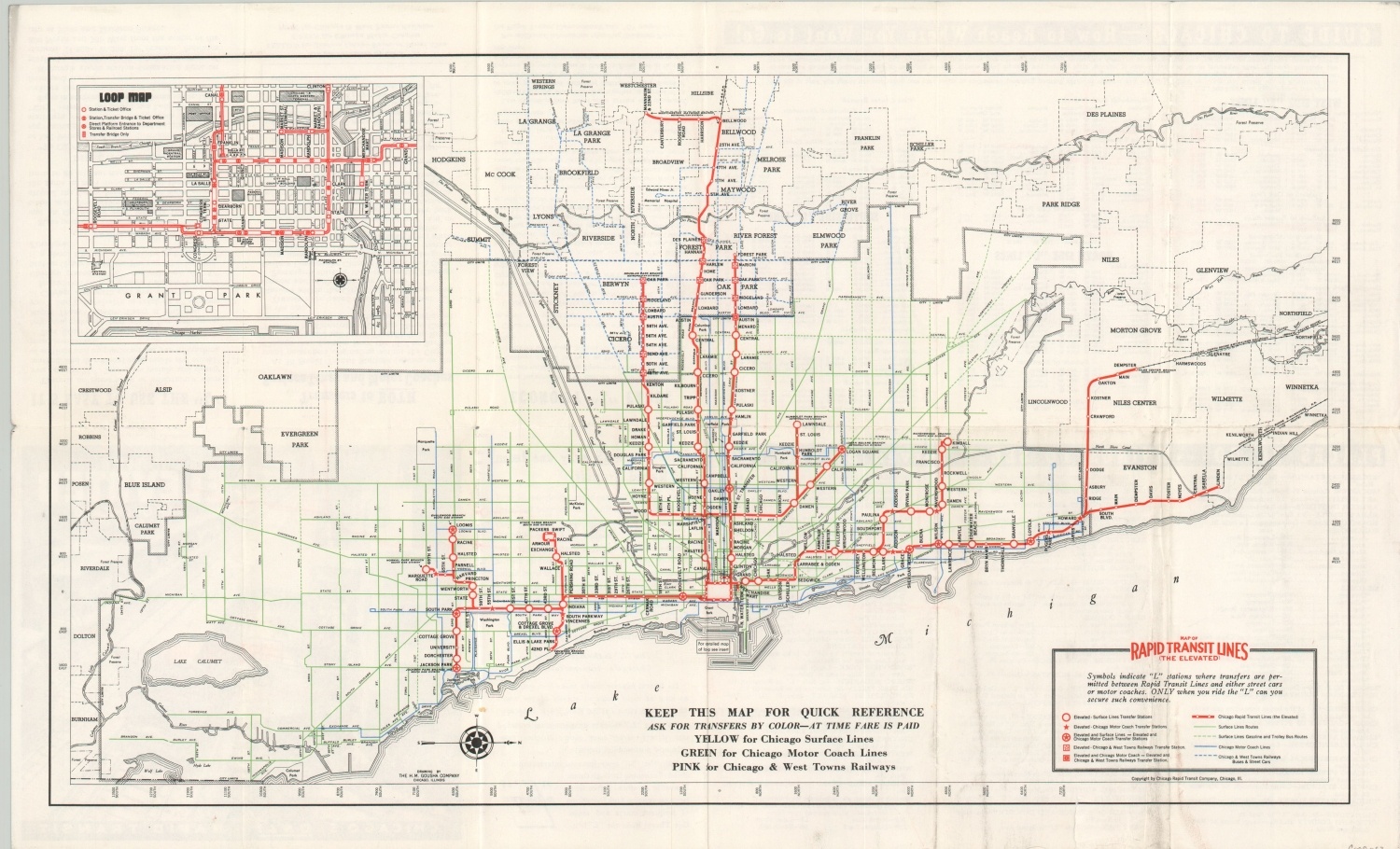
Map of Rapid Transit Lines (The Elevated)
$60.00
The predecessor to the Chicago Transit Authority (CTA).
1 in stock
Description
The Chicago Rapid Transit Company was organized by Samuel Insull in 1924 as an administrative body that consolidated the city’s four separate transit lines. It continued in operation until 1947, when it was absorbed by the newly created Chicago Transit Authority (CTA).
This map, published locally by H.M. Gousha on behalf of the CRT around 1939, shows the various system of interconnected lines and stations connecting Jackson Park to Evanston and Westchester. An inset map in the upper left shows details of the Loop and the verso includes a list of places to see, information for travelers, and an index of the various lines.
Map Details
Publication Date: c. 1939
Author: H.M. Gousha
Sheet Width (in): 21.75
Sheet Height (in): 13.25
Condition: B
Condition Description: Creasing and moderate wear along former fold lines, including soiling in the lower right and a few small edge tears.
$60.00
1 in stock