Map of Public Surveys in California to Accompany Report of Surveyor Genl
$425.00
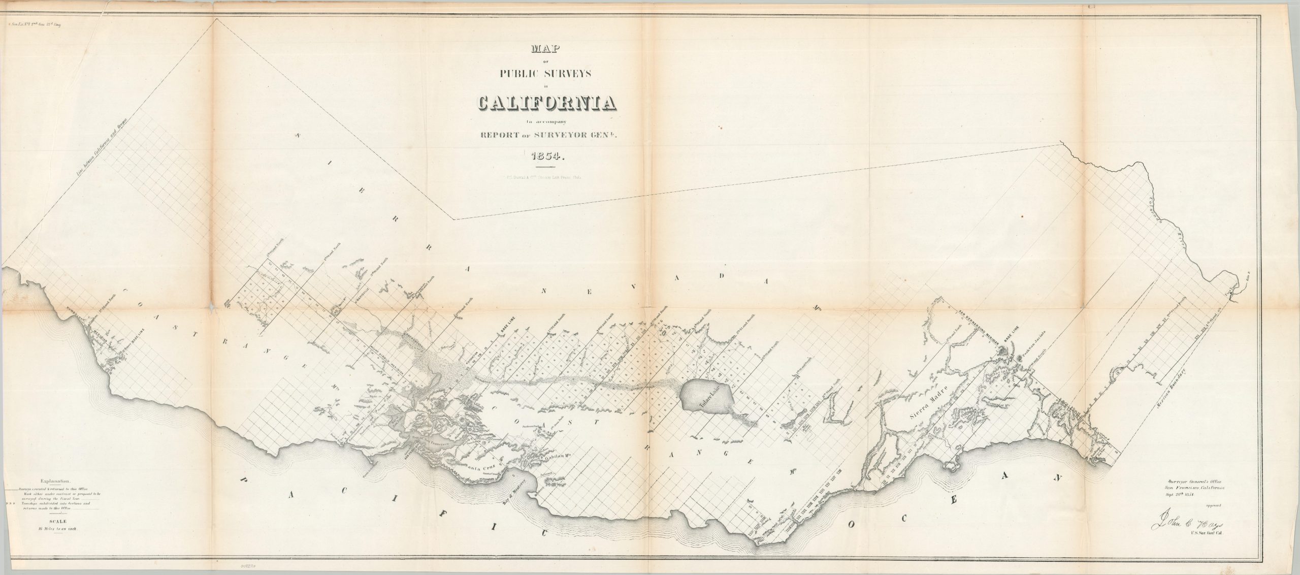
An important and early map of California.
1 in stock
Description
Despite the lawlessness and rapid expansion defining the region following the Gold Rush, the essential work of the General Land Office continued unabated. California had been granted statehood just four years prior, and the federal government was racing to bring order (via surveying, subdividing, and selling property) to a landscape flooded with miners, squatters, and disputed Spanish land grants.
This 1864 map meticulously documents the progress of public surveys across the diverse topography of the Pacific coast, from the fertile Central Valley to the rugged Sierra Nevada foothills. Survey status is indicated by a series of precise markings, described in the accompanying legend (lower left). Survey lines, towns, and geographic features are labeled throughout the carefully crafted image. Of particular note are the expanding urban centers of Sacramento and Los Angeles, Mt. Diablo, the Wool Military Reserve, and the tiny settlement of Napa (shortly before the establishment of the first commercial vineyard).
The image was approved by John Coffee Hays (the legendary Texas Ranger and Forty-Niner turned Surveyor General) and lithographed by the prestigious P.S. Duval & Co. Steam Press of Philadelphia. Published in Washington in 1854 to accompany a Congressional Report by the General Land Office.
Map Details
Publication Date: 1854
Author: John B. Hays
Sheet Width (in): 46.50
Sheet Height (in): 21.00
Condition: B
Condition Description: Lithographed map on a large, single sheet of paper. Moderate creasing and toning along old folds, most evident in the upper center and left (see scan). The upper corner had previously separated, required repairs with archival tape on the verso. Curling along the narrow left margin. Between fair and good condition overall.
$425.00
1 in stock