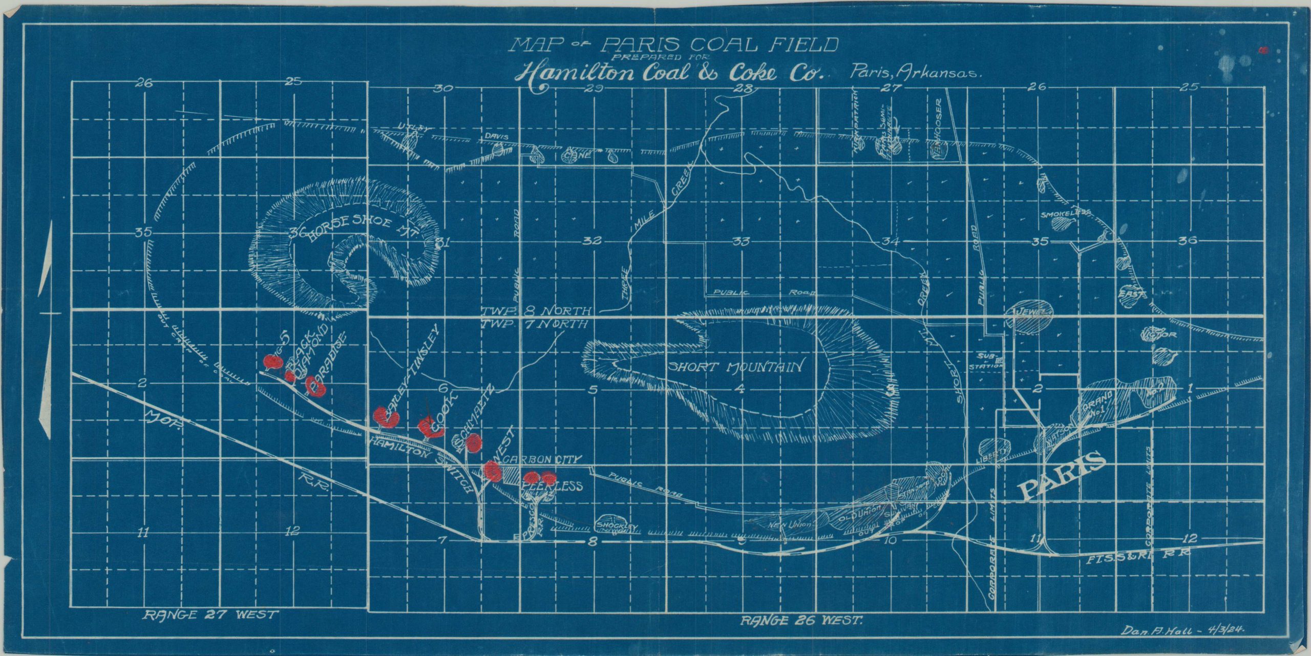
Map of Paris Coal Field Prepared for Hamilton Coal & Coke Co.
$125.00
Documenting coal claims in Arkansas during the mid-1920s.
1 in stock
Description
This interesting map of the Paris Coal Field was originally drawn in April of 1924 by Dan. A. Hall on behalf of the Hamilton Coal & Coke Company. Topography is shown in hachure, emphasizing Short and Horse Shoe Mountains in adjacent townships. Various mining claims are noted, with those in red presumably belonging to the sponsoring organization.
Coal was discovered near the small Arkansas town in the early 1880s and quickly became an important part of the local economy. According to the Encyclopedia of Arkansas,
“From 1917 to 1957, thirty-one privately owned coal mines operated in the Paris area, employing about 2,000 miners. At the height of the industry, an average of 250 to 300 tons of coal were shipped daily to northern markets. During one mining season of eight months, 13,000 railroad cars of coal were shipped from Paris mines.”
Map Details
Publication Date: 1924
Author: Dan A. Hall
Sheet Width (in): 17.5
Sheet Height (in): 8.75
Condition: A
Condition Description: Single sided map printed on blueprint paper with slightly uneven edges. Soft creasing along old fold lines and manuscript updates in red pencil. Scattered spotting in the upper right, possible a result of the original printing. Very good condition overall.
$125.00
1 in stock

