Map of Palm Springs California
“America’s Foremost Desert Resort” – Palm Springs, California.
Out of stock
Description
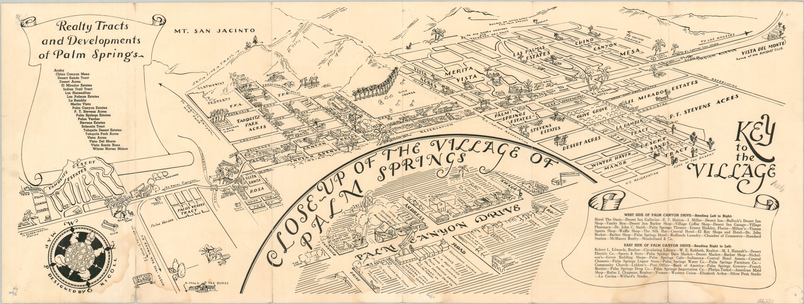
This charming pictorial view of Palm Springs, California was illustrated by Bee Nicoll as part of a promotional brochure compiled by the Palm Springs Printing Company. Oriented with west at the top, the image presents the idyllic desert oasis during a period of significant development. Palm Springs was becoming increasingly popular with movie stars, the health-conscious, and tourists looking to gamble, golf, and gawk at the impressive homes (many of which are named).
Locations of interest include the Sky Line Trail (predating the tramway), the El Mirador Hotel, and Sulphur baths. Numerous real estate firms and housing additions reflect the growing population. An inset in the lower center provides a ‘Close-Up of the Village of Palm Springs’, naming local businesses in the downtown area. Descriptive text, climate data, and photographs on the verso.
The map is undated, but was issued sometime after 1934 and before 1952, due to the presence of the Racquet Club and the absence of Palm Springs City Hall. The omission of any reference to the airport leads me to believe it was published shortly before the outbreak of World War II, and the lack of the Palm Springs Tennis Club may mean as early as 1936.
Map Details
Publication Date: c. 1940
Author: Bee Nichol
Sheet Width (in): 24
Sheet Height (in): 9
Condition: B
Condition Description: Six panel folding brochure, printed on both sides, as issued. Wear and clean separation along folds, repaired on verso. Two damp stains along the bottom edge creep up along the outer fold lines. Edge wear, scattered soiling, and pinholes in the corners. About good condition overall.
Out of stock