
Map of Oregon, Washington, and Part of Idaho
$175.00
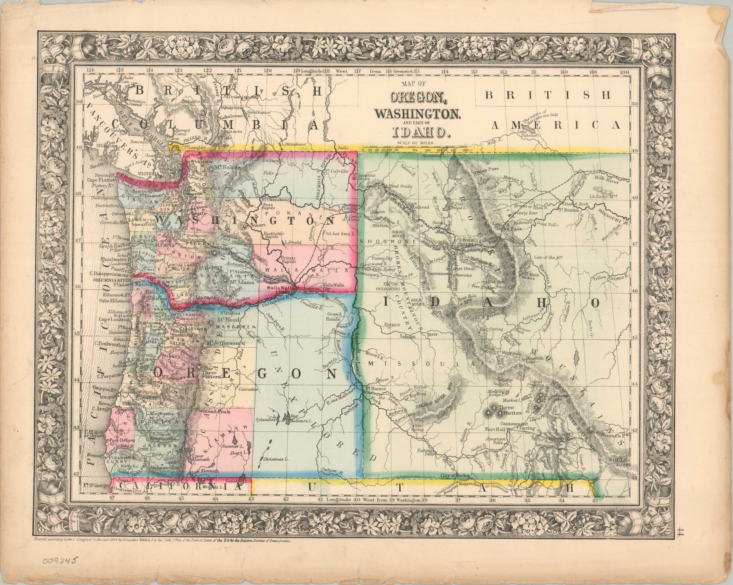
An uncommon map showing portions of the Idaho Territory a year before it was officially established.
1 in stock
Description
This steel-engraved map from S. Augustus Mitchell Jr.’s New General Atlas (Philadelphia, 1862) shows the Pacific Northwest during a short window of territorial change. Mitchell was one of the leading American map publishers of the 19th century, and his atlases were known for keeping up with fast-changing Western geography.
The huge region labeled Idaho, divided by a dramatic north-south mountain range, stretches across what is now Idaho, Montana, and western Wyoming. Congress formally created Idaho Territory in 1863 and cut it down a year later when it carved out Montana Territory. Few maps record that brief, oversized form. Counties and towns crowd the western valleys of Oregon and Washington, while much of eastern Oregon is simply marked “Unexplored.” The Oregon Trail, labeled “Emigrant Route from the States,” runs toward the Columbia River, and the track of Lewis and Clark recalls the exploration of half a century earlier. New gold discoveries are marked near Hell Gate and Elk City, early signs of the mining rush that would soon reshape the inland Northwest. The map also shows Mission Coeur d’Alene, the Nez Perce Agency, a network of military forts and posts, and Astoria at the mouth of the Columbia.
Map Details
Publication Date: 1862
Author: Samuel Augustus Mitchell, Jr.
Sheet Width (in): 15.30
Sheet Height (in): 12.50
Condition: A-
Condition Description: Steel engraved map with original color, likely applied by stencil. Moderate wear in the margins, including somewhat ragged upper and lower edges, scattered toning, creased corners, and a few small tears. Good to very good condition overall.
$175.00
1 in stock