Map of Northern Venezuela
Venezuela’s rise to the world’s leading oil producer.
Out of stock

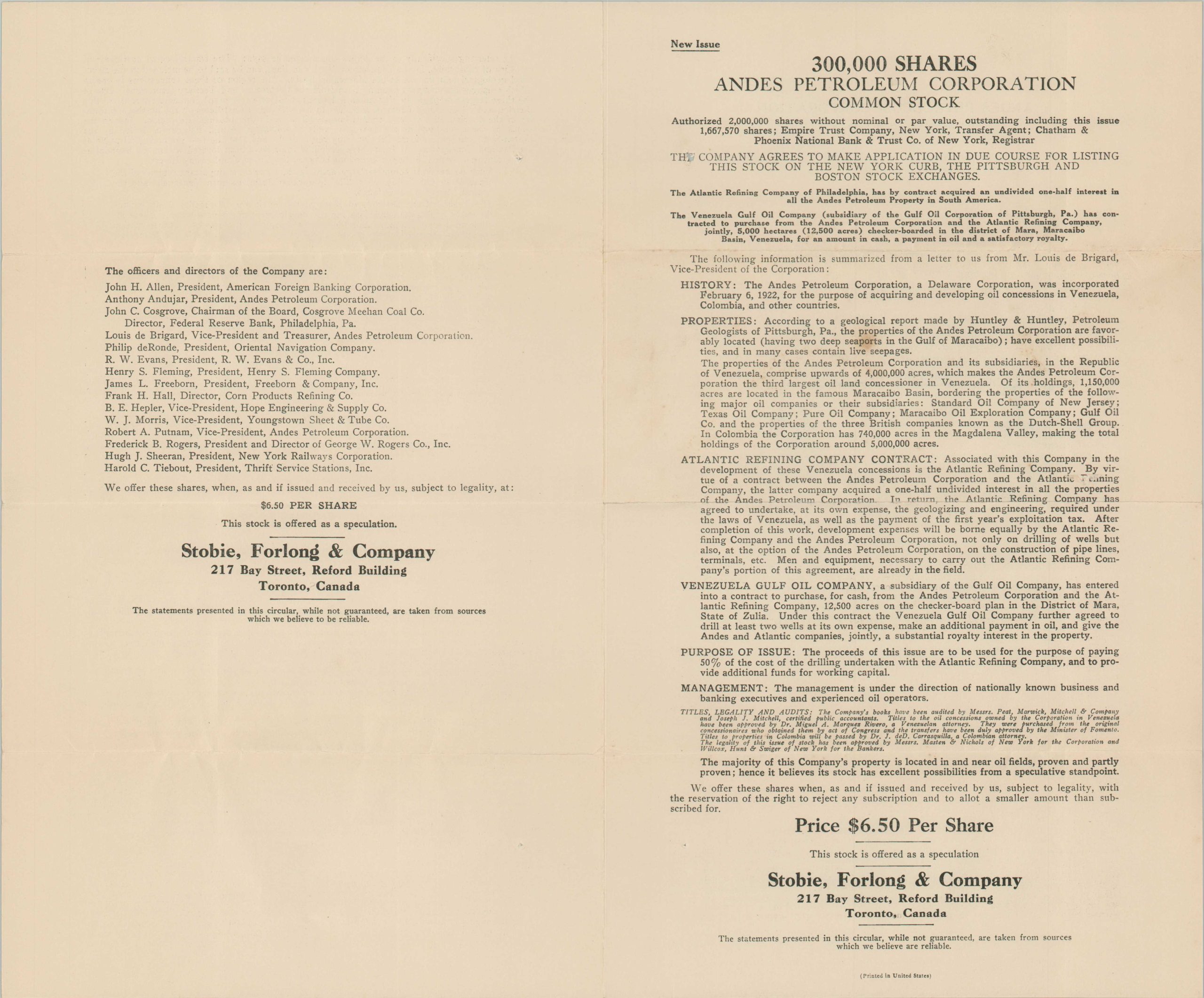
Description
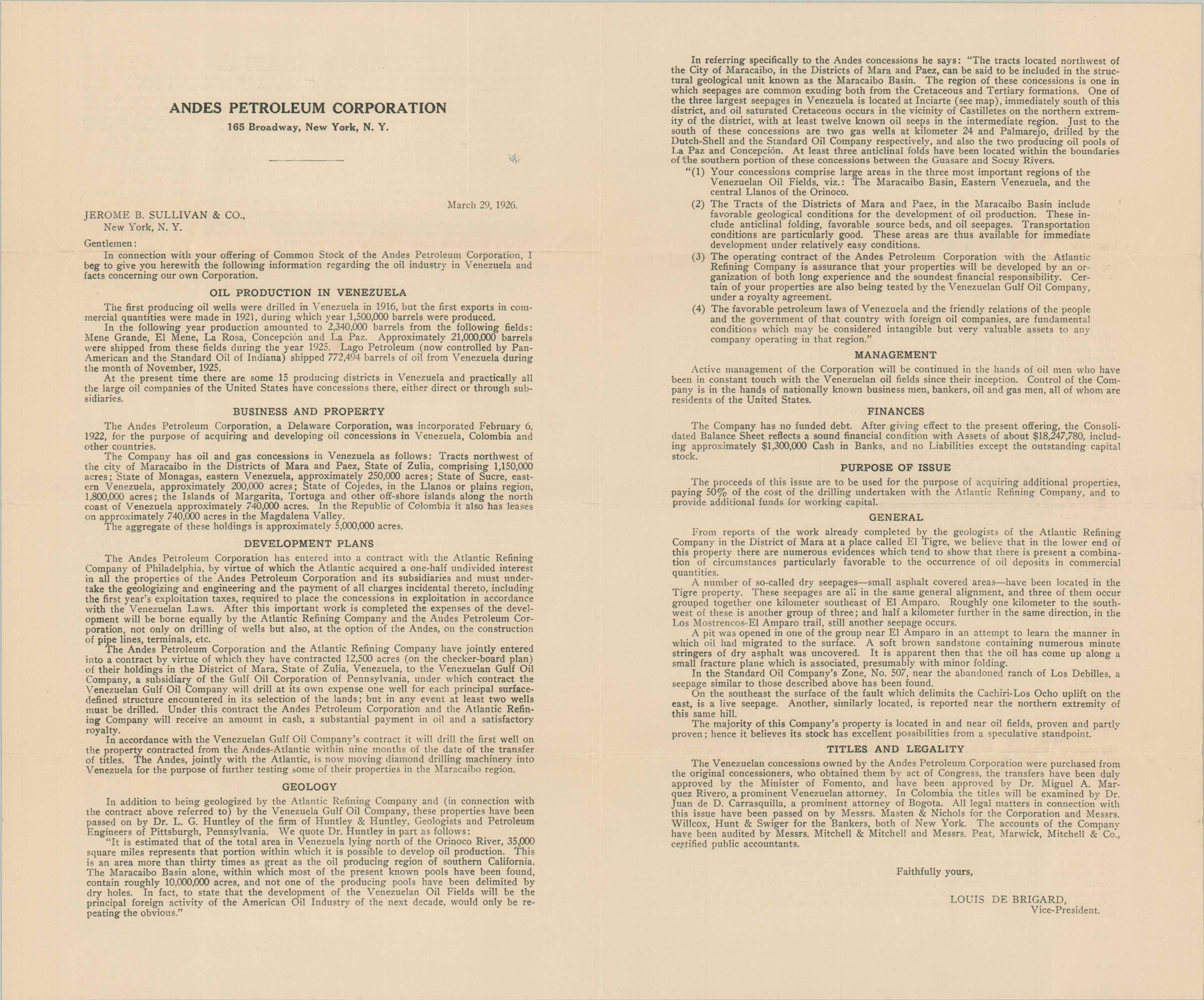
This rare map and prospectus were issued in early 1926 by the Andes Petroleum Corporation of New York. Just four years prior, the blowout of the Barroso II well near Cabimas ushered in Venezuela’s modern oil industry, with foreign investment pushing the country to become the world’s leading oil producer by 1928.
The map, dated Dec. 28, 1925, highlights the claims of the Andes Petroleum Corporation in red. Tracts owned by competitors like Standard Oil, the British Equatorial Oil Company, and the Caribbean Petroleum Company are also noted between Lake Maracaibo and the island of Trinidad.
The accompanying prospectus outlines a compelling argument for the potential investor. References to a geological report by Huntley & Huntley (of which the map was originally a part) indicate the nearly 5,000,000 acres under company control as having “excellent possibilities, and in many cases live seepages [of oil].”
A history of oil production in Venezuela, an overview of local geology, and future development plans are included in the circular, which offers stocks at $6.50/share by Stobie, Forlong & Company of Toronto.
Rare – not listed in OCLC and I’ve been unable to find other references in market records or online databases.
Map Details
Publication Date: 1926
Author: Andes Petroleum Corporation
Sheet Width (in): 21.75
Sheet Height (in): 8.4
Condition: A-
Condition Description: Folding map affixed to the top of a postmarked envelope. Includes a 2 page circular with a small damp stain on the front. Very good condition overall.
Out of stock