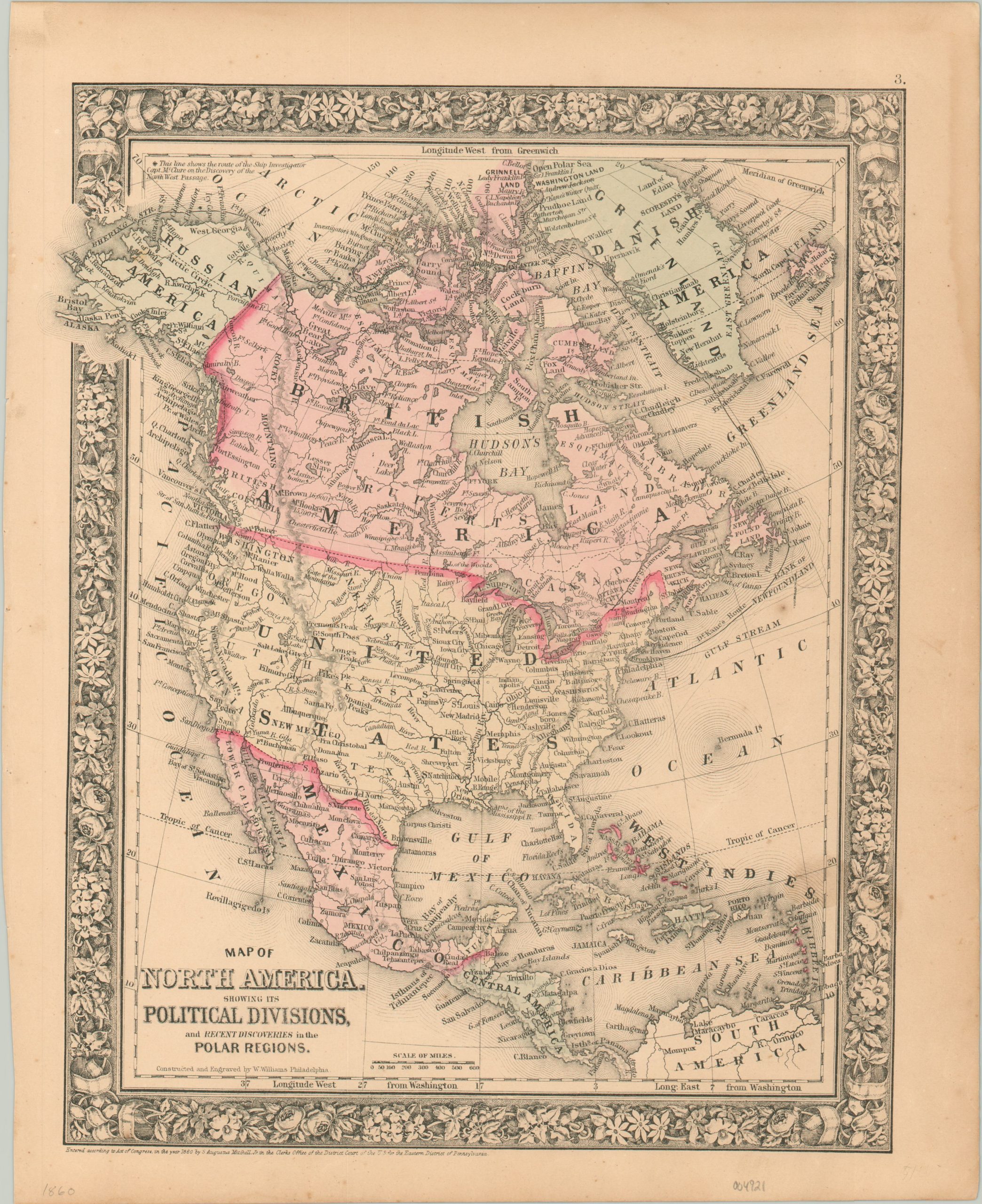
Map of North America Showing its Political Divisions, and Recent Discoveries in the Polar Regions.
Detailed overview of North America from 1860.
Out of stock
Description
This attractive map of North America was published in Philadelphia in 1860 by Samuel Augustus Mitchell. Mitchell was one of the most prominent American mapmakers of the 19th century and initially got involved with cartography as a school teacher who was frustrated with the quality of available maps. He collaborated with skilled engravers and produced high-quality maps and atlases that contained the most up-to-date information available. Mitchell’s son would take over the business after his death in 1860 and continue the tremendous output.
His attention to detail is evident within the image, which provides an informative snapshot of the continent shortly before the outbreak of the Civil War. National borders are shown with vibrant shades of pink, yellow, and green. Canada, Greenland, and Alaska are labeled as British America, Danish America, and Russian America, respectively.
A fascinating variety of place names, geographic features, and other locations of interest are labeled throughout the map. Of particular note are the routes of polar explorers Elisha Kent Kane and Robert McClure, both of whom explored the Arctic in an effort to determine the fate of John Franklin’s expedition.
Map Details
Publication Date: 1860
Author: Samuel Augustus Mitchell
Sheet Width (in): 12.5
Sheet Height (in): 15.25
Condition: A-
Condition Description: Some light toning and faint damp staining visible in the margins, most evident in the upper right corner. Uneven left edge where previously bound. A few small spots visible within the image (see West Indies). Very good overall, with original color.
Out of stock

