
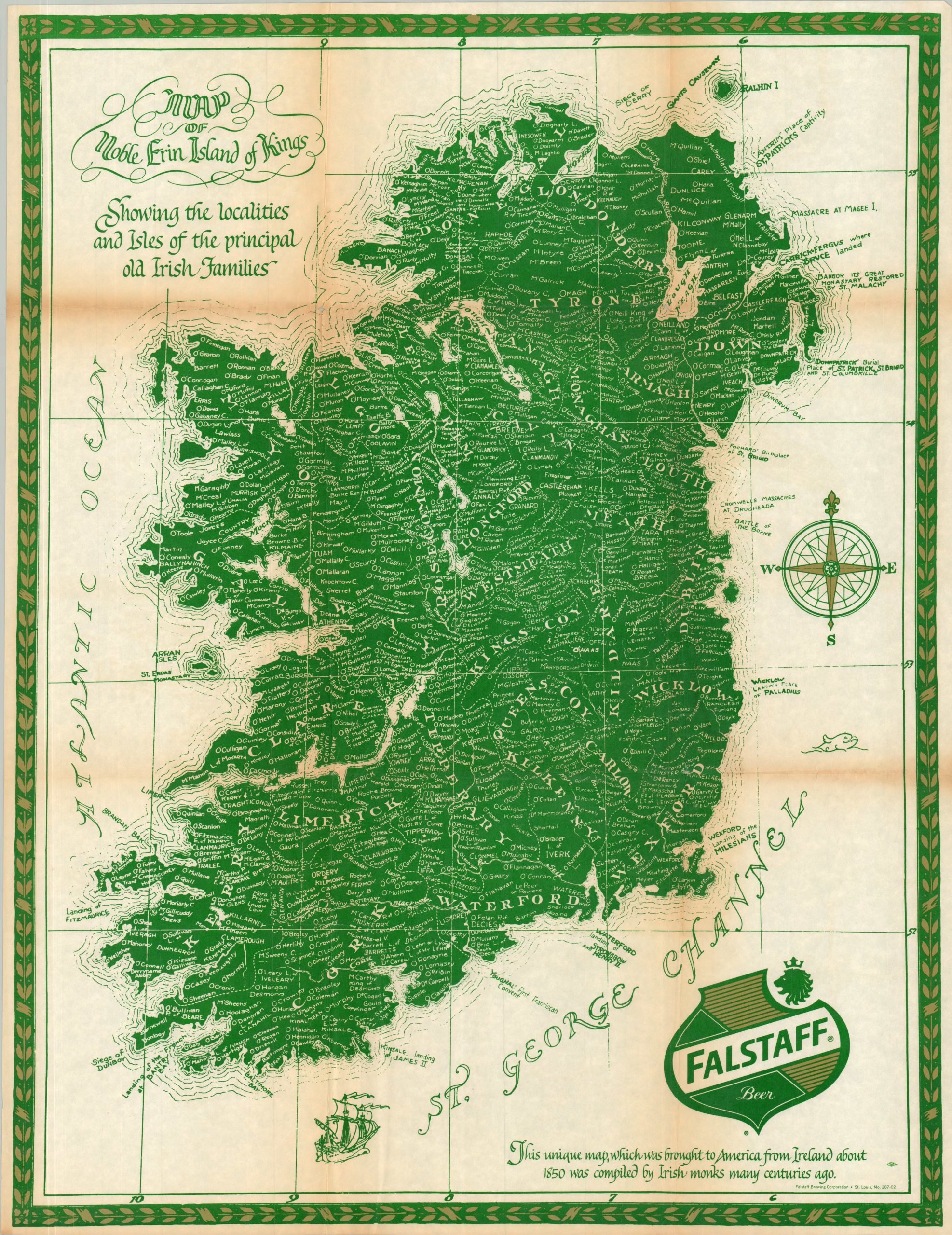
Map of Noble Erin Island of Kings
Have a pint while tracing the family’s Irish heritage!
Out of stock
Description
“This unique map, which was brought to America from Ireland about 1850 was compiled by Irish monks many centuries ago.” – Text, lower right.
This striking emerald-colored map of Ireland was published as a promotional piece in the latter half of the 20th century by the St. Louis-based Falstaff Brewing Company. Founded in 1903, the brewery was in the top five in terms of national operations around the time of issue, ultimately leading to a devastating antitrust case that significantly hindered operations. Though Falstaff has German roots, this piece is evidently intended for those looking to celebrate their Irish ancestry. Scores of surnames are carefully labeled across the historic thirty-two counties of the island. A handful of decorative elements, important events, and historic sites broaden the scope of potential interest.
The romantic claim that the map was compiled by Irish monks “centuries ago” is false. The cartography is actually based on a 1914 genealogical design by Chicago-based publisher George H. O’Sullivan, which was featured prominently in the Chicago Tribune to tap into early 20th-century Irish-American heritage pride.
Sources: Michigan State University; St. Louis County Library
Map Details
Publication Date: c. 1970?
Author: Falstaff Brewing Corporation
Sheet Width (in): 21.25
Sheet Height (in): 28.00
Condition: B
Condition Description: Single-sided map with moderate wear and toning along old folds. Small holes at the fold intersections and a bit of extraneous wrinkling. About good condition overall.
Out of stock