Map of New Hampshire
Early motorist’s map of New Hampshire, folded and mounted on linen.
Out of stock
Description
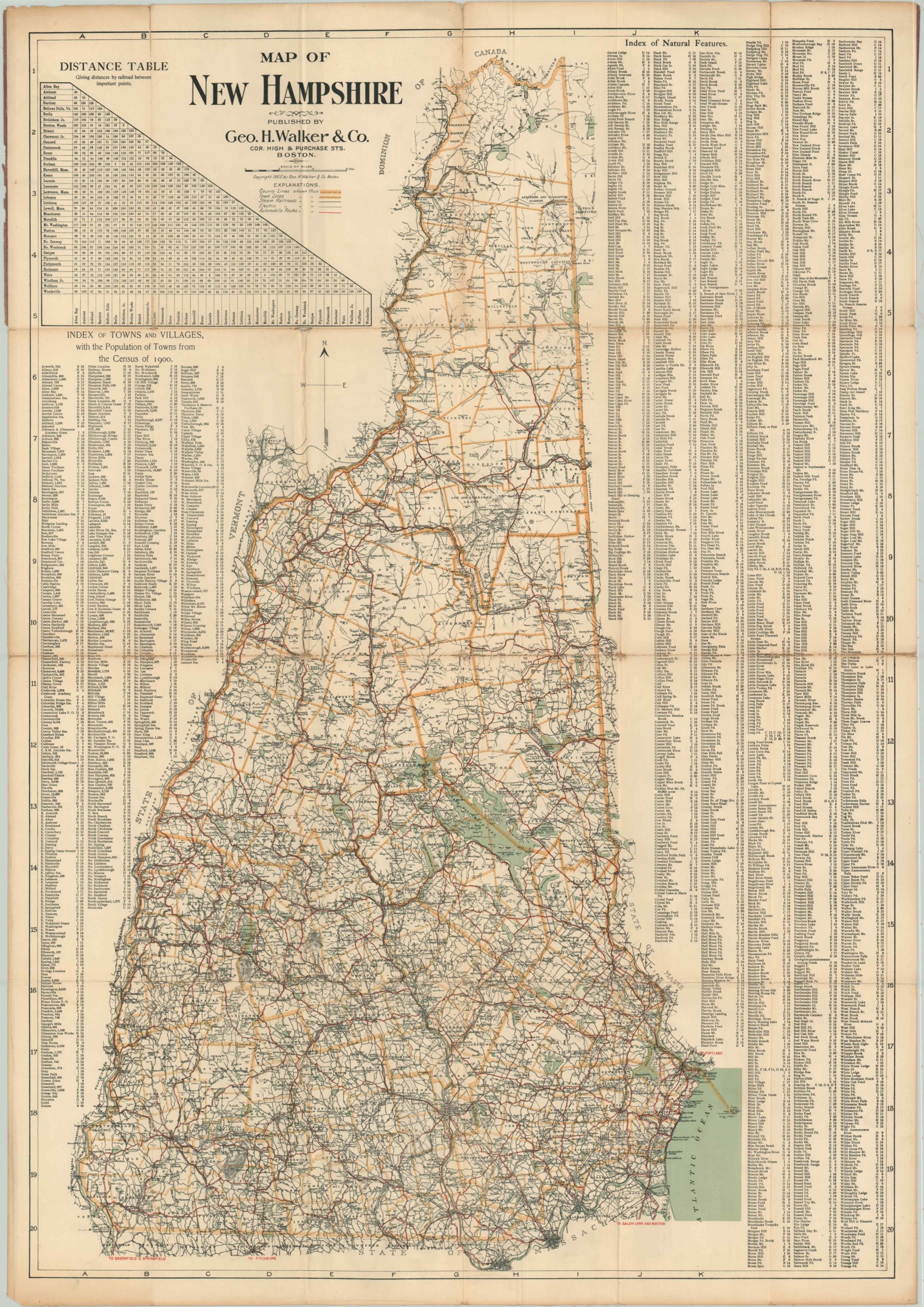
Although this 1905 map of New Hampshire prominently shows automobile routes in red, these roads were likely more frequently used by cyclists. According to the Federal Highway Administration, there were only 78,000 registered vehicles in the United States in 1905, though this number had more than doubled since 1903.
In addition to roads, the map also shows steam and electric railroads that serve the region, making it a useful reference for all travelers. A distance table in the upper left shows the length between points on these lines, while an index below lists the towns and their population. A list of natural features on the right side of the sheet makes for an amusing read – apparently coming up with unique names is more difficult than one would think!
Map Details
Publication Date: 1905
Author: George H. Walker & Co.
Sheet Width (in): 31.60
Sheet Height (in): 45.50
Condition: B-
Condition Description: The map is mounted on linen, but still exhibits moderate wear. Discoloration and minor image loss along fold lines and at fold intersections. Two separations along fold lines at the top of the map. Still very presentable, with good color and full margins.
Out of stock