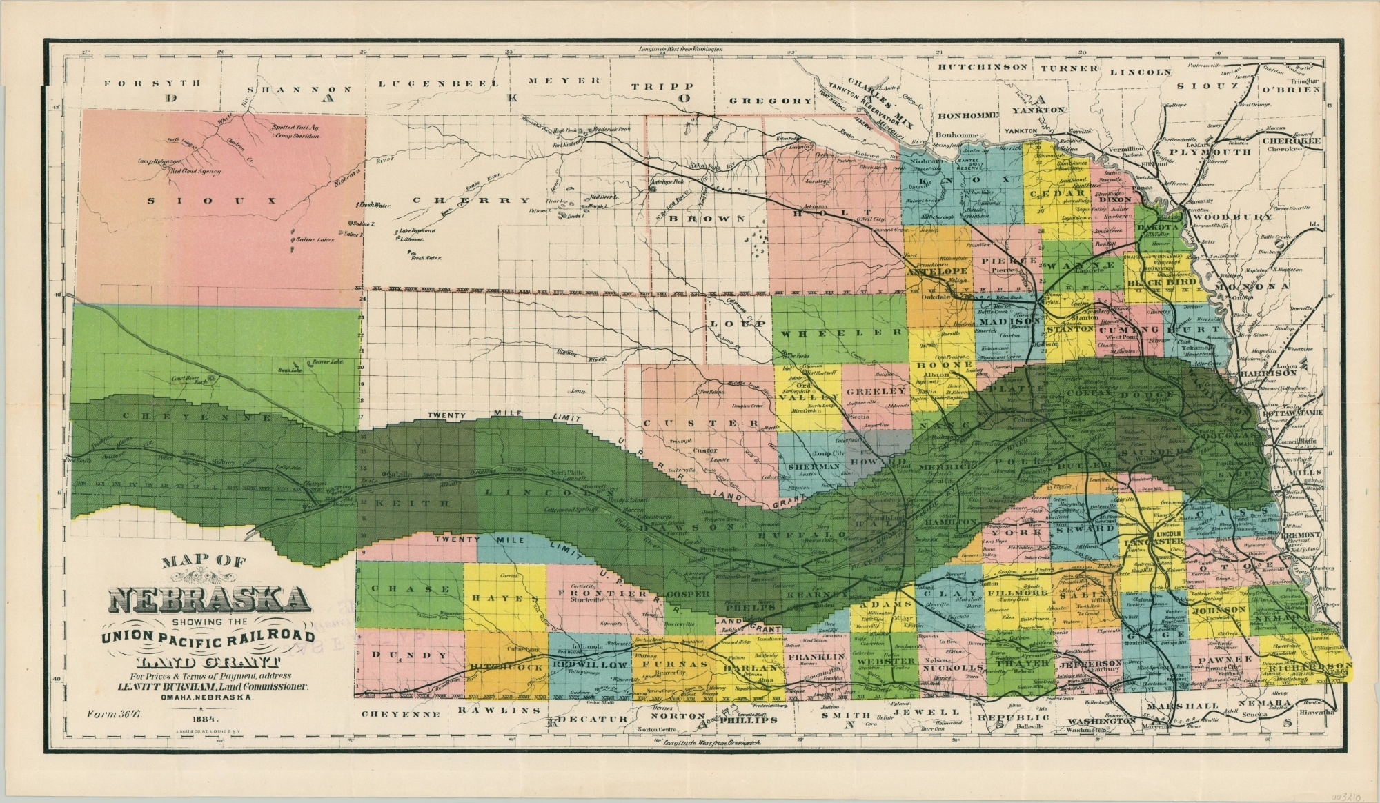
Map of Nebraska Showing the Union Pacific Railroad Land Grant
Unrecorded map of Union Pacific land grants in Nebraska.
Out of stock
Description
In order to help finance the construction of the nation’s first Transcontinental Railroad (and numerous subsequent lines), Congress enacted a series of bills that provided government bonds and land grants to various railroad companies. The Union Pacific was a huge recipient, and this map of Nebraska shows the twenty-mile limit along either side of the track that was allocated for sale.
The land grants were heavily advertised and brought settlers to the state by the thousands, as evidenced by the plotted townships and labeled towns that hug the lines. A St. Louis real estate agent rubberstamp can be found on the verso and text underneath the title encourages the audience to address Leavitt Burnham, Land Commissioner in Omaha, for prices and terms of payment.
The map is known in several separate editions, having been printed originally in 1880 by H.R. Page & Company in Chicago (the Library of Congress has one such example). Rand McNally also printed a version around this time, found at Yale and the University of Iowa libraries. WorldCat identifies five copies of an 1883 version. This is the first example I can find that is dated 1884.
Map Details
Publication Date: 1884
Author: A. Gast & Co.
Sheet Width (in): 23.5
Sheet Height (in): 13.75
Condition: A-
Condition Description: Lightly creased along former fold lines. Faint discoloration and two small tears along the outer edges are confined to the margins. Old manuscript writing and real estate agent rubberstamp on the verso. Very good overall.
Out of stock