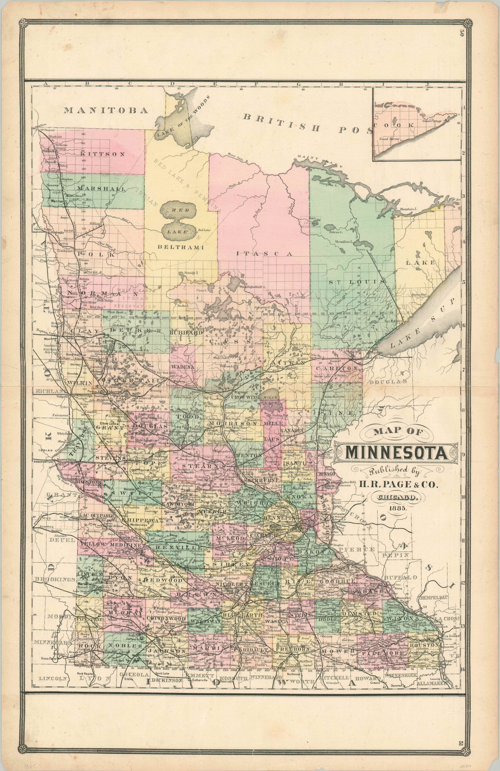
Map of Minnesota
Detailed map of Minnesota from the late 19th century.
Out of stock
Description
Railroads were the primary engines of growth, both economic and demographic, in the second half of the 19th century. That’s evident on this map of Minnesota, published in Chicago by H.R. Page & Company in 1885.
The robust rail network in the southern half of the state has resulted in county configurations that we know today, while the large northern counties remain incompletely surveyed and almost devoid of settlement outside of noted Native American reservations. Countless bodies of water can be found within the image, given visual support to the state’s nickname, the Land of 10,000 Lakes.
Map Details
Publication Date: 1885
Author: H.R. Page & Co.
Sheet Width (in): 19.50
Sheet Height (in): 27.00
Condition: B+
Condition Description: Outer edges are slightly toned and have a few chips. Minor soiling visible along the top of the sheet and along the horizontal centerfold.
Out of stock

