Map of Minneapolis
Vibrant lithographed transportation map of Minneapolis, Minnesota.
Out of stock
Description
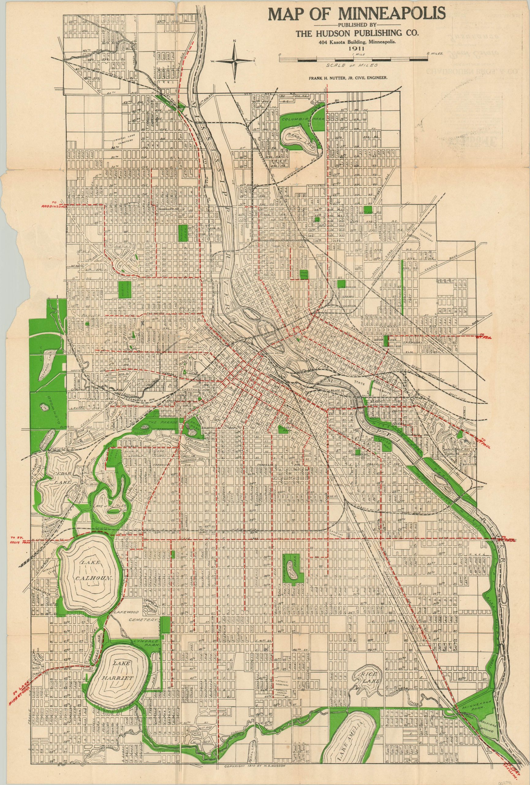
This detailed city plan of Minneapolis, Minnesota was compiled by Frank Nutter, Jr. and published locally by the Hudson Publishing Company in 1911. Based on an advertisement on the verso and a small area of old adhesive, it’s likely that it was originally issued in a guidebook or as a pocket map.
The emphasis is clearly on local transportation. Apart from a distinctly legible street grid, the image boldly depicts steam railroads (black) and streetcar lines (red hashes). The latter comprise a portion of the St. Paul/Minneapolis interurban transit network, with a number of various connecting cities noted in the margins.
Various outdoor spaces like parks and common areas are highlighted in green. Many are connected by a robust assortment of shaded boulevards and parkways draped like a necklace around the city.
Map Details
Publication Date: 1911
Author: Frank H. Nutter, Jr.
Sheet Width (in): 18.5
Sheet Height (in): 27.75
Condition: B
Condition Description: Originally issued in pocket map form, with heavy wear along former fold lines. This includes several areas of separation repaired on the verso with archival tape and small bits of image loss at the fold intersections. A few extra tears in the upper right corner have also been repaired. Minor offsetting in the upper right. Despite the damage, the image remains intact and the map is in good condition overall.
Out of stock