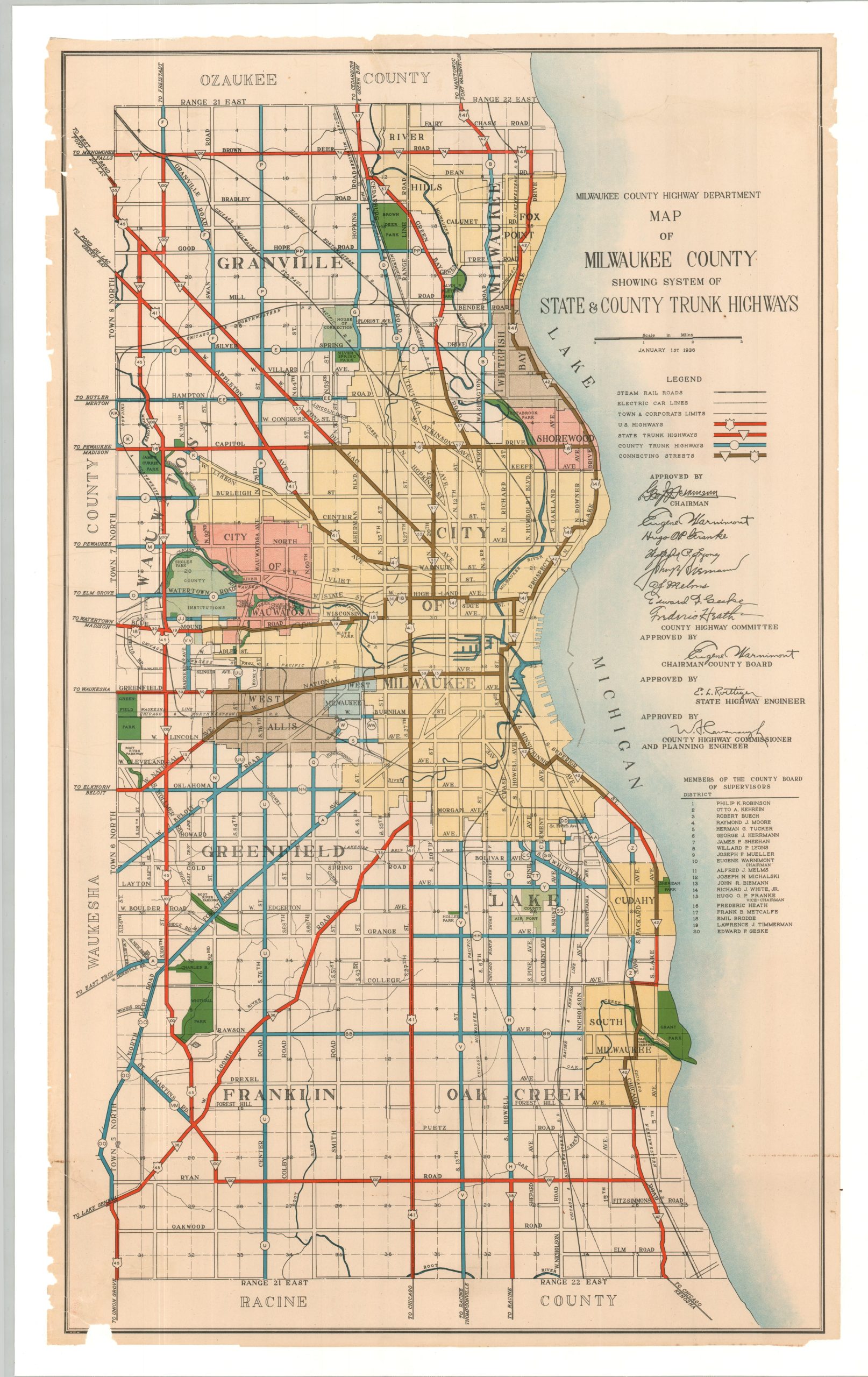
Map of Milwaukee County Showing System of State & County Trunk Highways
A brightly colored Depression-era map of the Milwaukee County road network.
Out of stock
Description
This vibrant road map of Milwaukee County, Wisconsin, was published in 1936 by the Milwaukee County Highway Department. Red, blue, and brown lines show the routes of U.S./State Highways, County Trunk Highways, and Connecting Highways, respectively (presumably all paved). Steam and electric railroads, then losing transportation domination to the automobile, are also shown according to the legend in the upper right corner.
Milwaukee city limits are highlighted in yellow, with several surrounding towns like Whitefish Bay, West Allis, and Wauwatosa also outlined and labeled. Other features of interest include the County Airport (opened a decade earlier), County Institutions (Poor Farm, Tuberculosis Hospital, etc.), several parks and parkways, and the House of Corrections (est. 1917).
Map Details
Publication Date: 1936
Author: Milwaukee County Highway Department
Sheet Width (in): 25
Sheet Height (in): 41.5
Condition: B+
Condition Description: Formerly a rolled wall map, now professionally flattened and mounted onto linen for preservation and stability. Several chips are visible in the margins, including one in the lower left that enters the neatline. Several closed tears faintly visible upon close inspection and a line of discoloration in the lower right corner. Good condition overall.
Out of stock