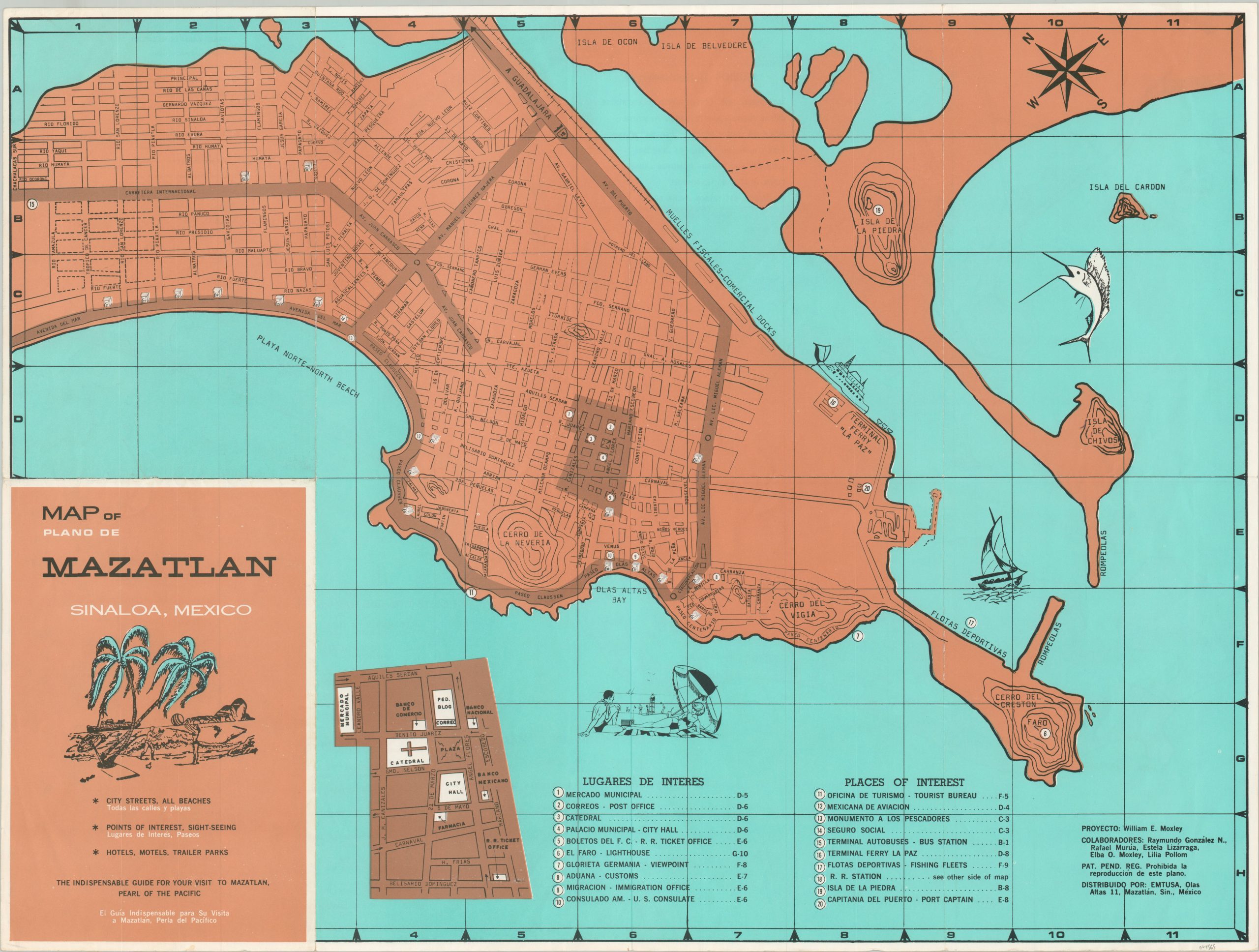
Map of Mazatlán Sinaloa, Mexico
“The indispensable guide for your visit to Mazatlán, Pearl of the Pacific”
Out of stock
Description
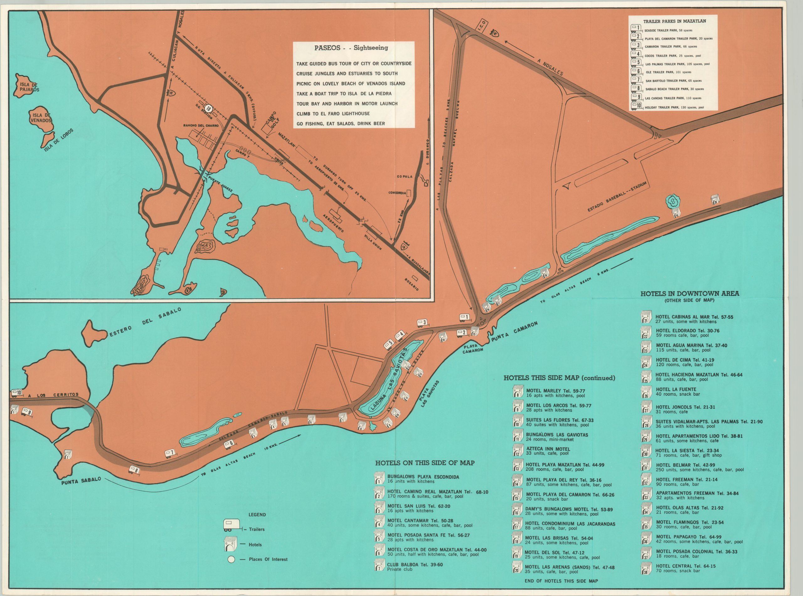
This bold map of Mazatlán shows the popular Pacific coast tourist destination with stark clarity, if in a somewhat muted style. A simple street plan identifies the most popular thoroughfares and twenty different locations of interest. An inset in the lower left shows the downtown area shaded in the center. The verso emphasizes accommodations and sightseeing tours in the immediate vicinity, identifying hotels and trailer parks, as well as popular nearby attractions.
Copywritten by William E. Moxley and published by EMTUSA in Mazatlán, probably around 1960.
Map Details
Publication Date: c. 1960
Author: William E. Moxley
Sheet Width (in): 23.75
Sheet Height (in): 17.75
Condition: A-
Condition Description: Creased and lightly worn along originally issued fold lines. Faint wear also visible along the outer edges of the sheet. Very good to near fine overall.
Out of stock