
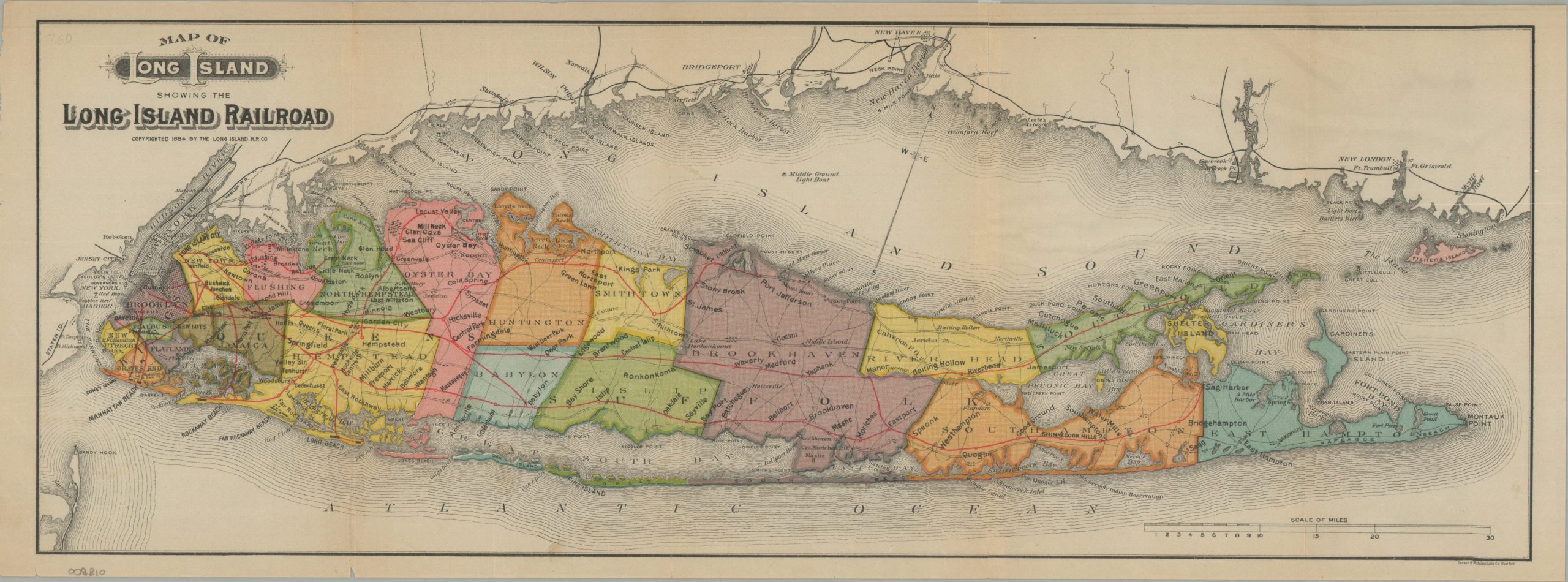
Map of Long Island Showing the Long Island Railroad
The Long Island Railroad during the Gilded Age
Out of stock
Description
This colorful map of the Long Island Rail Road was copyrighted in 1884 and published by Sackett & Wilhelm’s Lithography Company of New York. Company lines between Brooklyn and Greenport and Sag Harbor are highlighted in red, with bold text identifying numerous stops and destinations along the operational routes. Of particular interest is Manhattan Beach, which had recently been developed by LIRR president Austin Corbin as a major seaside resort competing directly with Coney Island. Other notable destinations include Garden City, Rockaway Beach, Oyster Bay, and Port Jefferson.
Map Details
Publication Date: 1884
Author: Long Island Railroad Company
Sheet Width (in): 22.00
Sheet Height (in): 8.10
Condition: B+
Condition Description: Color printed map on a single sided sheet of thin paper, with a ragged left binding edge. Lightly wrinkled and a few small spots. Good to very good condition overall.
Out of stock