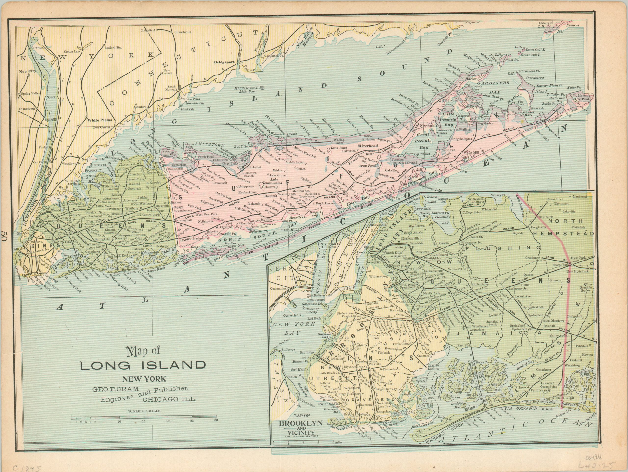
Map of Long Island New York
$50.00
Long Island and Brooklyn in the mid-1890s.
1 in stock
Description
This color lithographed map of Long Island, New York was published in Chicago in 1896 by George Cram. Queens and Suffolk County are highlighted in green and pink, respectively, with the latter showing some signs of a misprint around the borders. Railroad tracks, the vast majority in operation under the Long Island Railroad, are depicted as black lines connecting nearly every corner of the island.
An inset map in the lower right, also misprinted, shows the city of Brooklyn and the surrounding area. Several areas are labeled New Lots, reflecting recent annexations across Kings County. The municipality would be consolidated as part of Greater New York City just a few years after publication, in 1898.
Map Details
Publication Date: 1896
Author: George Cram
Sheet Width (in): 14.5
Sheet Height (in): 10.75
Condition: A-
Condition Description: Moderate toning and several small tears visible in the margins. One closed tear, about 1" long, repaired on the verso with archival tape. Very good overall.
$50.00
1 in stock

