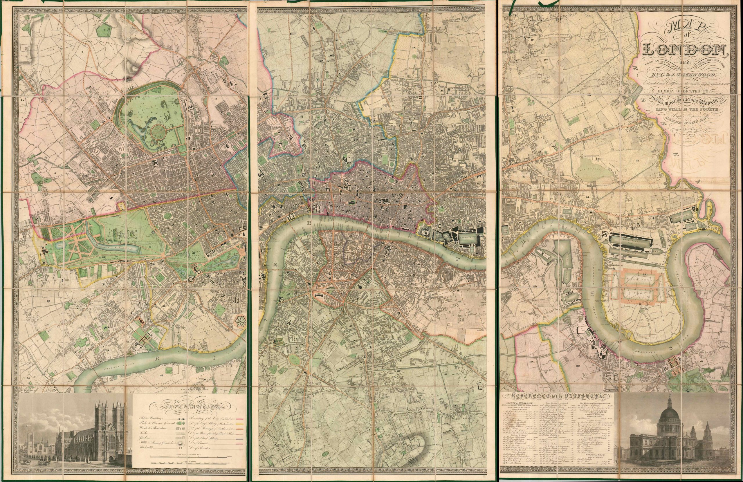
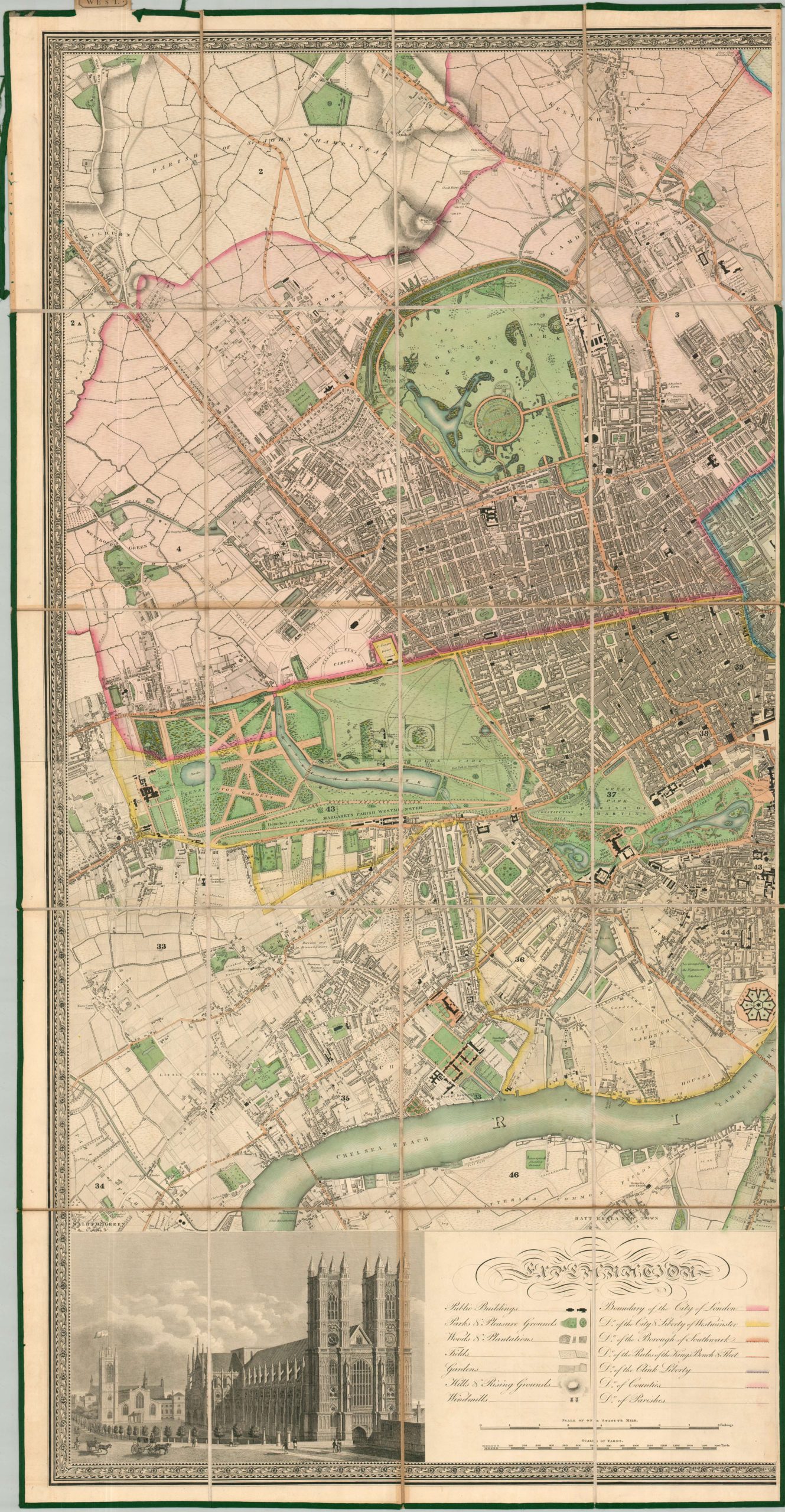
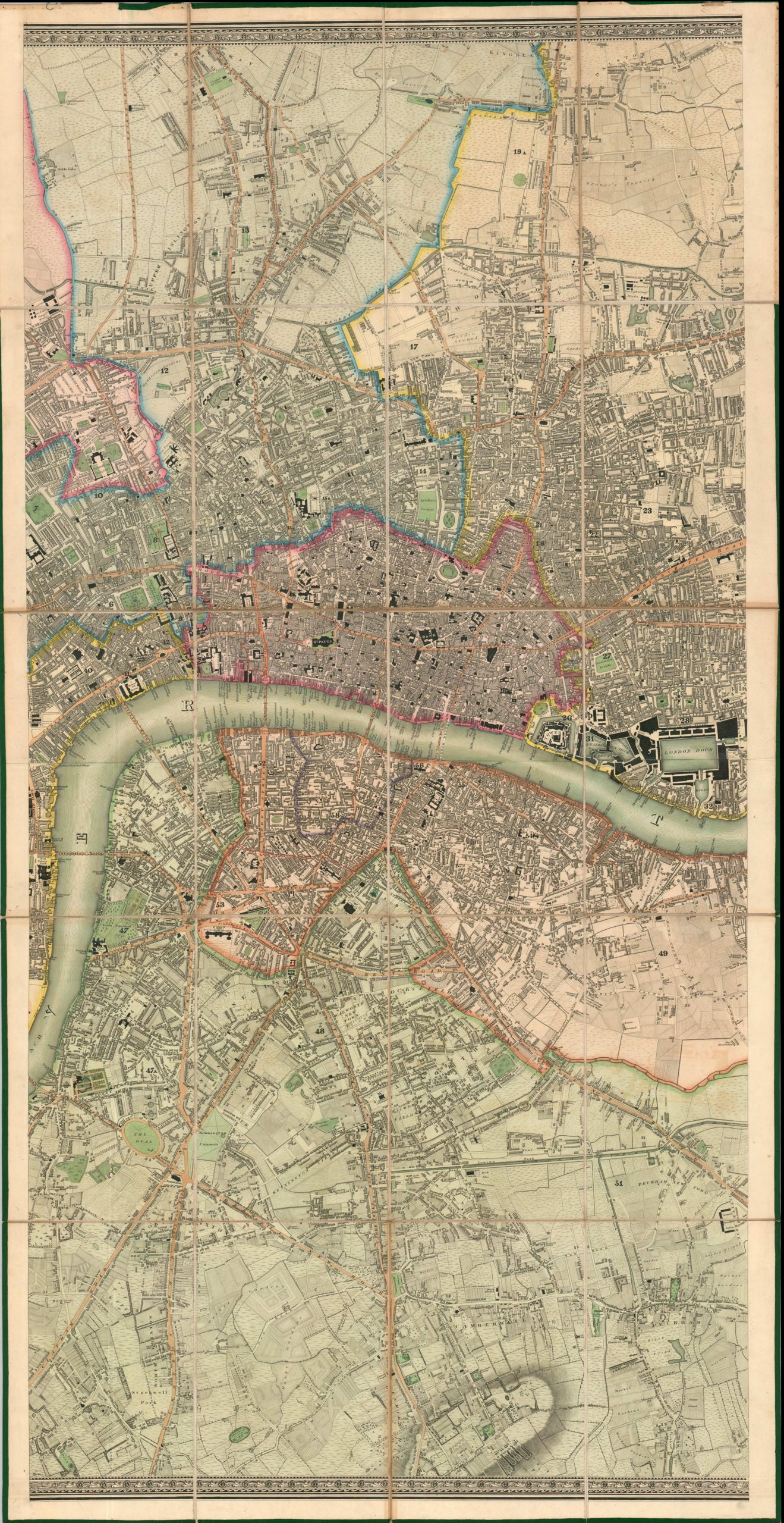
Map of London Made from an Actual Survey in the Years 1824, 1825, & 1826
London in 1830, then the largest city in the world.
Out of stock

Description
This magnificently detailed map of London was compiled by brothers Christopher & John Greenwood after they spent several years surveying the British capital – the hub of international trade and the largest city in the world at the time of publication. The dense image presents a wealth of information during a period of remarkable growth and transformation – population, industry, and the physical footprint all expanded greatly during the 19th century. Such growth was predicated on the availability of foodstuffs from the countryside and the construction of massive dock/shipbuilding facilities, both clearly represented within the decorative border.
The map presents London and the surrounding suburbs across three sheets, from the Isle of Dogs and its extensive dockyards to Kensington Gardens. Various boundaries (city, county, parishes, etc.) are brightly colored, along with parks and pleasure grounds in vibrant green. Windmills, fields, gardens, and public buildings are among the features identified in the legend (lower left). Notable recent construction includes St. Pancras New Church (1822), the British Museum (1823), Regent’s Street (1827), ongoing work on the Thames Tunnel, improvements to St. James Park, and a nearly completed London Bridge (adjacent to the old one). Less-famous, but still certainly interesting, contemporary landmarks include the Surrey County Gaol (a public execution site), Daguerre and Bouton’s diorama in Regent’s Park, and a workhouse in the infamous slum of St. Giles. Elegantly engraved scenes in the lower corners show two of London’s most iconic landmarks – Westminster Abbey (lower left) and St. Paul’s Cathedral (lower right).
An incredible cartographic encapsulation of Regency-era London, though the map fails to explicitly show the stark contrasts in wealth, education, and hygiene that defined the city at the time. There are signs, however, as hunting lodges are labeled next to country farms, and private mansions sit far away from the tanneries, butchers, and factories that plagued the slums. Police offices and several prisons ensure public order, for the most part, whereas public entertainment for the upper classes is available in numerous theaters, music halls, and museums.
Source: Levanthal Map Collection at the Boston Public Library
Map Details
Publication Date: 1830
Author: C. & J. Greenwood
Sheet Width (in): 25.75
Sheet Height (in): 50.25
Condition: A-
Condition Description: Group of three (size given for each) maps, each dissected, mounted onto sturdy linen, bordered with green cloth, and affixed to leather covers with a tab reading East, Central, and West. Original full color. Some scattered discoloration visible as a result of foxing and transference from the printed black ink, most evident below the title block in the upper right. The green cloth border is beginning to pull away and is lost in a few areas, though the image is not impacted. Some paper toning visible between the panels. Good to very good condition overall.
Out of stock