Map of Lake Tahoe Recreational Area
$55.00
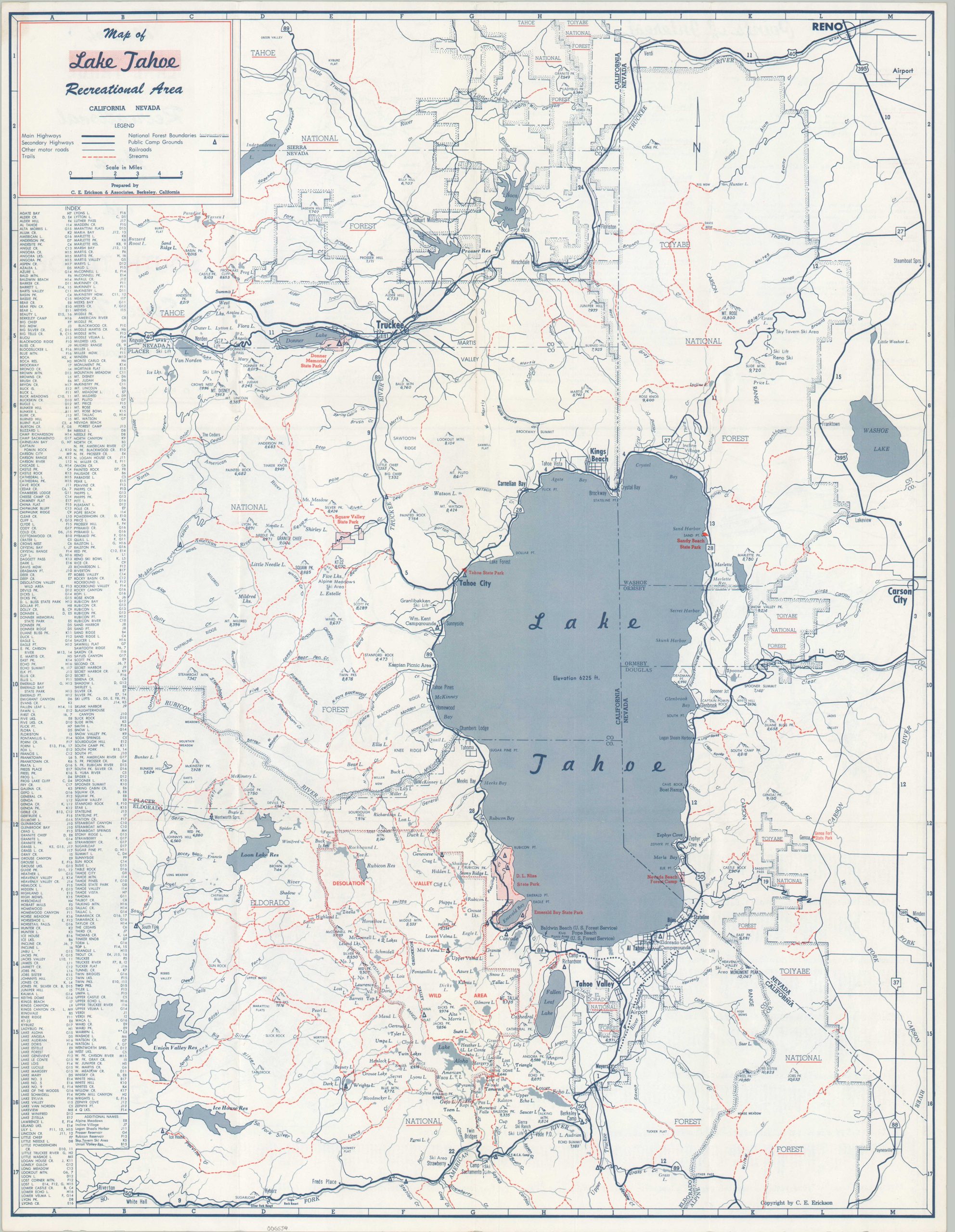
Double-sided map highlighting the popular recreational area around Lake Tahoe.
1 in stock
Description
Lake Tahoe is a large freshwater body of water straddling the border between California and Nevada. It’s a popular region for outdoor enthusiasts, especially winter sports, thanks in large part to hosting the 1960 Winter Olympics at Squaw Valley. This map was created in the early 1960s by C.E. Erickson & Associates of Berkeley, California, and issued by the Lake Tahoe South Shore Chamber of Commerce.
The primary image shows a detailed overview of the Lake Tahoe recreational area. It identifies transportation routes, campgrounds, National Forests, geographic features, and much more. The abundance of hiking trails (red dotted lines) is evident. The verso provides a detailed street plan of the south shore of Lake Tahoe, as well as brief snippets on various points of interest.
Map Details
Publication Date: c. 1960
Author: C.E. Erickson & Associates
Sheet Width (in): 16.75
Sheet Height (in): 21.75
Condition: A
Condition Description: Creased along originally issued fold lines and faint wear consistent with age and use. Toning on the verso does not affect the image. Good to very good condition overall.
$55.00
1 in stock