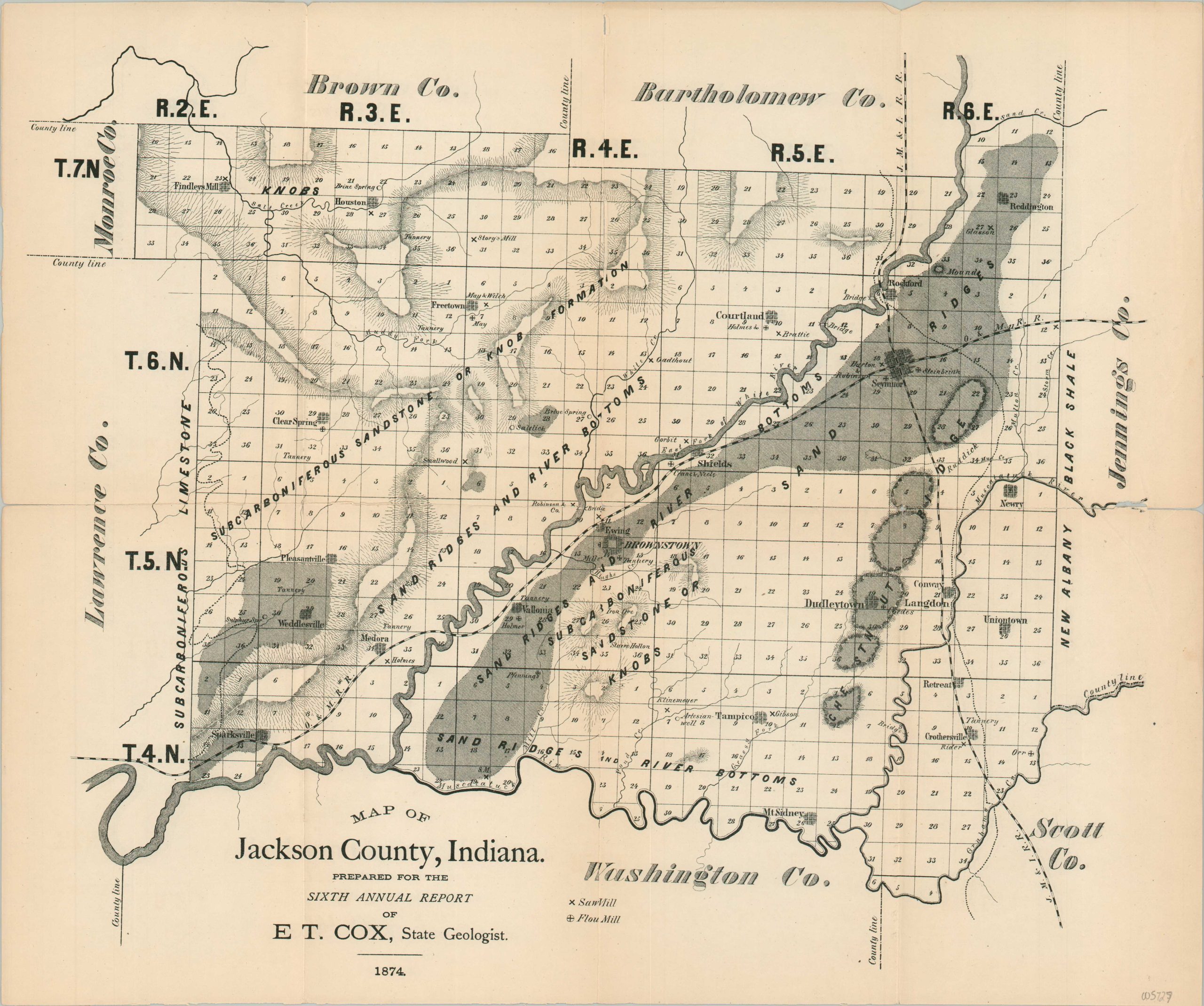
Map of Jackson County, Indiana
$125.00
Detailed Reconstruction-era geologic map of Jackson County, Indiana.
1 in stock
Description
This fascinating map of Jackson County, Indiana was compiled by state geologist Edward Travers Cox for inclusion in his Sixth Annual Report of the Geological Survey of Indiana, published in Indianapolis in 1874.
The image shows an intriguing overview of the largely agricultural county in central Indiana, broadly labeling geographic formations and surface features – river bottoms were especially suitable for farming. Two railroads can be seen – just eight years earlier, the Ohio and Mississippi R.R. was victim of the first recorded robbery of a moving train in the United States!
Saw mills, flour mills, and other local industries are also labeled. The iconic Medoa Covered Bridge, the longest of its kind in America, would be constructed the year after publication. Named communities include Brownstown (the county seat), Seymour (the site of the robbery), Dudleytown, and Pleasantville.
Map Details
Publication Date: 1874
Author: E.T. Cox
Sheet Width (in): 18
Sheet Height (in): 15
Condition: B+
Condition Description: Printed on brittle paper that has separated along many of the original fold lines. Heavy repairs with archival tape on the verso with very minimal image loss. Good condition overall.
$125.00
1 in stock

