Map of Iowa with 1910 Census
$195.00
Nowhere in Iowa is safe from tornadoes!
1 in stock
Description
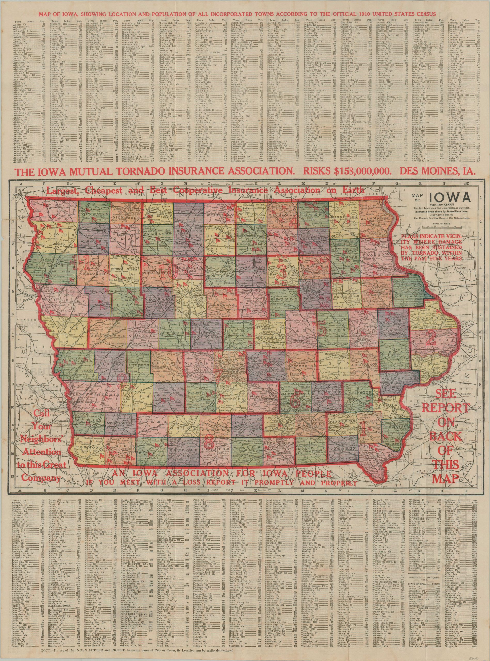
Though Kansas might be the first Great Plains state that comes to mind when one thinks of devastating twisters (thanks to Dorothy), much of Iowa is also situated in Tornado Alley. The Hawkeye State experiences extensive property damage every year from unpredictable windstorms and the early 20th century was no different!
This colorful map of Iowa was published in Des Moines by The Kenyon Company in 1911. It was sponsored by The Iowa Mutual Tornado Insurance Association, an “Iowa Association for Iowa People”, to inform (uninsured) residents about the possible risks. A base county map of the state has been overprinted with literal red flags that “indicate vicinity where damage has been sustained by tornado within the past five years.”
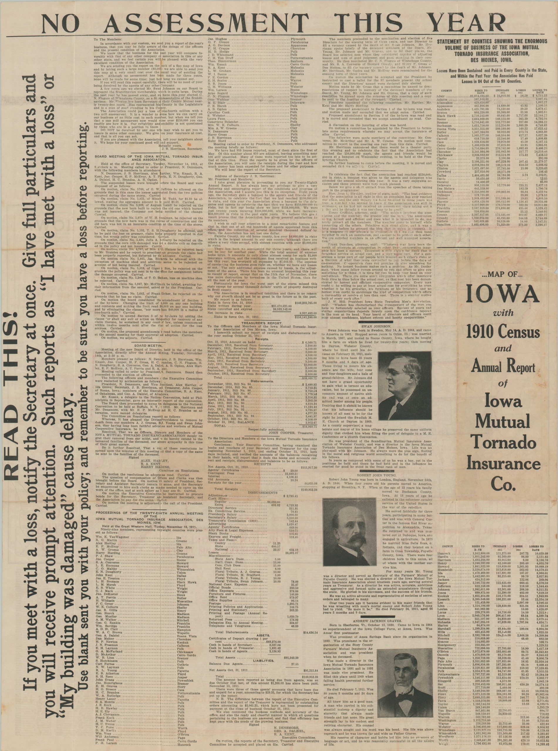
A comprehensive index of Iowa cities and towns, along with their respective populations from the 1910 census, is provided at the top and bottom of the page. The verso presents the Annual Report of the Iowa Mutual Tornado Insurance Co., which notes nearly 1,000 claims were made the prior year.
Also of interest is a brief quote from the Treasurer which reads “There has been no unusual happening this year to record or report, except on the 11th day of November, there was more destruction by tornadoes in the United States, than for all the rest of the year.” The report was submitted to a meeting on November 14th, 1911, just three days after the Great Blue Norther of 11/11/11 crushed the Midwest, killing over 50 people and including at least 12 tornado touchdowns.
Source: U.S. Weather Department;
Map Details
Publication Date: 1911
Author: The Kenyon Co.
Sheet Width (in): 19.9
Sheet Height (in): 26.9
Condition: A-
Condition Description: Folded into 18 panels, as originally issued, with creasing and wear along fold lines. Clean separation in a few spots at fold intersections and some toning on the verso that does not affect the image. Very good condition overall.
$195.00
1 in stock