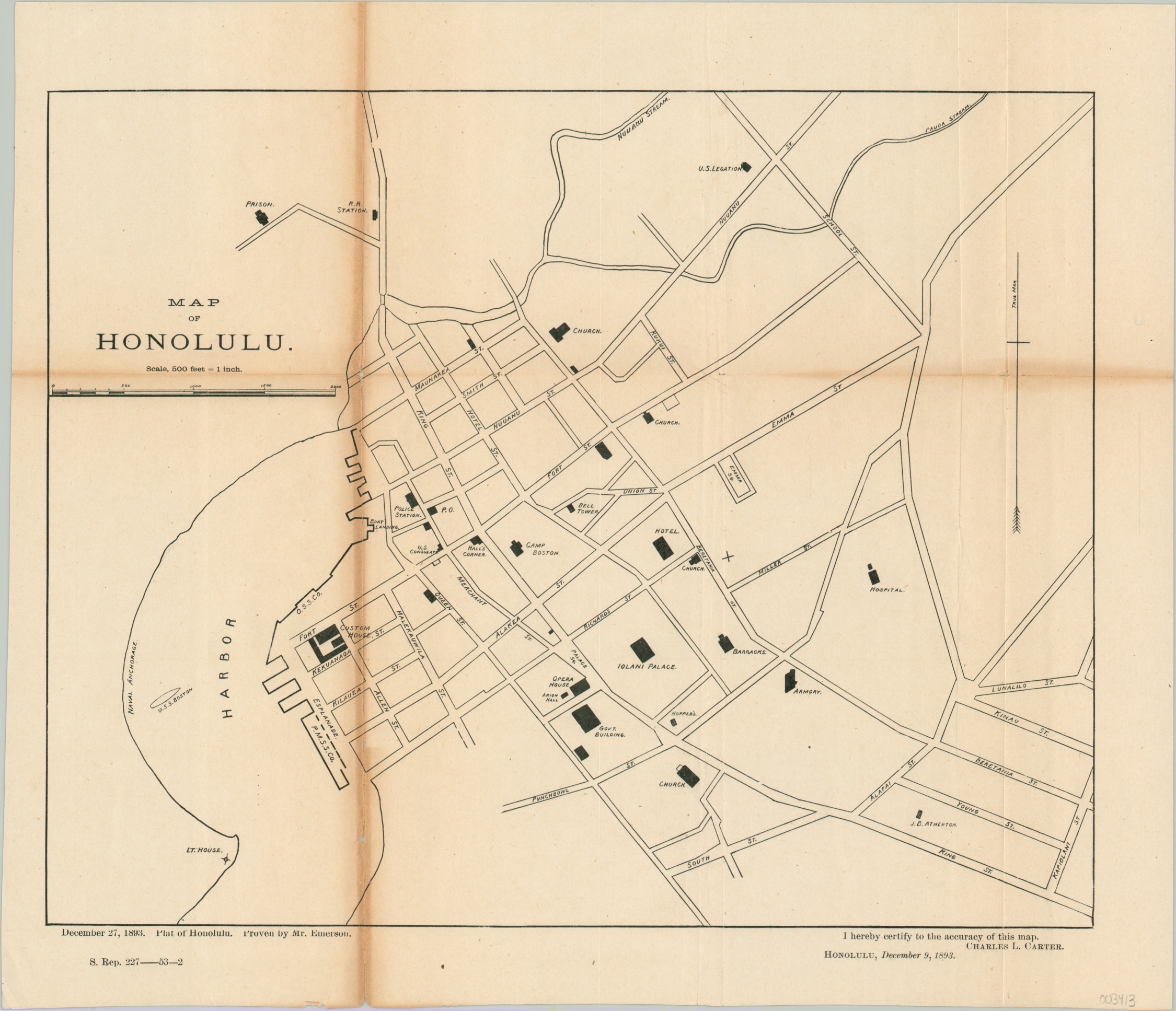
Map of Honolulu
$110.00
Honolulu shortly after the U.S.-backed coupe d’etat.
1 in stock
Description
In January of 1893, an unlawful coup d’et tat, supported by business interests and military troops of the United States, took place against Queen Liliuokalani of the Hawaiian Islands. Shortly thereafter, President Grover Cleveland would declare, “By an act of war…a substantial wrong has been done.” But this admission wasn’t enough to convince Congress to return the territory, then under the provisional government of pineapple magnate Sanford Dole.
This map was published in late 1893 as part of a government report and shows a simple street plan of the Hawaiian capital of Honolulu. Almost two dozen buildings of importance are individually outlined and labeled amid the street grid, along with the U.S.S. Boston in the Harbor. Over 100 marines and sailors from the ship participated in the January coup.
Map Details
Publication Date: 1893
Author: Charles Carter
Sheet Width (in): 15.90
Sheet Height (in): 13.75
Condition: B
Condition Description: Heavy toning across a vertical fold lines on the left side, which has also been reinforced on the verso with archival tape. Lighter toning also visible across a horizonal fold, but otherwise in good condition.
$110.00
1 in stock