Map of Hollywood
$350.00
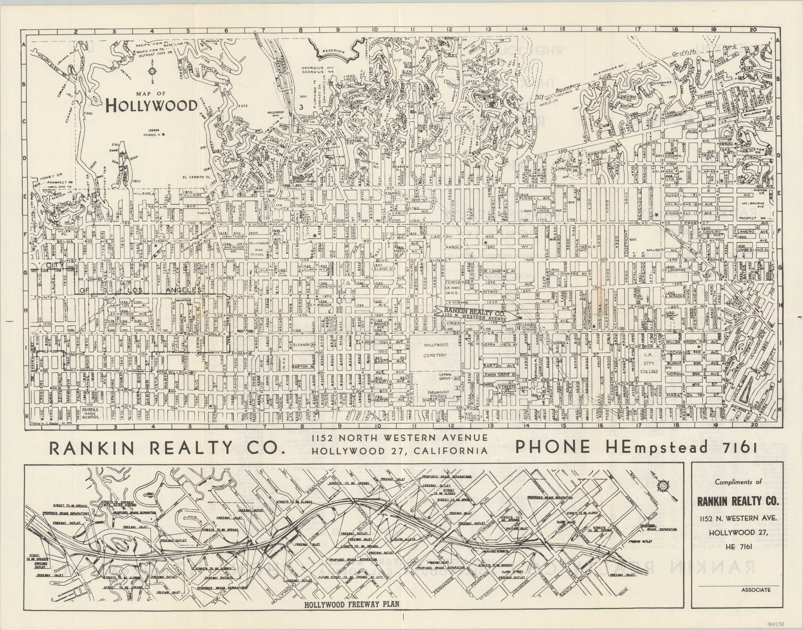
Postwar map of Hollywood highlight ongoing construction on the Hollywood Freeway.
1 in stock
Description
This simple black-and-white street map of Hollywood was drawn by C. Blanton and published around 1949 by the Rankin Real Estate Company. It provides a clear and concise overview of the popular Los Angeles suburb; labeling streets, schools, and other notable locations. Of particular interest are CBS, Goldwyn, RKO, and Paramount Studios, the Hollywood Bowl, and a ‘Flemish Village.’ The last, of which little can be found today, was likely demolished to make way for the construction of the iconic Hollywood Freeway.
The planned route can be seen in dotted lines bisecting the image from the upper center to the lower right. A segment completed in 1940 called the Cahuenga Freeway can be seen near the top of the page. The Pacific Electric Railway operated streetcars in the median until 1952, helping to date the map to an earlier year. An inset map at the bottom of the page provides further detail on the proposed construction, which took place from 1947 – 1954.
Source: Hollywood Versus the Freeway
Map Details
Publication Date: c. 1949
Author: C. Blanton
Sheet Width (in): 21.5
Sheet Height (in):
Condition: A-
Condition Description: Creasing along originally issued fold lines and small spots of separation at fold intersections. Very good to near fine overall.
$350.00
1 in stock