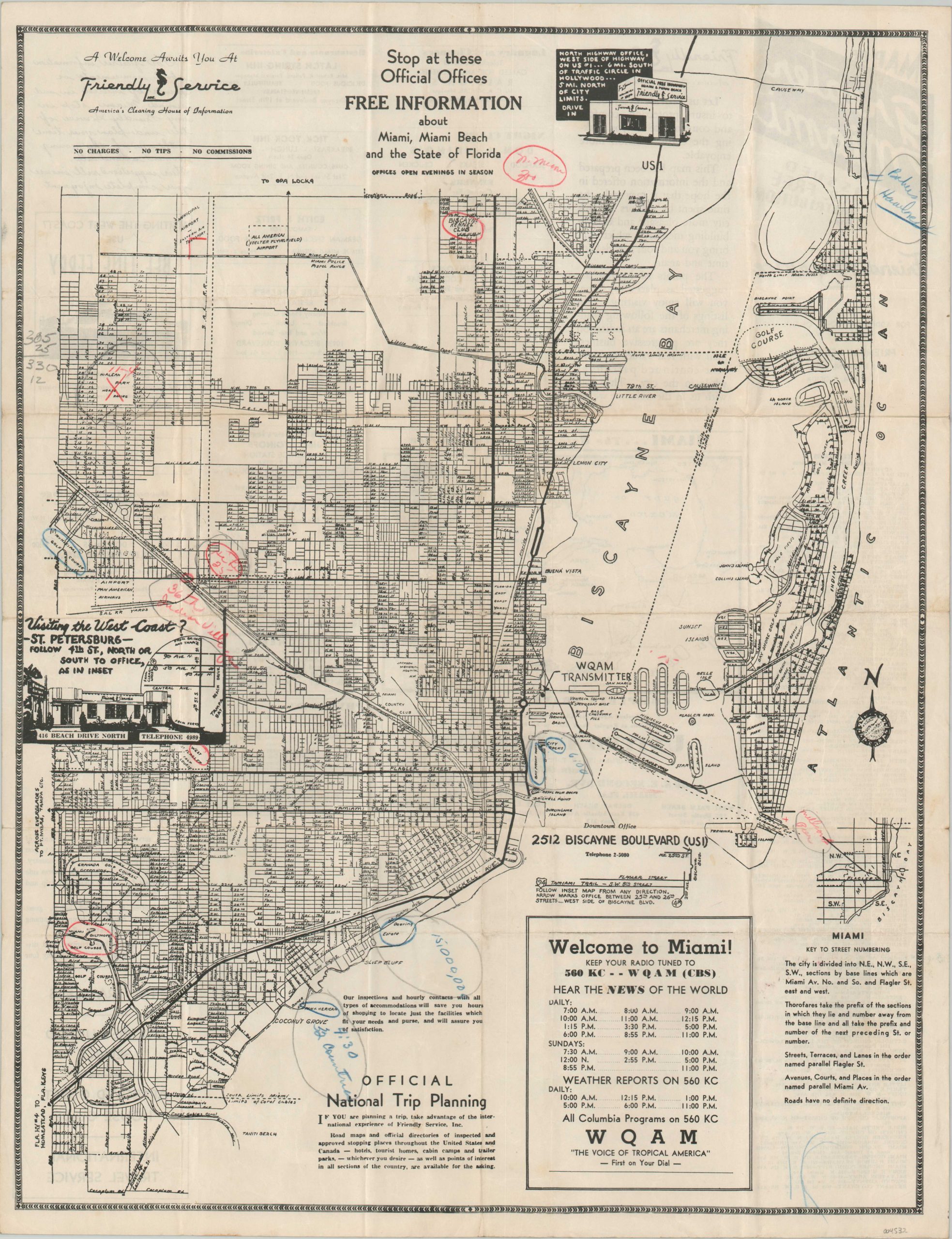
Map of Greater Miami [Title on Verso]
The city of Miami shortly before its World War II overhaul.
Out of stock
Description
This straightforward street map of Miami was published around 1937 by Friendly Service, Inc. – ‘America’s Clearing House of Information.” Primary transportation routes are noted, with a key to the street numbering provided in the lower right. Numerous locations of interest are labeled throughout, including recreational facilities, public buildings, and transportation hubs.
Many of the golf courses would be converted to military training facilities with the outbreak of World War II. The WQAM radio transmitter is prominently noted and a corresponding schedule of programs can be seen in the lower center. Several old manuscript annotations highlight previous usage as a trip itinerary.
Red pencil marks can be seen at the Hialeah Park Horse Track (11-4), the Biscayne Bay Kennel Club, and the ‘Indian Village [at] 36th.’ Blue pencil notes 32 different countries at the Pan-American exhibit? at Dinner Key, a 6:00 p.m. appointment at the City Docks, and more. Numerous contemporary advertisements, a comprehensive list of Miami-area churches, and promotional text for Friendly Service, Inc. can be found on the verso.
“This map has been prepared and the information offered in the hope that it may make the time spent by visitors in this city more pleasant and assist in building memories which will bring you and your friends back time and again. The points of interest are suggested as places we know you will enjoy visiting. The listings of the following leading merchants are indications they are progressive businessmen with real values to merit your continued patronage while in the city. They join with us in the welcome we extend to you.” [Text, verso]
Map Details
Publication Date: c. 1937
Author: Friendly Service, Inc.
Sheet Width (in): 16.5
Sheet Height (in):
Condition: B+
Condition Description: Map brochure with creasing and moderate wear along originally issued fold lines. A few seams have discolored somewhat with age, and there is light scattered spotting visible in the lower right. Several areas show old annotations in graphite, red, and blue pencil.
Out of stock

