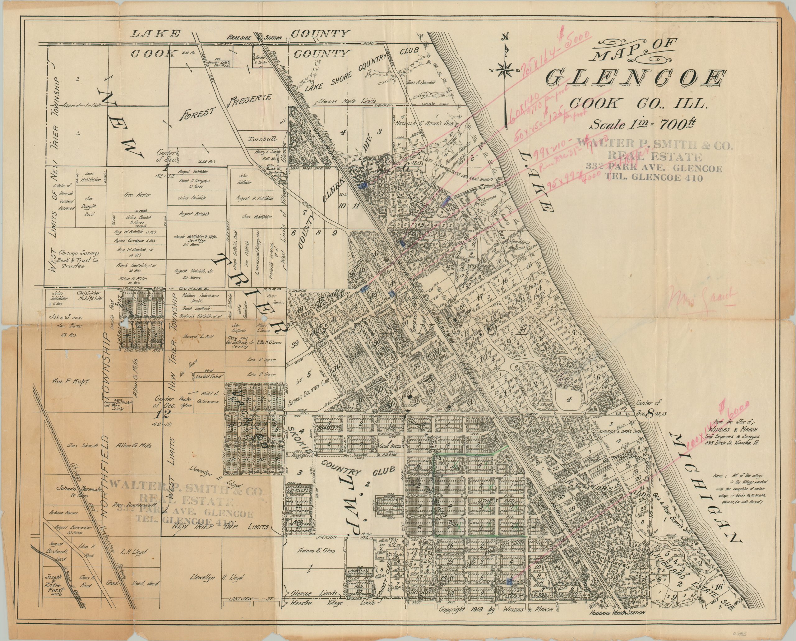
Map of Glencoe Cook Co., Ill.
Early 20th century real estate map of the northern Chicago suburb of Glencoe.
Out of stock
Description
Situated about 20 miles north of downtown Chicago, the village of Glencoe was incorporated in 1869 near a railway depot along the Chicago and Milwaukee line. It grew slowly but steadily over the following decades; with independent sewage constructed in 1900, electric power in 1903, and connection to the Chicago Sanitary District in 1913.
This detailed real estate map was created in 1919 by Windes & Marsh, 50 years after Glencoe was first chartered. Additions, sections, and subdivisions are labeled, along with prominent local landowners, important buildings (churches, schools, etc.), and geographic features. Names like Beinlich, Hesler, Kopf, and Hohlfelder highlight the concentration of European (predominantly German) immigrants to the area.
Old manuscript annotations note several lots, colored in blue, ranging from $4,000 – $7,000. An interesting note in the lower right reads; “All of the alleys in the Village vacated with the exception of certain alleys in blocks 20, 32, 33, & 44” – possibly a reflection of unpermitted tenements or temporary structures?
Source: Encyclopedia of Chicago;
Map Details
Publication Date: 1919
Author: Windes & Marsh
Sheet Width (in): 24.5
Sheet Height (in): 19.75
Condition: B
Condition Description: Heavily toned in the lower left quarter and worn along former fold lines. Numerous old annotations in red pencil, toned and worn margins, and several separations have been repaired on the verso with archival tape. Small holes at fold intersections has resulted in some minor paper loss, most evident in the center left. Between fair and good overall.
Out of stock

