Map of Florida
Early map of Florida published just a few years after statehood, shortly before the outbreak of the Third Seminole War.
Out of stock
Description
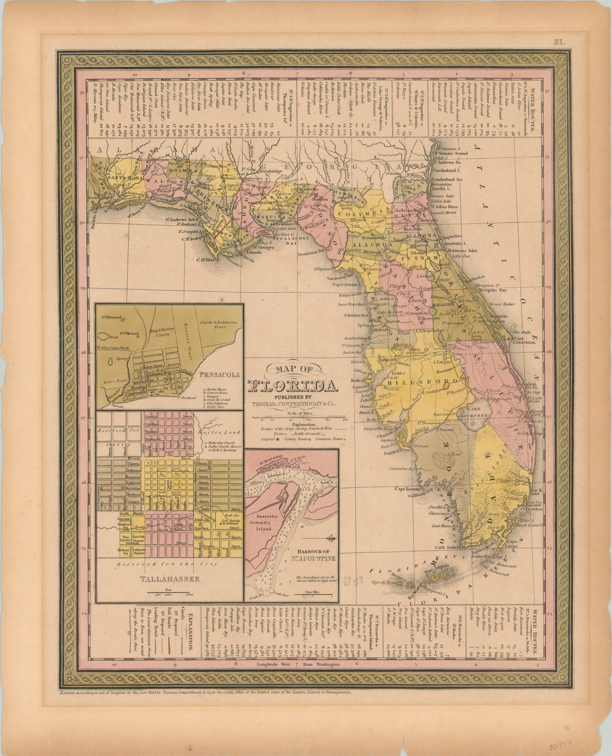
This detailed map of Florida was published by Thomas Cowperthwait & Co. in Philadelphia in 1850 and shows the relatively new state just five years after incorporation into the Union. The image shows a peninsula mostly devoid of large settlements, but includes inset maps of Pensacola, Tallahassee, and the harbor of St. Augustine.
Transportation routes, including canals, rail roads (only 2 short lines), and “leading roads” are noted in the legend, but the map fails to provide the promised land distances from town to town – possibly due to a scarcity of available information at time of publishing. Panels on either side list primary water routes as an alternative to the apparently haphazard overland travel.
The image also shows extensive information related to conflicts with local Native Americans – primarily the Second Seminole War of 1835 – 1842. Dated battle grounds (including Dades’ Massacre), forts, and the routes of the United States Army are all noted. Despite the tentative peace, conflict simmered throughout the late 1840’s as U.S. efforts to remove the remaining Native American tribes increased violently. A third (and final) Seminole War would outbreak a few years after the maps publication in 1855 and largely put an end to large scale indigenous resistance to U.S. settlement in the state. However, several hundred Seminoles would continue to live in the Big Cypress and Everglades swamplands, the latter of which can be seen taking up an extensive part of the lower peninsula on the map.
Map Details
Publication Date: 1850
Author: Thomas Cowperthwait & Co.
Sheet Width (in): 13.75
Sheet Height (in): 17.00
Condition: B+
Condition Description: Faint matte burn and a few small chips in the outer edge. The paper is slightly toned from age, but features lovely original hand color.
Out of stock