Map of Evanston, Illinois Depicting 3 Periods Indians Pioneers & Present
$1,500.00
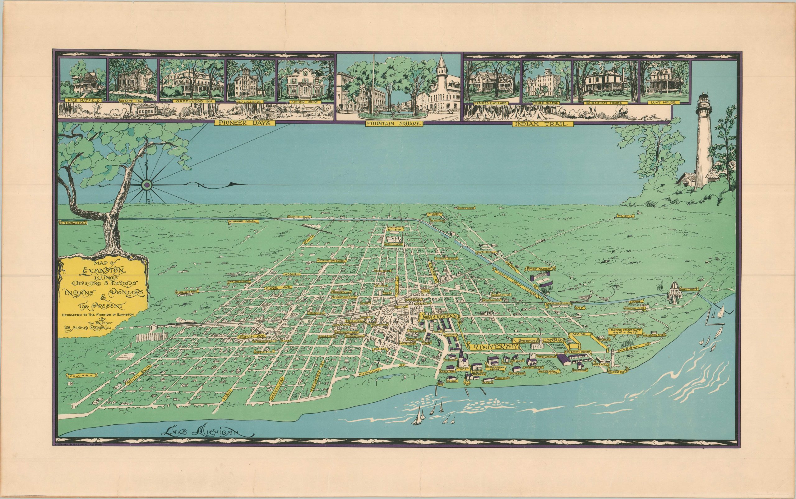
Rare bird’s eye view of Evanston, Illinois from the mid-1930s.
1 in stock
Description
This arresting view of Evanston, Illinois, shows the northern Chicago suburb situated along the shores of Lake Michigan, with west at the top of the sheet. Buildings across both the city and the campus of Northwestern University are individually illustrated and labeled, along with major streets and rail lines. Notable examples include Dyche Stadium, the Bahai Temple, Grosse Point Lighthouse, and the Willard School. Of interest to birdwatchers is the site of annual martin congregations in August. Vignettes running across the top of the page highlight further the attractive historic architecture and civic spaces of Evanston. Two panels immediately below harken back to the generalized eras of Pioneer Days and Indian Trail.
The image was drawn by Ida Schmid Randall around 1934 and dedicated to the Friends of Evanston, a local organization. Though the map is undated, the orientation of Evanston mimics several popular views of Chicago that were published during the Century of Progress Exposition. An example located at the Chicago History Museum notes that their copy was donated by Ms. Randall in 1937.
Randall was described as an “artist, architectural draughtsman, and experienced cartographer” by a near-contemporary publication, though her cartographic work was apparently limited to this and one other map, a cloth commemorative map of the U.S. designed for the Women’s Christian Temperance Union. Both are scarce on the market, though the view of Evanston is certainly rarer. Only three can be found in institutional collections, all of which are local to the Windy City (University of Chicago, Northwestern, Chicago History Museum). One further known as part of a private collection.
Sources: OCLC# 701562558; Center for Women’s History and Leadership; David Rumsey Map Collection (Temperance Map); Chicago History Museum;
Map Details
Publication Date: c. 1934
Author: Ida Schmid Randall
Sheet Width (in): 28.90
Sheet Height (in): 18.25
Condition: A-
Condition Description: A handful of closed marginal tears, one of which just enters the neatline, have been professionally repaired with no loss of image or paper. A bit of faint toning also visible along the outer edges of the sheet, but overall in very good condition.
$1,500.00
1 in stock