Map of Elmira and Vicinity
Street map and index of Elmira, NY created for use at the Pennsylvania Railroad.
Out of stock
Description
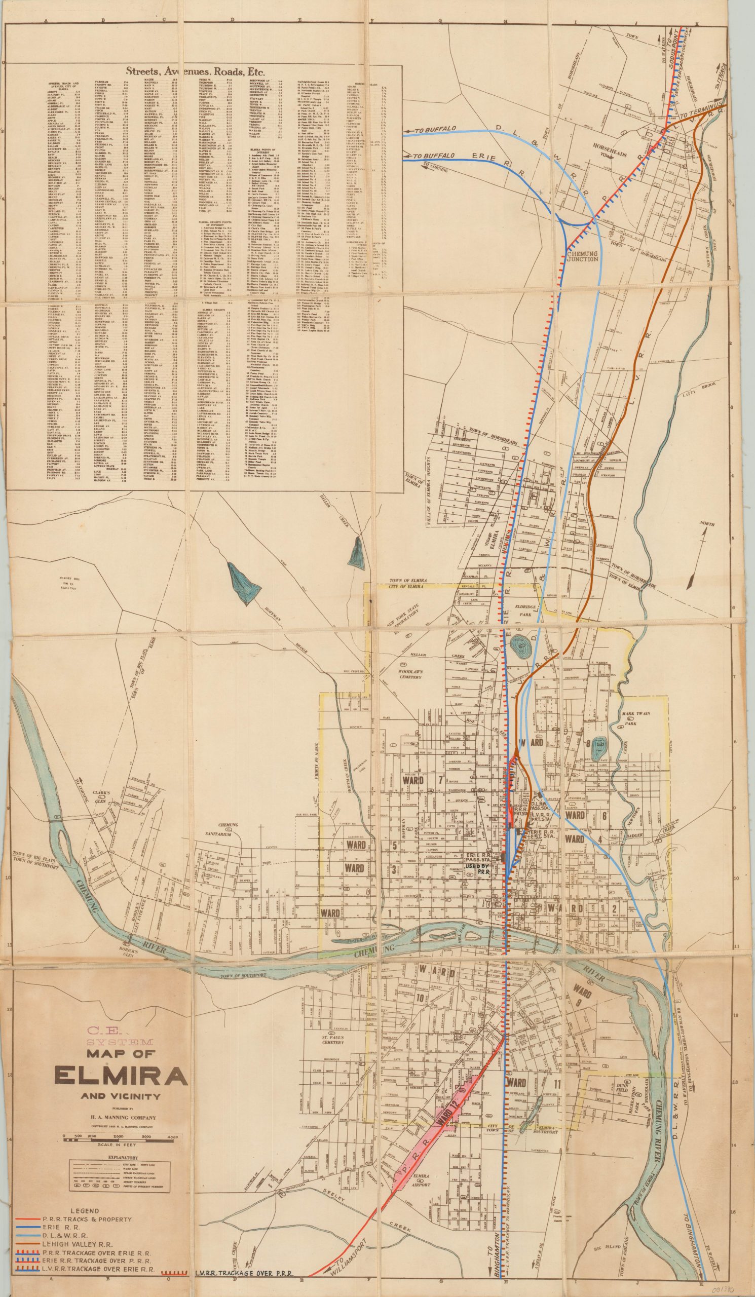
This detailed city plan of Elmira, New York was originally published locally in 1935 by the H.A. Manning Company. Issued at a large scale (approximately 1″ to 1200′), the map shows individually labeled streets, wards, creeks, parks and other locations of interest. A comprehensive street index is provided in the upper left, which corresponds to the grid system seen in the border.
This particular example of the map was customized for use in the Central Engineering Department of the Pennsylvania Railroad. It has been dissected and mounted to linen for preservation and convenient storage. Bright color has been applied by hand to denote track and property ownership across the city, while a custom legend was added to the lower left to identify the primary railroad operators.
Further updates identify the location of specific buildings of particular relevance, such as passenger stations, freight stations, and connecting destinations.
Map Details
Publication Date: 1935
Author: H.A. Manning Company
Sheet Width (in): 17.40
Sheet Height (in): 31.00
Condition: B
Condition Description: Dissected into 16 panels and mounted on linen with black leather covers. Two lower panels exhibit moderate discoloration due to the residue used to affix the covers to the verso. Narrow left margins and scattered soiling and wear consistent with age. The map remains in good condition, especially given its history and use.
Out of stock