Map of Douglas Townsite
$345.00
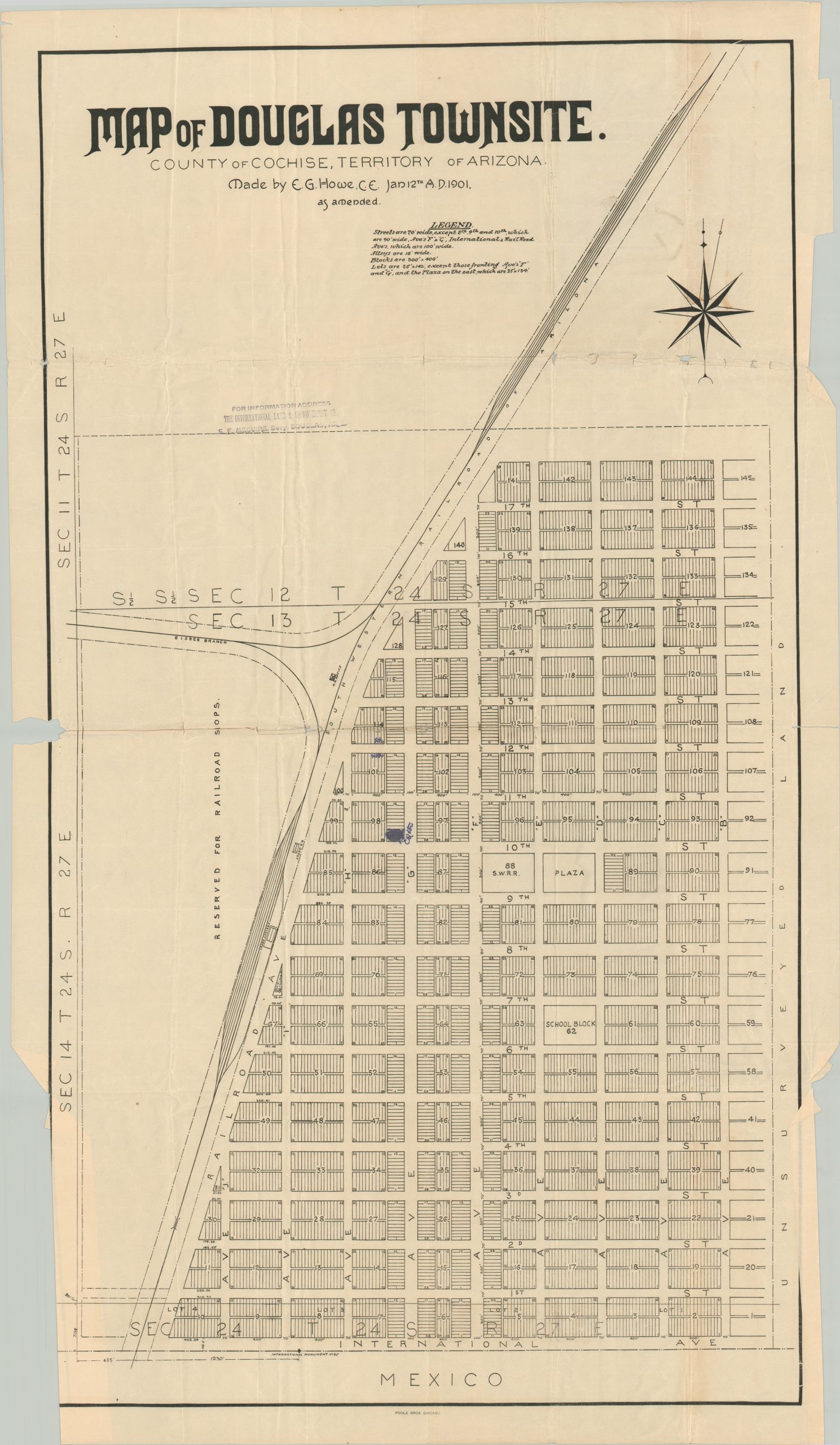
One of the first printed maps of Douglas, Arizona.
1 in stock
Description
This 1901 plat map shows some of the earliest American surveying in what would eventually become the town of Douglas, Arizona (incorporated in 1905). It was first established as a smelting site for the copper ore extracted in nearby Bisbee and grew relatively consistently through the 20th century.
The planned city’s streets (70′ wide, according to the legend at the top) are named (quite boringly) and numbered blocks are divided into individual lots for sale. A school block, plaza, and Southwestern Railroad depot are labeled, along with a large parcel of land ‘Reserved for Railroad Sops.’ Mexican territory is shown just across International Avenue, with a monument denoting the boundary line.
The map was designed by Chief Engineer E.G. Howe in January of 1901 and published in Chicago by Poole Brothers. A rubberstamp in the upper left requests interested parties to address S.E. Meguire, Secretary of The International Land & Development Company in Douglas. The map is scarce, with only three examples noted in WorldCat.
Sources: WorldCat; About Douglas
Map Details
Publication Date: 1901
Author: E.G. Howe
Sheet Width (in): 21.5
Sheet Height (in): 37.5
Condition: B
Condition Description: Printed on thin paper that shows heavy to moderate wear, most evident along the outer margins. A 2" chip can be seen in the center left, along with numerous tears that have not resulted in any image loss. Heavy wrinkling in several areas, resulting in some abrasion and tearing in the upper right (under the compass rose). One spot of manuscript annotations in the center in dark purple ink. About good condition.
$345.00
1 in stock