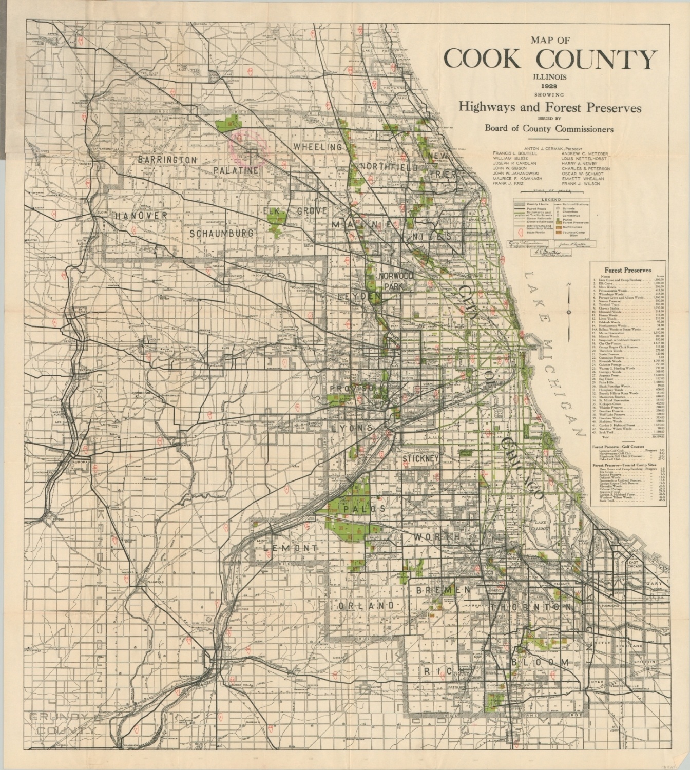
Map of Cook County Illinois
Roads and forest preserves of Cook County just before the Great Depression.
Out of stock
Description
This detailed map of Cook County, Illinois was published in 1928 by Rand McNally on behalf of the local Board of County Commissioners. At the time of publication, the department was led by President Anton J. Cermak, who would become mayor of the city in 1931.
The image presents a comprehensive snapshot of the county’s transportation routes and gradually developing forest preserves (first lands were obtained in 1916) on the cusp of the Great Depression. A key identifies the various surface roads and railroads in operation, as well as tourist campsites, golf courses, schools, churches, and cemeteries.
A list of each forest preserve and its corresponding acreage is provided on the right side, with each entry corresponding to an individually numbered ‘green space’ within the map. A fascinating snapshot of the county at a period of tremendous growth and development.
Map Details
Publication Date: 1928
Author: Rand McNally
Sheet Width (in): 26.6
Sheet Height (in): 29.9
Condition: A-
Condition Description: Pocket map folded into 40 segments, with creasing and light wear along fold lines. Several areas of separation (center middle, upper left) have been repaired on the verso with archival tape, and a small tear persists where the map is affixed to its original paper covers.
Out of stock