Map of Cleveland and Vicinity
$75.00
Detailed map of Cleveland, Ohio published near the end of the Roaring 20s.
1 in stock

Description
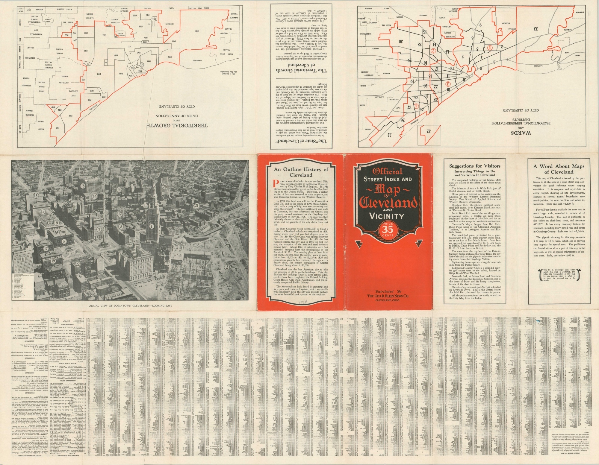
This finely lithographed map of Cleveland, Ohio shows a broad area around the port city situated on the shores of Lake Erie. Bright red lines indicate the city borders, village limits, county line, and house numbers across the city. Parks, cemeteries, and other outdoor areas are highlighted in green.
Inset maps at the top of the sheet show a continuation of the image in the northeast corner as well as a simple outline map of the downtown district. Within the latter, over one hundred different buildings are identified.
The map was compiled, published, and copywritten in 1928 by the Foreman-Bassett Company. Additional maps on the verso show the territorial growth and dates of annexation across the Cleveland area, as well as the various city words and proportional representation districts. An aerial view of the city gives a photographic perspective on the skyline, with construction ongoing for the Cleveland Union Terminal (completed in 1930).
Map Details
Publication Date: 1928
Author: Foreman-Bassett Company
Sheet Width (in): 31.50
Sheet Height (in): 24.6
Condition: A-
Condition Description: Light wear and creasing along originally issued fold lines, including small holes at fold intersections and a few tiny tears along the outer edges of the sheet. Some old pencil marks in light red scattered throughout the image.
$75.00
1 in stock