Map of Clay County
$95.00
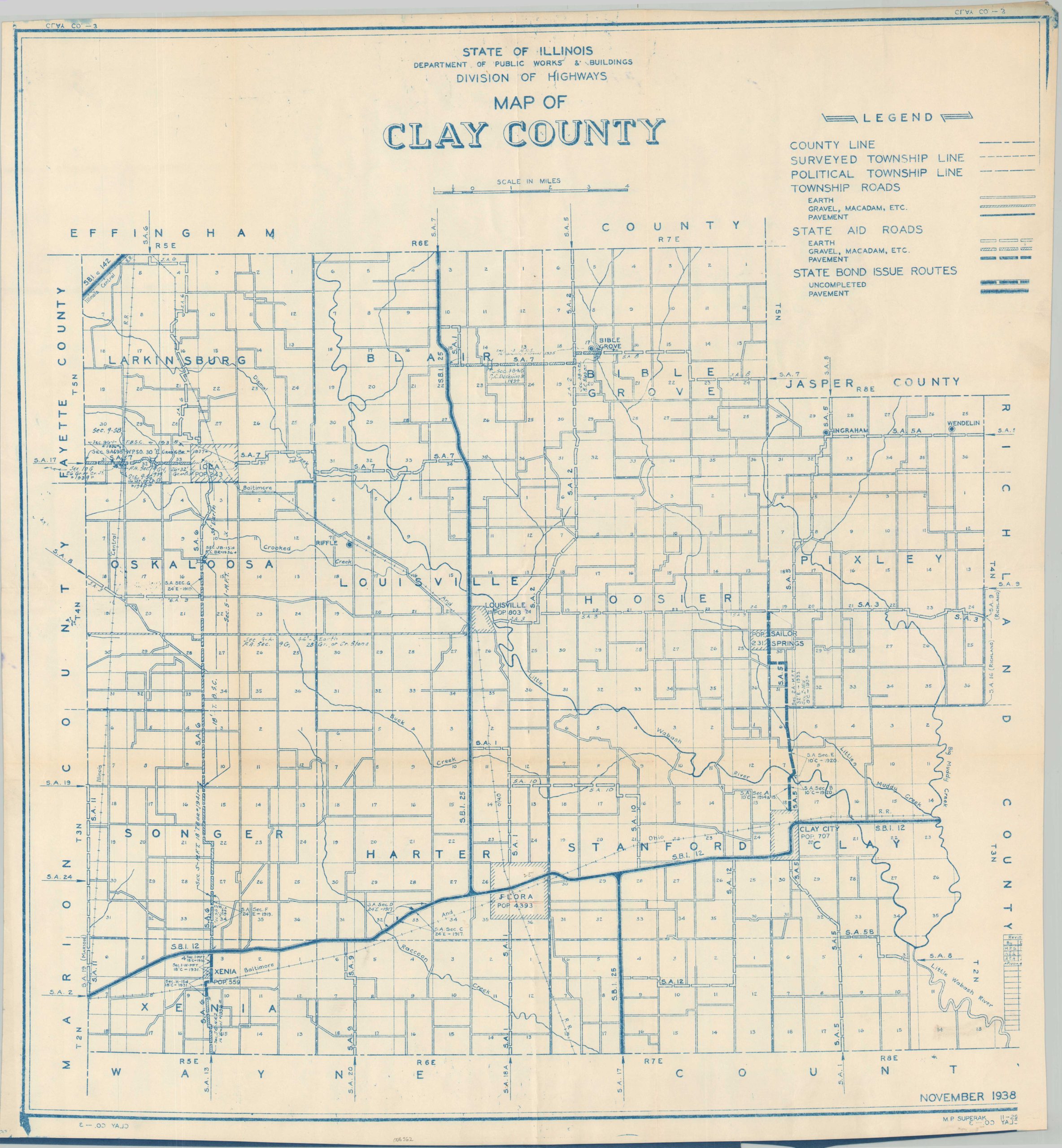
The roads of Clay County, Illinois during the mid-20th century.
1 in stock
Description
This detailed road map of Clay County, Illinois was originally designed by the state’s Division of Highways in 1938, though a table of revisions, the printing method, and publication years of similar maps indicate a later date of issue – probably around 1950. A variety of lines denote different roads according to their surface style (dirt, gravel, etc.) and governing entity (township, state), described further in the accompanying legend. Of notable interest are the state bond issue routes, shown in various stages of completion.
Map Details
Publication Date: c. 1950
Author: Illinois Department of Public Works & Buildings Division of Highways
Sheet Width (in): 27.25
Sheet Height (in): 29.5
Condition: A-
Condition Description: Blueprint style map printed on a single-sided sheet of thick paper that shows faint creasing and wrinkling from where previously rolled. A few tiny spots of soiling and blue ink from the printing process, as well as a few scattered penciled annotations. Very good condition overall.
$95.00
1 in stock