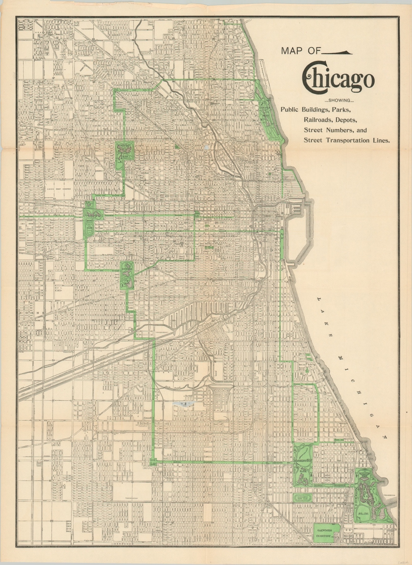
Map of Chicago showing Public Buildings, Parks, Railroads, Depots, Street Numbers, and Transportation Lines
Chicago at the close of the 19th century.
Out of stock
Description
Though much of its contents are described in the title, this map of Chicago provides a wonderful overall view of the city in the final year of the 19th century. Light green highlights the connected system of parks and boulevards, and tiny print labels many of the various amenities locations of interest available within the city limits.
Notable examples include the Field Columbian Museum in Jackson Park (plus other nearby remnants from the Columbian Exposition), The ‘Bridewell’ (Chicago House of Correction), a proposed enlargement of Lincoln Park, and the old Cook County Hospital.
The Chicago Ship & Sanitary Canal, labeled Drainage Ditch, is prominently featured and would open the year after the map was issued. In addition to facilitating the transportation of large shipping vessels, the completion of the canal also permanently reversed the flow of the Chicago River. Published in Chicago by Rand, McNally & Company in 1899.
Map Details
Publication Date: 1899
Author: Rand McNally
Sheet Width (in): 20.3
Sheet Height (in): 27.5
Condition: A-
Condition Description: Creasing and light wear along former fold lines. One 4" tear and two smaller tears along the fold lines have been repaired on the verso with archival tape. One irregular gap, about 2" long, in the lower center has also been repaired on the verso.
Out of stock