Map of Chicago Rapid Transit Lines
Around-the-world-in-Chicago
Out of stock
Description
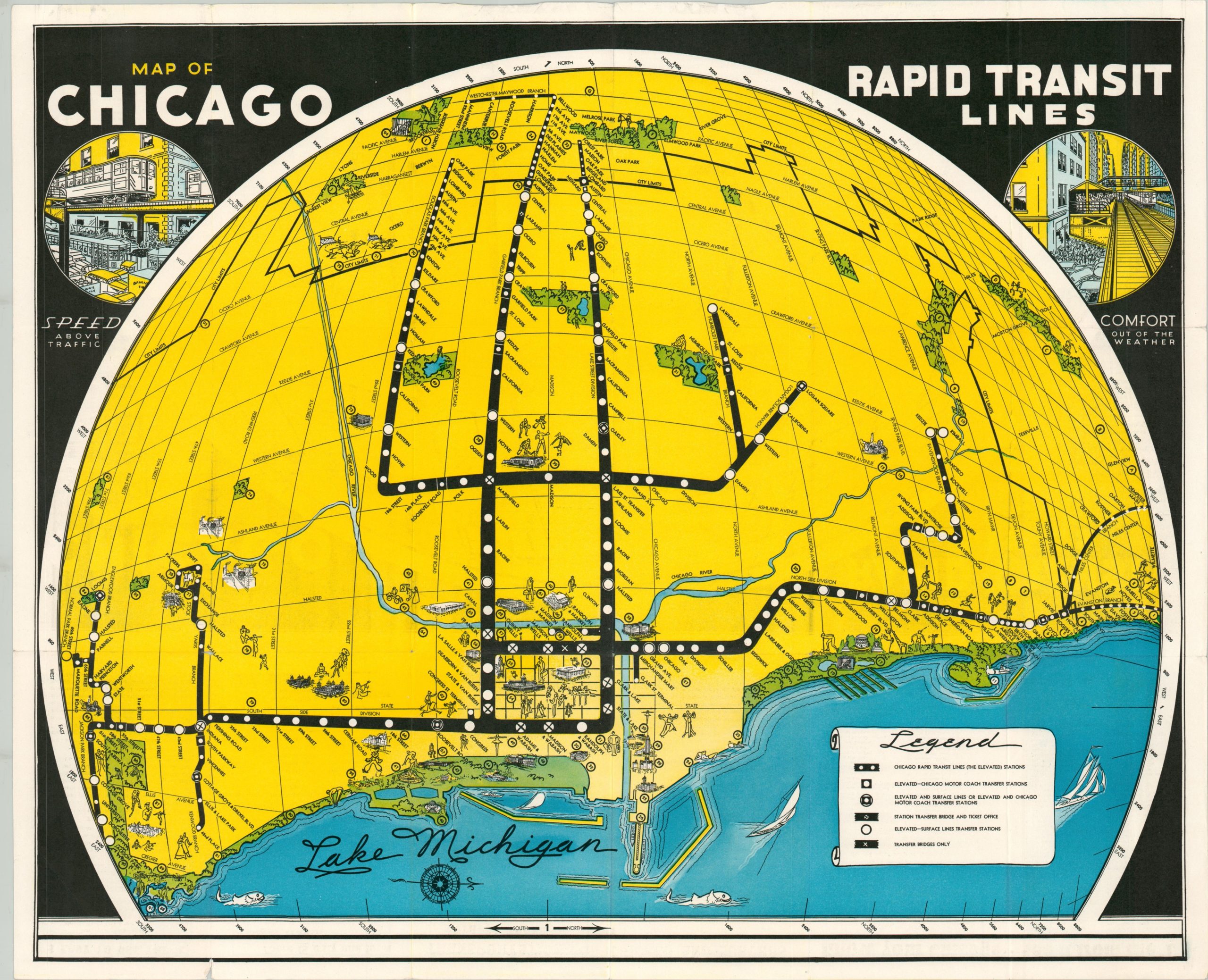
This eye-catching map uses an ingenious art-deco design to showcase how the entire ‘world’ of Chicago can be accessed by the Rapid Transit Lines (a predecessor to the CTA). The image is oriented with west at the top and features a bright yellow background with thick black lines representing the various routes emanating from the Loop. Numerous parks (though interestingly, not forest preserves) are accentuated in green and the waters of Lake Michigan are presented with a vibrant blue.
Nearly 100 different points of interest are numbered and identified on the verso, many of which are represented with a fun custom vignette. Scenes in the upper corners show how the L offers ‘Speed Above Traffic’ and ‘Comfort out of the Weather.’
Map Details
Publication Date: c. 1936
Author: Chicago Rapid Transit Lines
Sheet Width (in): 22.5
Sheet Height (in): 18
Condition: A
Condition Description: Lightly creased along originally issued fold lines and a few small tears along the outer edges of the sheet, confined to the margins. Very good overall.
Out of stock