Map of Chicago, Illinois
$110.00
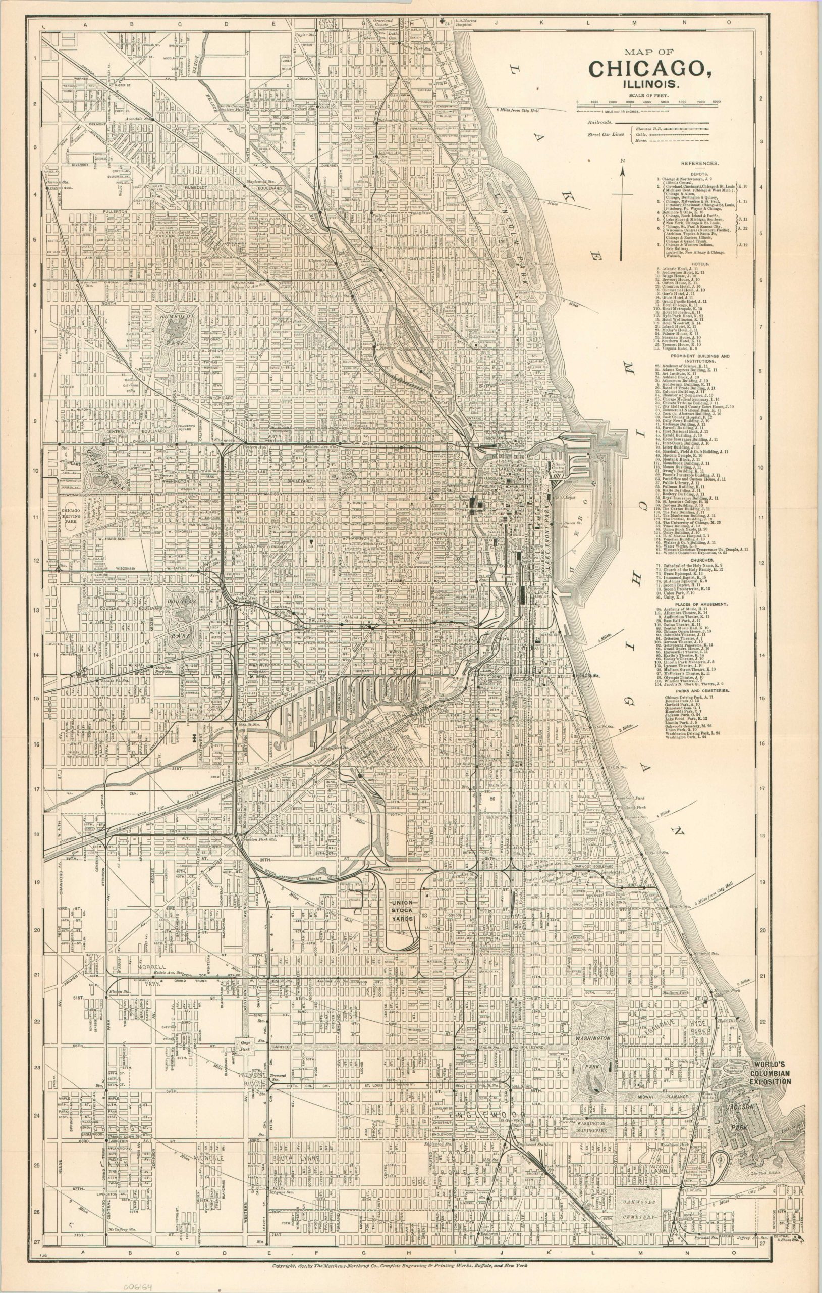
Chicago on the eve of the Columbian Exposition.
1 in stock
Description
This detailed street plan of Chicago, Illinois was designed and engraved by the Matthews-Northup Company of Buffalo, New York in 1891. The year prior, President Benjamin Harrison awarded the Windy City the honor of hosting a World’s Fair to celebrate the 500th anniversary of Columbus’ arrival to the New World. The site for this World’s Columbian Exposition (held in 1893) is noted in Jackson Park, along with a very preliminary outline of the grounds.
Over 100 different buildings are identified across the city, organized into train depots, hotels, prominent institutions, churches, places of amusement, and parks and cemeteries. Various other locations of interest are also labeled throughout the image. The rapidly changing transportation network is also emphasized, noting steam railroads in addition to elevated, cable, and horse-drawn street car lines.
Map Details
Publication Date: 1891
Author: Matthews-Northrup Company
Sheet Width (in): 13
Sheet Height (in): 20.5
Condition: B+
Condition Description: An irregular closed tear, about 3", in the upper center of the sheet (repaired on verso). Light wear and toning along originally issued fold lines. Good to very good condition overall. Blank on verso.
$110.00
1 in stock