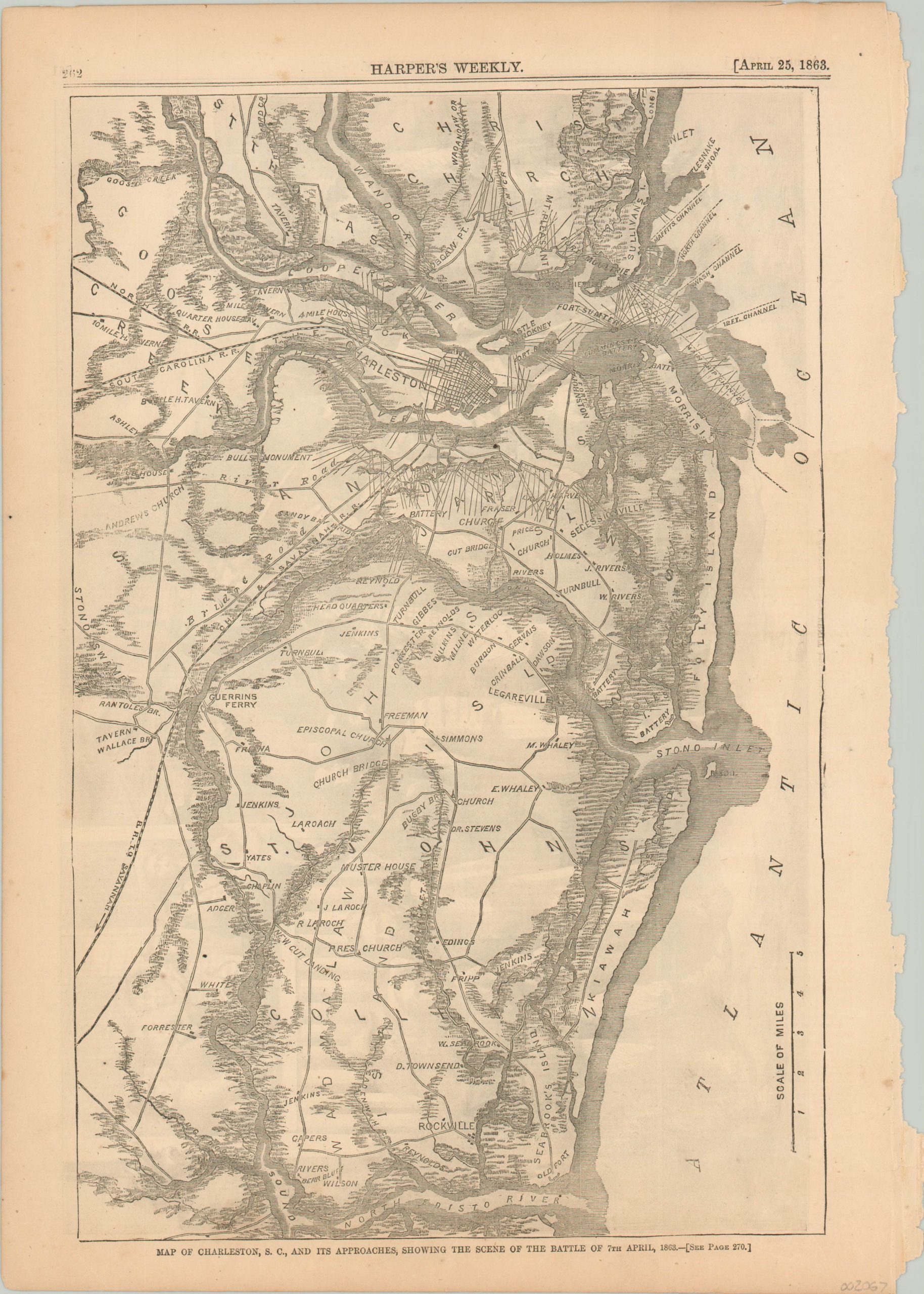
Map of Charleston, S.C., and its Approaches, Showing the Scene of the Battle of 7th April, 1863
$110.00
Contemporary map of the First Battle of Charleston Harbor in the American Civil War.
1 in stock
Description
This detailed plan of the area around Charleston, South Carolina was issued in the April 25th, 1863 issue of Harper’s Weekly magazine. Just over two weeks prior, the First Battle of Charleston Harbor had taken place between Union gunboats under the command of Rear Admiral Samuel Francis Du Pont and the local Confederate defenders. Du Pont’s fleet, comprised of some of the latest in ironclad ship designs, was unsuccessful in their bombardment, and was forced to retreat.
Both land and sea defenses (along with their respective angles of fire) are shown on this map of the region, which also includes topographic details, primary transportation routes (notably railroads) and local landmarks. The city, barely discernable in the middle of the image, is included almost as an afterthought.
Map Details
Publication Date: 1863
Author: Harper's Weekly
Sheet Width (in): 11.00
Sheet Height (in): 15.60
Condition: A-
Condition Description: A few spots in the margins and a ragged right binding edge, but in very good condition overall.
$110.00
1 in stock

