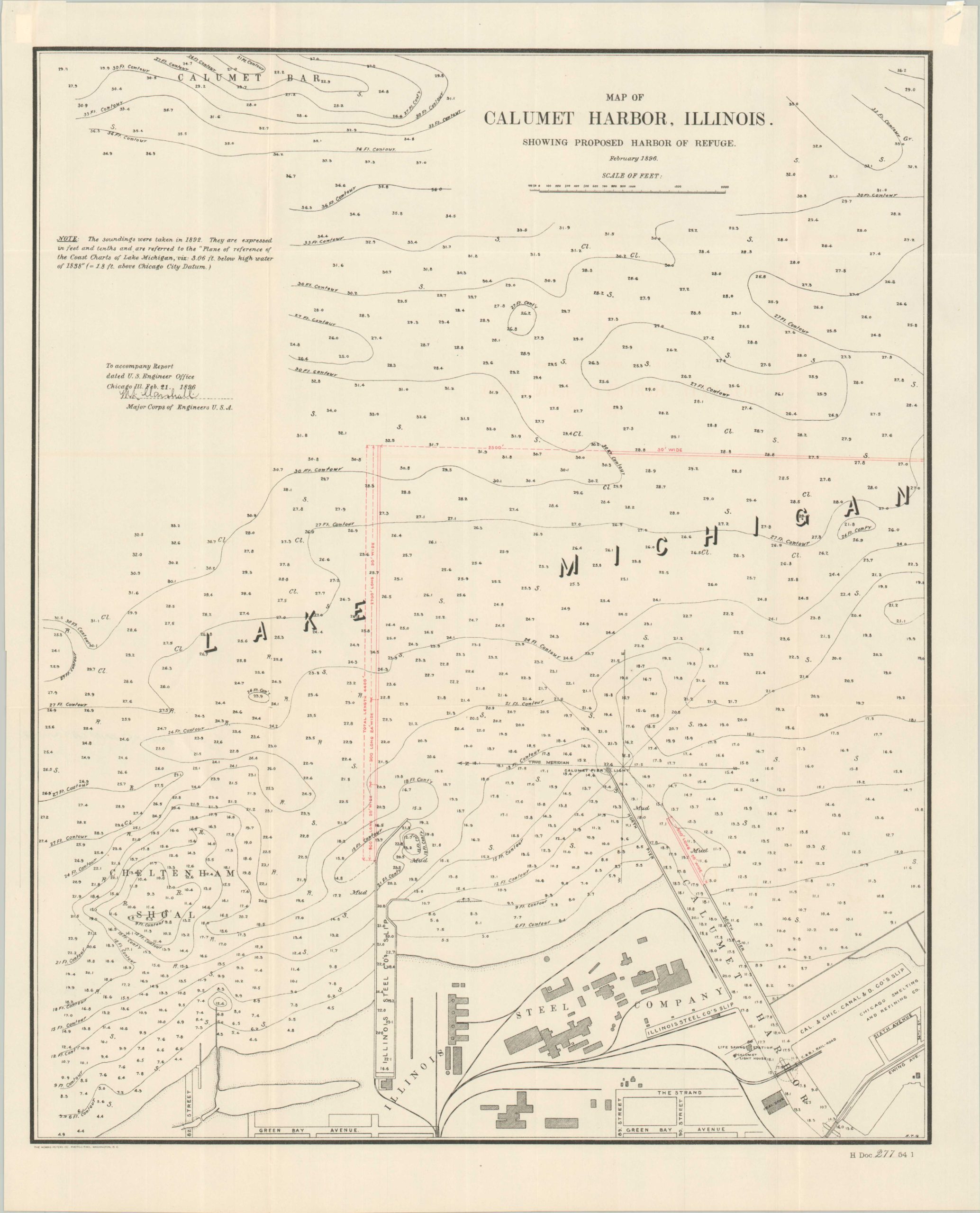
Map of Calumet Harbor, Illinois Showing Proposed Harbor of Refuge
$45.00
Proposed updates to Calumet Harbor from the late 19th century.
1 in stock

Description
This detailed overview of the southern shoreline of Lake Michigan around the Calumet River was created by a member of the U.S. Army Corps of Engineers and published in an official government report in 1897. The image highlights (in red) a 4,400′ extension of the breakwater adjacent to the Illinois Steel Company, creating a protected harbor for ships entering the mouth of the river and harbor. Depth soundings are noted throughout and the Calumet lighthouse and life-saving station are labeled.
Map Details
Publication Date: 1897
Author: United States War Department
Sheet Width (in): 16.6
Sheet Height (in): 20.6
Condition: A
Condition Description: Softly creased along old folds, but overall in near fine condition.
$45.00
1 in stock