Map of California Showing the State as it was known a century ago
$75.00
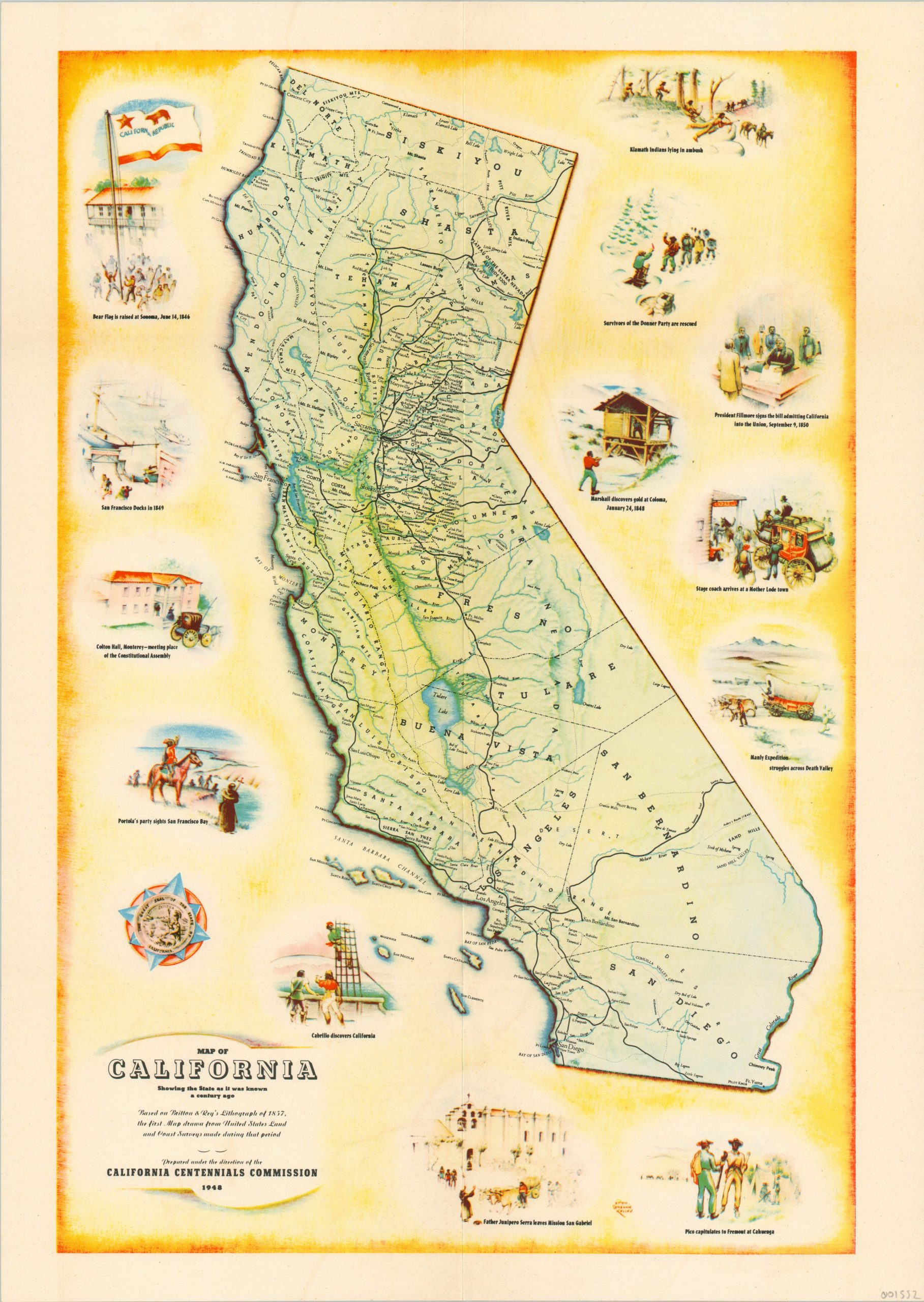
Historic pictorial map of California issued for the state’s 100th anniversary.
1 in stock
Description
This attractive pictorial map of California was published in 1948 in celebration of 100 years since the Bear Flag’s state’s admission to the union. It was drawn by artist Dion Greame Kelley and issued by the California Centennials Commission.
The central map is a reproduction of Britton & Rey’s 1857 lithograph of California, one of the most accurate early maps of the new state, and shows the transportation system and county configuration in the mid 19th century. On either side of the map are numerous illustrations of important historic events that took place throughout California, including its first discovery by Europeans, the Gold Rush, and the departure of Father Junipero Serra.
Map Details
Publication Date: 1948
Author: California Centennials Commission
Sheet Width (in): 14.50
Sheet Height (in): 20.40
Condition: A
Condition Description: Faint wear and creases along fold lines, otherwise in near fine condition.
$75.00
1 in stock