Map of California and Nevada
$350.00
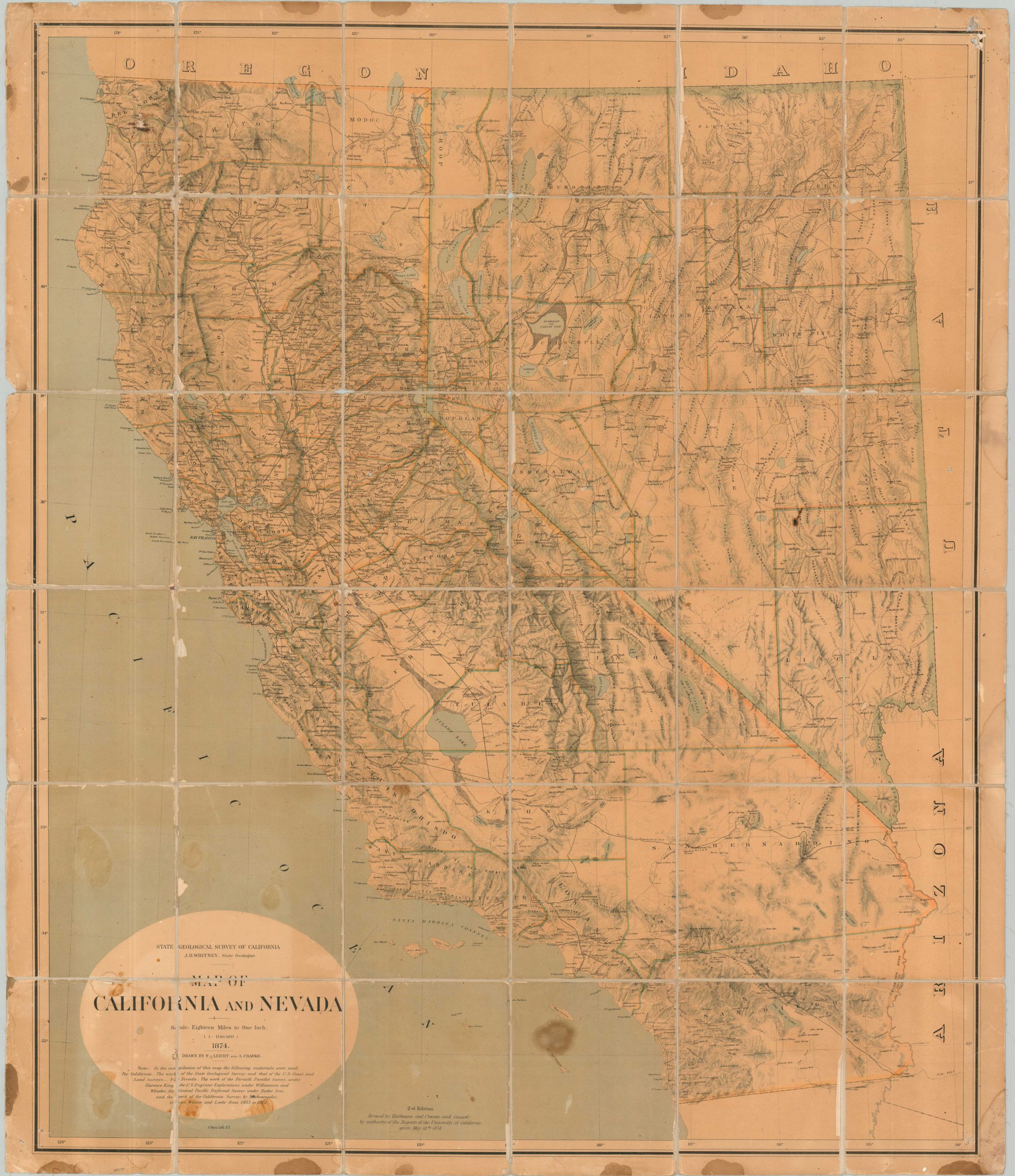
Second edition of an incredible 19th century geologic map of California and Nevada.
1 in stock
Description
This wonderfully detailed map of California and Nevada shows the states just five years after the completion of the Transcontinental Railroad. The link between east and west opened up the floodgates for thousands of farmers, investors, ranchers, miners, and loggers – all eager to take advantage of the bountiful available natural resources.
The famous Central Pacific route is boldly shown, along with numerous other lines (completed and proposed) and their respective stations. Wagon roads are also noted, with variations in the darkness of the path possibly reflecting its accessibility. Scores of toponyms are scattered throughout the image. They pinpoint a fascinating variety of settlements (ranchos, villages, forts, missions, towns), geographic features (hot springs, mountains, rivers), and local industries (ferries, mines, mills).
The first edition of the map was originally drawn by Alfred Craven and Ferdinand von Leicht in 1873. The authors diligently credited their sources below the title. This is the second edition, revised by Craven and Charles Hoffman and published by the authority of the University of California in 1874. Lithographed in New York by Julius Bien & Co.
Map Details
Publication Date: 1874
Author: Charles Frederick Hoffman and Alfred Craven
Sheet Width (in): 36.4
Sheet Height (in): 42.4
Condition: B
Condition Description: Case map separated from original covers, dissected into panels, and mounted onto old linen. Several areas of chipping along the seams, spots of dampstaining and discoloration (concentrated along the bottom), and a few small holes in the linen. About good condition overall.
$350.00
1 in stock