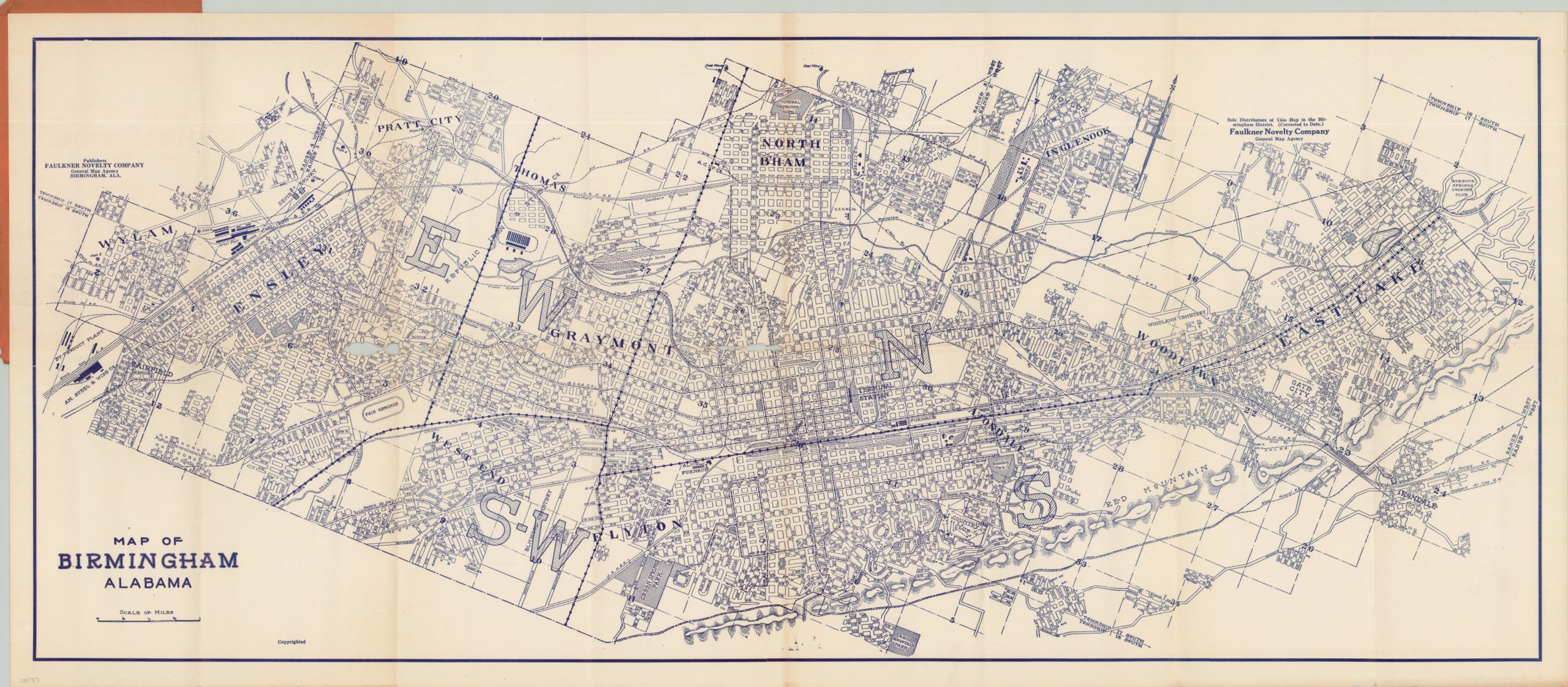
Map of Birmingham Alabama
$150.00
Detailed fold out map of Birmingham, Alabama issued by a local publisher.
Description
This is a large scale city plan of Birmingham, Alabama published during the latter half of the 1920’s. Apart from showing street names, the map focuses on the city’s industrial footprint and labels numerous factories, mills, and furnaces – all concentrated primarily in the field of metallurgy. A robust railway system was necessary to transport raw material, finished product, and workers; and the ensuing network of tracks and yards can also be seen.
Neighborhoods and geographic features are labeled and basic topographic detail on Red Mountain is provided in hachure. Two stamps noting the publisher, the Faulkner Novelty Company, are featured prominently on the image. The company was owned by William Faulkner and operated at three separate downtown Birmingham addresses between the early 1920’s and late 1940’s. This particular example has a seller’s stamp on the front cover noting the address as 406 N. 20th St., which dates the map to between 1926 and 1929. The map is scarce, with only 4 examples listed in OCLC.
Map Details
Publication Date: c. 1926
Author: Faulkner Novelty Company
Sheet Width (in): 38.80
Sheet Height (in): 16.90
Condition: C
Condition Description: Unfortunately there are several spots of severe worming visible in several places along the centerfold and corresponding locations on the front and back cover. Otherwise, the sheet is clean and divided into 16 panels which neatly fold into the original paper covers.
$150.00

