Map of Bermuda Islands
$200.00
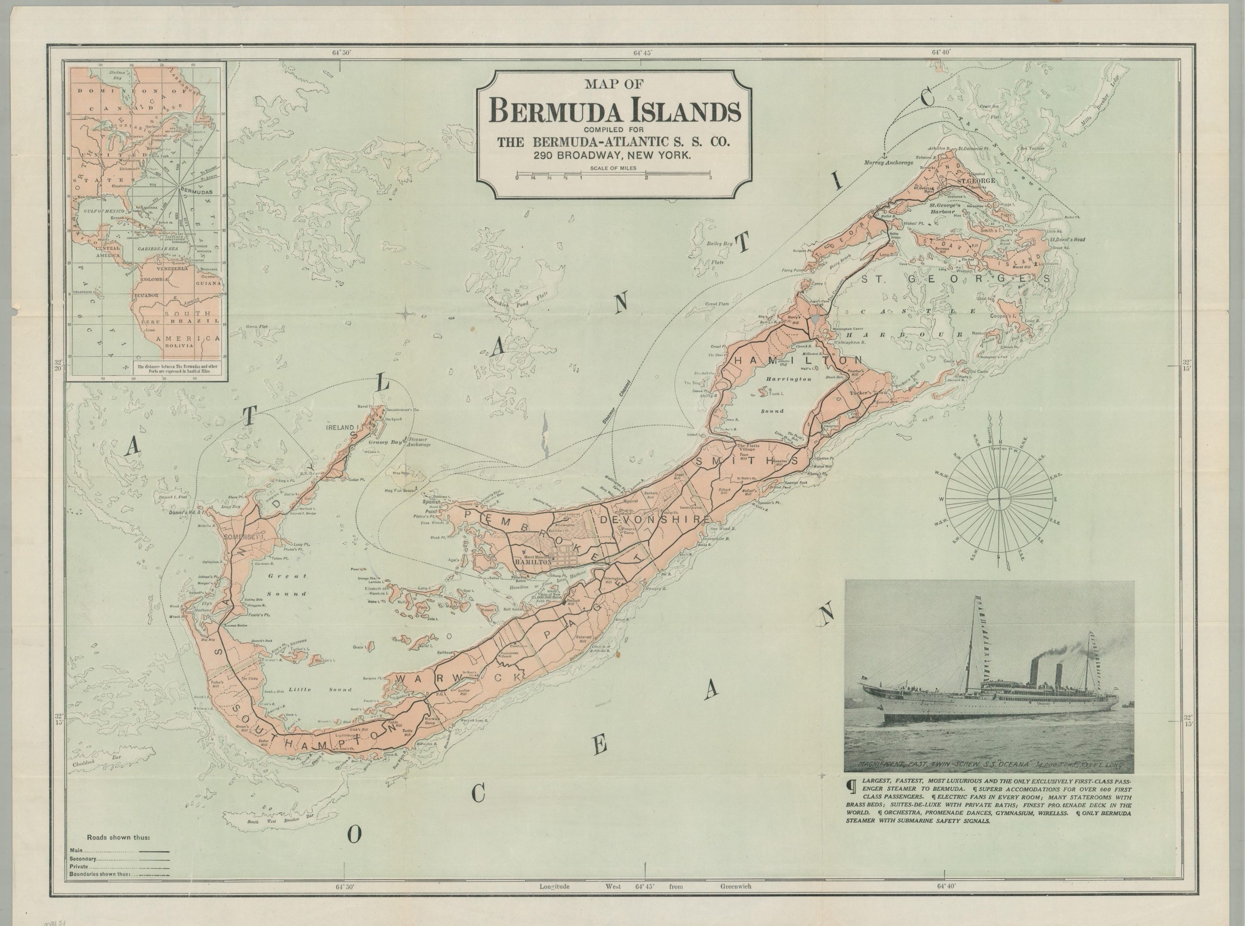
An uncommon promotional map for steamship travel to Bermuda in the early 20th century.
1 in stock
Description
This interesting early 20th-century map of Bermuda was created anonymously on behalf of the Bermuda-Atlantic Steamship Company. A detailed image offers an engaging overview of the island, noting the local transportation network, important buildings, and geographic features. A significant amount of attention is given to coastal hazards, which are outlined and shaded. An inset in the upper left notes the distances to various ports across the Atlantic.
Undated, but likely published around 1910. The Bermuda-Atlantic Steamship Company was formed in 1903, but the Oceana wasn’t named as such until 1905, after it was rebuilt as a cruise ship by the Hamburg-America Line. The ship is described in the lower right as the “largest, fastest, most luxurious, and the only exclusively first-class passenger steamer to Bermuda.”
Map Details
Publication Date: c. 1910
Author: Bermuda-Atlantic Steamship Company
Sheet Width (in): 25.50
Sheet Height (in): 19.25
Condition: B
Condition Description: Color printed map on a thin sheet of paper. Sharp creasing and wear along folds, including several splits at the fold joints (repaired on verso with archival tape). An unfortunate tear near the center, about 2" long, has resulted in minor paper loss. Light wrinkling and minor marginal wear. About good condition overall.
$200.00
1 in stock