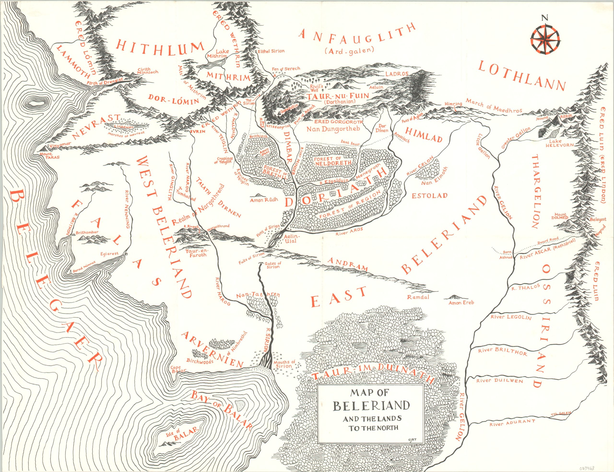
Map of Beleriand and the Lands to the North
Tolkien-style map that accompanied The Silmarillion.
Out of stock
Description
The land of Middle Earth reigns as one of the most comprehensive fantasy worlds of all time and has been well represented in written and visual arts. The creator, J.R.R. Tolkien, is famous for giving life to memorable characters and vivid scenery, but it was his son, Christopher, who would forever memorialize the universe by creating its first maps for publication.
This sheet, covering the north-western lands of Middle-Earth known as Beleriand, was first published in 1977 to accompany The Similarion, a collection of J.R.R. Tolkien’s original writings that was published posthumously. Geographic features are shown pictorially, while the typography displays a host of place names not well known in LoTR lore (most of the Similarion takes place prior to the ‘main story’). The aesthetic style follows the distinctive red and black of other maps of Middle-Earth created for the original trilogy.
Map Details
Publication Date: c. 1977
Author: Christopher John Reuel Tolkien
Sheet Width (in): 18.25
Sheet Height (in): 14.00
Condition: A-
Condition Description: Creased along fold liens and a small spot visible in the upper left corner.
Out of stock