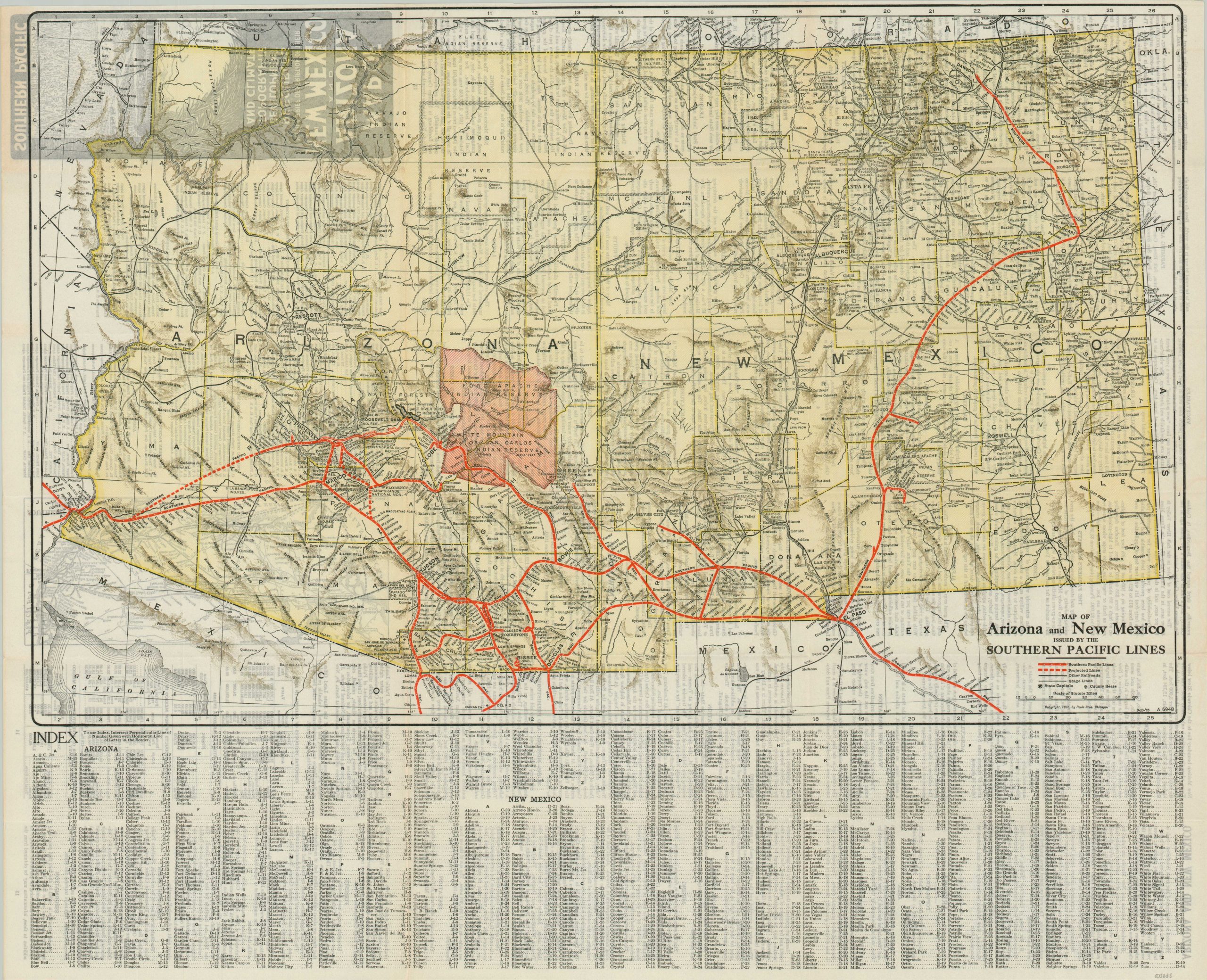
Map of Arizona and New Mexico issued by the Southern Pacific Lines
$125.00
Mid-1920s promotional map of Arizona and New Mexico, issued by the Southern Pacific Railway.
1 in stock
Description
“Situated in the heart of the great Southwest – rich in agricultural resources, minerals, forests and pasture lands – both these states have made immense strides in recent years. Yet they seek new settlers and capital, that their resources may be fully developed, and it is hoped that the information here given will induce homeseekers to visit these States and make further investigation.” – text, verso.
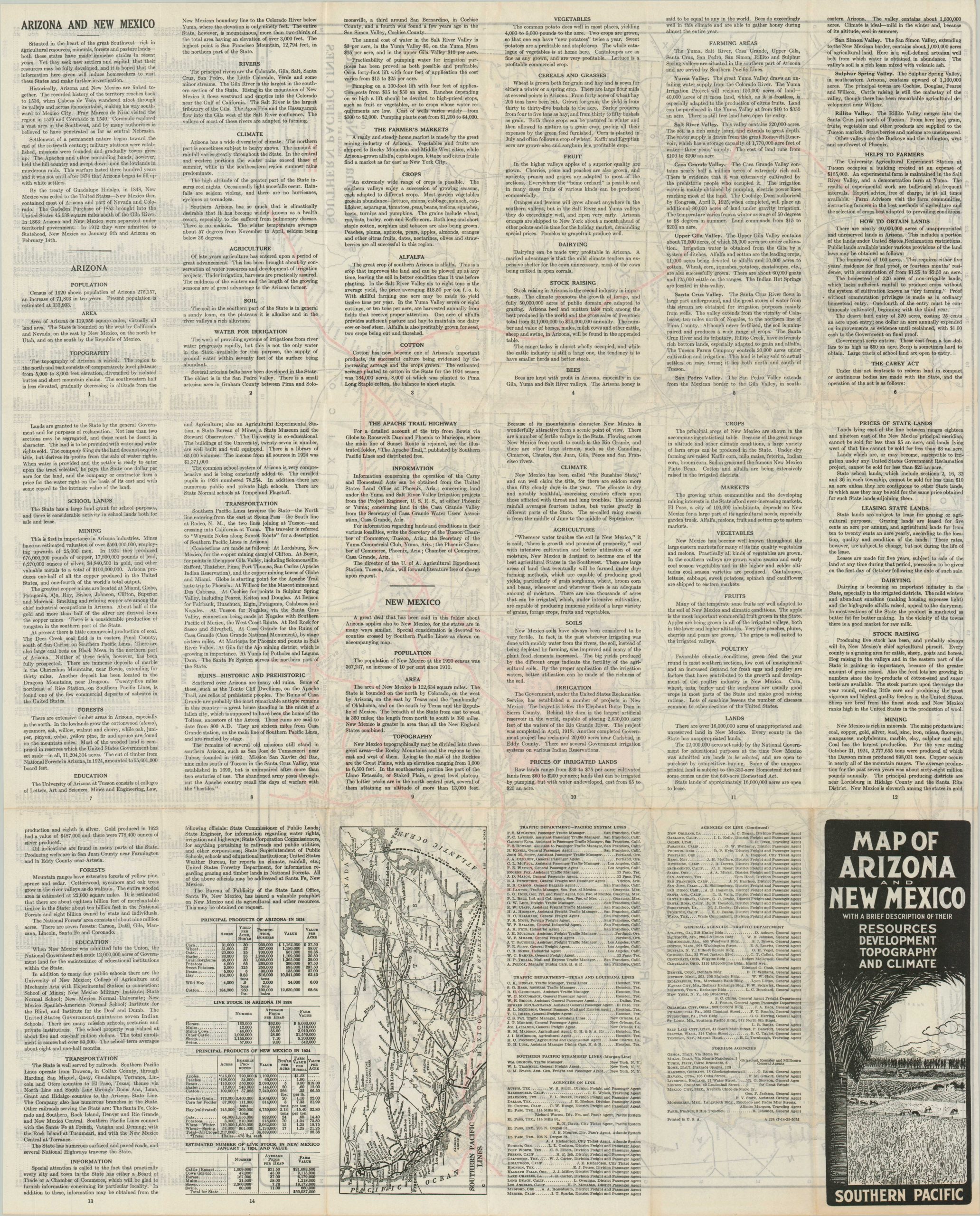
This detailed map of Arizona and New Mexico was published in Chicago in 1925 by the Poole Brothers on behalf of the Southern Pacific Lines. Company routes are shown in bright red, with a handful of proposed (dotted) lines. An index of towns and cities is provided on the bottom, and descriptive text of geography, local resources, climate, history, and infrastructure is offered on the verso.
Map Details
Publication Date: 1925
Author: Poole Brothers
Sheet Width (in): 27
Sheet Height (in): 21.5
Condition: A
Condition Description: Folding pamphlet printed on somewhat thin paper. Near fine condition overall.
$125.00
1 in stock